Back forward
Attention! Slide previews are for informational purposes only and may not represent all the presentation options. If you are interested in this work, please download the full version.
Traditionally, the study of history is associated primarily with the study of various written sources: chronicles, legal and church documents, memoirs of participants in certain events, works of predecessor historians. But in fact, the range of sources of historical data is much wider: these are works of art, and data from archeology, and information from the so-called auxiliary historical disciplines, such as genealogy, heraldry, sphragistics, and numismatics. Philologists also contribute to the study of historical sources, whose research helps to determine the authenticity of certain documents, to determine the place and time of their creation.
Krasnodar Territory is a truly inexhaustible source of various historical data, and along with archaeological monuments from Gorgippia, artifacts from Scythian and Meotian burials, toponymy data can also be attributed to them.
This is especially interesting in connection with the uniqueness of the history of the Kuban, the oldest settlements on the territory of which date back to the late Neolithic, and according to some information, as a result of excavations in the area of the village of Peresyp, Taman region (“Bogatyrka”), artifacts were discovered that allow preliminarily dating this ancient settlement to the early Neolithic ... The earliest population of the Kuban, according to ancient historians, were Meots, Sinds and Zikhs, and who, possibly, became the ancestors of the modern Adyghes, as well as the Iranian-speaking Scythians and Sarmatians, the Turkic-speaking Huns, Bulgars, Türkuts, Polovtsians, who contributed to the formation of the Nogais. On the territory of the Kuban (the modern river in Greek sources was called Gippanis), according to historical sources, ancient Greek settlements are mentioned: Gorgippia, Phanagoria, Hermonassa, Bata, Torik. In the era of the early Middle Ages, the territory of modern Krasnodar Territory was controlled by the Turkic-speaking Khazar Kaganate, and at the end of the 10th century, after the defeat of this state by the Kiev prince Svyatoslav, the Tmutarakan principality arose on the Taman island, the most famous prince of which was Mstislav Vladimirovich. The last time it was mentioned as an independent principality was in 1094, after which its territory came under the control of the Byzantine Empire. The population of the principality was very variegated: Slavs, Kasogs (Circassians) and related monkeys (Abaza), Greeks, Polovtsians, Khazars, Armenians, Jews. In the 14th century, the Genoese colony of Kopa appeared on the territory of modern Kuban, then this territory fell into dependence on the Crimean Khanate, in the middle of the 16th century, the Kabardian prince Temryuk, with the help of servicemen sent by Ivan the Terrible, temporarily acquired control over these lands, then they again fell into under the control of the Crimean khans. Until the end of the 80s of the 18th century, the main population of the Kuban lands were the Turkic-speaking Nogais, after the annexation of the Kuban to the Russian Empire by the Manifesto of Empress Catherine II of April 8, 1783 and a number of military skirmishes with the troops of General A.V. Suvorov who migrated to the foothills of the Caucasus. The Don Cossacks began to settle on these lands, ensuring control over the border with the Adyghe territories along the Kuban, Laba and Belaya rivers.
On January 14, 1788, the royal favor was announced to the colonel of the former Zaporozhye army, Sidor White, and other foremen of this army, and the Cossacks who did not cross the Danube were allowed to settle on the Taman Peninsula. In 1792, the gradual resettlement of the Black Sea Cossacks to the lands of the Taman Peninsula began,
On June 30, 1792, the army of the Black Sea Cossacks, "in an expression of special attention and mercy, for courageous exploits on land and on the waters and fearless loyalty during the successfully ended war with the Ottoman Port", was granted the "island" of Phanagoria with lands, between the Kuban and the Sea of Azov lying, "in eternal possession" and, in addition, 2 silver timpani, 2 silver trumpets and the military banner "For Faith and Loyalty." From that moment on, a new period began in the history of the Kuban.
All of the above must be recalled in order to understand how many different traces can be found in the geographical names of the Krasnodar Territory.
I distinguish the following layers of geographic names:
- Adygo-Abkhazian, there are especially many of them on the Black Sea coast of the Caucasus and in the foothill zone;
- Slavic, as pre-revolutionary, historical names, including the names of the historical kurens of the Zaporozhye army, common throughout the territory of the region, and the names of the Soviet era;
- Turkic, associated with the Nogai and Crimean Tatar periods in the history of the Kuban;
- Ethnonyms associated with the name of certain peoples who lived in the Kuban;
- Eponyms associated with the names of people who made a major contribution to the development of the Kuban or the founders of settlements;
Foreign language names associated with immigrants from other regions of the Russian Empire and other countries.
Therefore, students may be interested in information about the emergence of certain names of settlements and natural objects in their home towns and villages. This data will help them to better understand the connection with their ancestors, to find out specific information about their life, which makes the study of the history of their native land more interesting.
Since the number of geographical names of the Krasnodar Territory is very large, I will cite as examples the most characteristic ones and interesting for students.
Let's start with the capital of the region. The pre-revolutionary name of Krasnodar - Yekaterinodar, is a vivid example of an eponym, when the city was named in honor of the Empress of All Russia Catherine II, who granted the lands of the Kuban to the Black Sea Cossack army. In 1920, the city received its modern name.
The Cossacks who moved to the Kuban brought with them the names of 38 historical Zaporozhye kurens:
1) Baturinsky - from the town of Baturin (on the territory of the present Bakhmach district of the Chernigov region), located on the left tributary of the Desna Seim. In 1669-1708 Baturin was the residence of hetmans Demyan Mnogogreshny, Ivan Samoilovich, Ivan Mazepa, in 1750-1764 - Kirill Razumovsky;
2) Bryukhovetsky - in Krasnodar Territory there is a regional center, the village of Bryukhovetskaya;
3) Vasyurinsky (Vasyurenskoy) - there is a village of Vasyurinskaya in the Dinsky district;
4) Vedmedovsky (Medvedevskoy, Medvedovsky, Medvedevsky) - from the village of Medvedevka, which lies on the bank of the right tributary of the Dnieper river. Tyasmine (now in the Chigirinsky district of the Cherkasy region) - the village of Medvedovskaya, Timashevsky district;
5) Velichkovsky - by the name of one of the chieftains of the Zaporozhye army of the mid-17th century Ivan Velichko-Bossovsky - the village of Starovelichkovskaya of the Kalinisky district and the village of Novovelichkovskaya of the Dinsky district;
6) Vyshne-Steblievsky (Verkhny Steblievskaya, Ukrainian. Vishesteblivsky) - from the town of Steblev, lying on the right tributary of the Dnieper Ros in the Korsun-Shevchenkovsky district of the Cherkasy region - the village of Vysheteblievskaya, Temryuk district;
7) Derevyanivsky (Derevyankovskaya, Derevyankivsky) - the exact etymology is unknown - the villages of Staroderevyankovskaya and the village of Novoderevyankovskaya, both of the Kanevsky district;
8) Dzherelyevsky (Zheralovskoy) - the exact etymology of the name is unknown, possibly from the Ukrainian "dzherelo" - source, spring - the village of Starodzhereliyevskaya, Krasnoarmeysky district and the village of Novodzherelievskaya, Bryukhovetsky district;
9) Donskoy (Densky, Dinsky) - from the Don River and Seversky Donets (this is how the name of the population of the Middle Don is still pronounced between its tributaries Boguchar and girls who are descendants of the Cossacks of the Ostrozh Slobodsky Cossack regiment) - the village of Dinskaya - the regional center of the region of the same name ;
10) Dyadkovsky (Dyadkovskaya, Dyadkivsky) - the exact etymology is unknown - the village of Dyadkovskaya, Korenovsky district;
11) Ivanivsky (Ivanovskaya) - associated with the name of the possible founder of the kuren - the village of Ivanovskaya, Krasnoarmeysky district;
12) Irkleevsky - from the village of Irkliev (now a village in Chernobaevsky
region of the Cherkasy region) on the left bank of the Dnieper near the mouth of the Irkley River - the village of Irklievskaya, Vyselkovsky district;
13) Kalnibolotsky (Konibolotskaya) - from the town of Kalniboloto (since 1795 Katerinopol), the regional center of the Cherkasy region, located on the Gniloy Tikich river - the village of Kalniboltskaya, Novopokrovsky district;
14) Kanevsky - from the city of Kanev on the right bank of the Dnieper (now the regional center of the Cherkasy region) - the village of Kanevskaya, the regional center of the district of the same name, the largest village in the world (44 386 inhabitants according to the 2010 census);
15) Kislyakovsky - from the village of Kislyak on the Sob River, the left tributary of the Southern Bug in the Gaysinsky district of the Vinnytsia region - the village of Kislyakovskaya, Kushchevsky district;
16) Konelovsky (Konelevskoy) - from the name of the town of Koneloi on the river of the same name, modern. the village of Konela in the Zhashkovsky district of the Cherkasy region - the village of Kanelovskaya, Starominsky district;
17) Korenovsky (Kurenivskoy) - the exact etymology is unknown - the city of Kornovsk, the center of the region of the same name;
18) Korsunsky - from the city of Korsun on the Ros river (now the regional center of the Cherkasy region Korsun-Shevchenkovsky) - the village of Starokorsunskaya, the rural settlement of the Karasunsky intracity district of Krasnodar and the village of Novokorsunskaya of the Timashevsky district;
19) Krylevsky (Krylovskaya) - from the city of Krylov, which, before it was flooded with the waters of the Kremenchug reservoir, stood at the mouth of the Tyasmin river in the Kirovograd region - the village of Krylovskaya, the regional center of the district of the same name;
20) Kushchevsky - from the village of Kushchevka on the Orel river in the Tsarichansky district of the Dnepropetrovsk region on the territory of the Protovchansky palanka - the village of Kushchevskaya, the regional center of the district of the same name;
21) Leushkovsky (Levushkovskaya) - from the village of Leukhi on the Soroka river in the Ilyinetsky district of the Vinnitsa region - the villages of Staroleushkovskaya and Novoleushkovskaya of the Pavlovsky district;
22) Minsky (Mynskoy, Mensky) - from the city of Mena (now the regional center of the Chernigov region) on the right tributary of the Desna Mena. At the time of Bohdan Khmelnitsky, it was the center of the Menskoy Hundreds of the Chernigov Cossack Regiment, some authors talk about the connection of the name with the capital of the Republic of Belarus, the city of Minsk - the village of Starominskaya, the center of the district of the same name and the village of Novominskaya of the Kanevsky District;
23) Myshastovsky (Mishastovsky) - the exact etymology is unknown - the village of Staromyshastovskaya of the Dinsky district and the village of Novomyshastovskaya of the Red Army region;
24) Nezamaevsky (Nezamaevsky, Nezamaikovsky) - the exact etymology is unknown - the village of Nezamaevsky, Pavlovsky district;
25) Nizhne-Steblievsky (Nizhny Steblievskaya, Ukrainian Nizhchestablivsky) - from the town of Steblev, lying on the right tributary of the Dnieper Ros (now in the Korsun-Shevchenkovsky district of the Cherkassk region) - the village of Staronizhnesteblievskaya, Krasnoarmeyvensky district and the village of 1912 Kalininsky district;
26) Pashkovsky - the exact etymology is unknown, most likely by the name of the founder Pavel (diminutive Pashka) - the village of Pashkovskaya, a rural settlement of the Karasunsky inner-city district of Krasnodar;
27) Pereyaslavsky (Pereyaslovskaya) - from the city of Pereyaslav (now the regional center of the Kiev region Pereyaslav-Khmelnitsky) over the Trubezh river - the village of Pereyaslovskaya, Bryukhovetsky district;
28) Plastunivsky (Plastunovskaya) - from the name of the foot Cossacks-Plastuns, a kind of Cossack special forces operating on foot - the village of Plastunovskaya, Dinskoy district;
29) Platnirovsky - the exact etymology is unknown, it can be assumed that the name is associated with the word "plotnir", which denoted a carpenter or a military engineering specialist who ensured the crossing of troops and undermining the enemy's fortifications - the village of Platnirovskaya, Korenovsky district;
30) Poltava - from the regional center of Ukraine, the city of Poltava on the Vorskla River - the village of Poltavskaya, the regional center of the Krasnoarmeysky district (from 1932 to 1994 it was called the village of Krasnoarmeyskaya);
31) Popovichevsky - the etymology is associated with the word “priest” - the son of a priest - the village of Popovichevskaya (since 1957 - the village of Kalininskaya), the regional center of the Kalinin region;
32) Sergievsky - the etymology is associated with the name “Sergius”, the possible founder or Saint Sergius as the heavenly patron of the kuren - the village of Sergievskaya, Korenovsky district;
33) Rogeyevsky (Rogovskoy) - from the village of Rogov, Mankovsky district, Cherkasy region - the village of Rogovskaya, Timashevsky district;
34) Timoshevsky (Tymoshevskaya) - from the village of Timoshovka, Mankovsky district of the Cherkasy region - the city of Timashevsk (until 1966 - the village of Timashevskaya), the center of the Timashevsky district;
35) Titarovsky (Tatarovskaya) - the exact etymology is unknown, possibly from the word "ktitor" - a person who allocated funds for the construction or repair of an Orthodox church or monastery or for its decoration with icons, frescoes, objects of decorative and applied art - the village of Starotitarovskaya, Temryuk district and the village of Novotitarovskaya, Dinsky district;
36) Umansky (Gumanskaya) - from the city of Uman, the center of the Umansky district of the Cherkasy region of Ukraine on the Umanka river - the village of Umanskaya (since 1934 - the village of Leningradskaya), the regional center of the Leningradsky district;
37) Shcherbinovsky - etymologically related to the word "shcherbina" - a gap, a defect in the teeth as the nickname of the founder of the kuren - the village of Staroshcherbinovskaya, the regional center of the Shcherbinovsky district and the village of Novoshcherbinovskaya of the same district;
38) Shkurinsky (Shkurenskoy) - etymologically connected with the nickname of the founder of the kuren - the village of Shkurinskaya, Kushchevsky district.
Thus, on the map of the Krasnodar Territory, all the historical kurens of the Zaporozhye Cossack army were reflected.
But the number of settlements in the Krasnodar Territory is much higher: these are 26 cities, 12 urban-type settlements (urban-type settlements), 411 rural, settlement, stanitsa districts, a total of 1725 rural settlements, of which 11 are abandoned. The number of names of natural objects cannot be calculated at all.
Due to the limited scope of this work, it is impossible to cover all their names, so I will focus on a few of the most typical examples.
Since a large layer of Slavic names of settlements is considered above, let us dwell on toponyms of a different origin.
For Black Sea coast The Krasnodar Territory is very characteristic of the toponyms of the Adyghe-Abkhazian etymology, which were inherited after the end of the Caucasian War in 1864.
Let's start with the Olympic capital - the city of Sochi.
Sochi - for the first time the term is found (in the form of Sadsha) in the famous Turkish traveler Evliya elebi, who, accompanied by a strong Turkish detachment, on his way in 1641 from Turkey to Azov, along the Black Sea coast of the Western Caucasus, compiled a description that is still of exceptional interest ... According to a number of researchers, this name was given by the Ubykhs who inhabited these lands, language related to the Abkhaz. After the Kakvkaz war, the overwhelming majority of the Ubykhs moved to the territory of the Ottoman Empire. The city of Sochi itself was founded on April 21, 1838 as the fort of Alexandria. Since 1874, the settlement was called Dakhovsky Posad, and since 1896 - the city of Sochi (by the name of the river of the same name).
On the territory of the city of Sochi is the city of Adler, whose name does not go back to the German word Adler - "Eagle", as one might expect, but with the Turkish name of this area Artlar ("Arty") - the plural of art - "back", apparently , due to the location of the port; Khosta village - the name is associated with the Khosta river of the same name (Boar river, Abkhazian language).
The village of Matsesta - the name Matsesta (Matzipsta) is translated from the Abkhaz language as “Matsba gorge”. The Matsbovs lived just in the vicinity of the modern resort of Matsesta, Asa - a gorge in Abkhazian. Other Abkhaz names of rivers, gorges and peaks are formed similarly: Aapsta, Agepsta (Agasa), Aguripsta, Achipsta, Gumista (from Gumpsta), Lapsta, Lashipsta, Rechepsta, Khosta (Huapsta), etc.
The name of the village of Loo comes from the name of the largest Abaza feudal clan Lau or Low (Loovy), which are in the period of greatest prosperity. On the site of the present city in 1838, as part of the Black Sea fortified coastline, was built Velyaminovskoe fortification, named after General A.A. Velyaminov (1785-1838). A year later, the fortification was destroyed by the Shapsugs, but was gradually restored. In 1864, on the site of the former fortification, the village of Velyaminovskaya was erected, in 1896 it was renamed into Posad Tuapse. and in 1916 the settlement became a city.
The city of Gelendzhik. There are several versions about the origin of the name:
Galen jikha - "outer fortress" in Megrelian (Georgian);
Helenge in Arabic poplar;
Gelin - bride + - light (Turkish);
Gelin - bride + cik - diminutive (Turkish);
Khul'yzhiy - “Small pasture” - from the Adyghe (Natukhai) name of the area.
The city of Gelendzhik received its current name during the Ottoman Empire, approximately in the 15-16th centuries. Earlier this place was the ancient Greek colony of Torik, in 63 BC. on this place the Romans built the port of Pagra, in the Middle Ages there was a Genoese trading post-port of Mavrolaco. In 1831 the Gelendzhik fortification was created. in 1864 it was renamed into the village of Gelendzhikskaya. In 1896 the village was transformed into a village. and in 1915 Gelendzhik received the status of a city.
The name of a large industrial center and the largest Black Sea port of Novorossiysk is etymologically quite transparent. However, the name is relatively new, in the 5th century BC. on the bank of the Tsemes bay was the Greek city of Bata, destroyed at the beginning of the Middle Ages by nomads, in the 13th century at the mouth of the Tsemes river the Genoese built the Batario fortress, and after its capture by the Turks, it became known as Sudzhuk-kale. In Turkish, Russian and other languages, the name of the fortress is found in several variants. In Turkish: Sogucuk kale, Sucuk kale; in Russian: Sogudzhuk-kale, Soguchak-kale, Suchak-kala and even Sunjuk-kale; in Western European languages: Sudgiak kaleh, Soudjiack kale, Sujuk kaleh, Soudjouk kale, Sogoudjak kale, etc.
There is no consensus on the translation of the word Sogucak (Sogucuk) into Russian. The Turkish word Sogukca is closest in sounding - “coldish”.
The well-known children's resort town of Anapa also has a Turkic name, meaning “the edge of the table; smooth bank ledge ”. In this place was located a Turkish fortress, located on the site of the former Genoese colony named Mapa. In the ancient era, the Greek city of Gorgippia was located next to modern Anapa.
The history of the name of the large industrial center of the Krasnodar Territory, the city of Armavir, is very interesting. It was named after the ancient capital of Armenia of the 4th - 2nd centuries BC Armavir. The fact is that it was founded by the Circassogians - an ethnographic group of Armenians who moved in the 14th century to the territory occupied by the Adyghe (Circassian) tribes. The newcomers adopted the customs and clothes of the Circassians. but preserved the Christian faith and the Armenian language. In the 18th century, Islam began to actively spread among the Circassians, and the Circassogians, in order to preserve their faith, asked for patronage from the Russians. In 1839, they were allowed to compactly settle on the site of the present city, and in 1848 the settlement of Armavir officially received the status of a county town.
Of course, in a short essay it is impossible to fully disclose the topic declared in the title, but I would like to hope that this material will be useful for students of the history of the Krasnodar Territory.
Ethnic aspects of toponymy of the Krasnodar Territory
Toponymy (from the Greek topos - place and onima - name, title) is a section of linguistics that studies geographical names (toponyms), their meaning and origin, distribution area, development and change over time. The set of toponyms in any territory is called toponymy.
Being at the junction of linguistics, geography, history, toponymy allows you to solve special problems that cannot be solved by methods of only one of the above sciences. It is impossible to give the correct etymology of a geographical name just by translating it from one language or another (the task of a linguist). At the same time, it is necessary to take into account the binding of a geographical object to a terrain (the task of the geographer), as well as the historical conditions in which this object was named and renamed (the task of the historian). In addition, in the study of toponymy, the factual data and methodological apparatus of a number of other sciences are widely used - ethnography, demography, statistics, archeology, even biology (for example, the distribution area of the plant, the name of which formed the basis of the toponym, is revealed). Thus, toponymic research is always a complex research involving information from various fields of knowledge.
Not a single more or less serious historical study, from an essay on local history to scientific monographs, can do without the use of toponymic information.
The Kuban (as well as the North-Western Caucasus in general) has been a place of settlement for many, many peoples since ancient times. Centuries, millennia, epochs passed, some peoples replaced others. Some of these ethnic groups disappeared, dissolved in neighboring ethnic groups, assimilated, or moved to other lands. The descendants of others still live here, on the territory of the modern Krasnodar and Stavropol Territories, the republics of Adygea and Karachay-Cherkessia. "Tombs, mummies and bones are silent, only the word is given life ..." wrote Ivan Bunin. The word, immortalized in the toponym, brings to us the history of distant eras and those peoples who gave life to the word.
The framework of this lecture, unfortunately, does not allow us to cover the entire toponymic spectrum of our region for nearly three millennia, where the first Kuban toponyms are found already in ancient written sources. I propose to look at the toponymy of the Krasnodar Territory through the eyes of a modern Russian-speaking inhabitant. Those. it will focus on the Slavic and, above all, the Cossack toponymy of the Kuban and the foreign language influence on it.
Toponymy of the Nekrasov Cossacks
.
After the suppression of the uprising of Kondraty Bulavin, part of the Old Believer Cossacks who participated in the uprising moved from the Don to the Kuban, where Old Believer settlements had already existed since the end of the 17th century. By the name of their leader Bulavin Colonel Ignat Nekrasov, these Cossacks began to be called Nekrasov Cossacks and constituted a special sub-ethnic unit. The names of the towns they founded are known: Bludilovsky, Golubinsky, Chiriansky (Chirsky) - and settlements: Irla, Zolnik, etc. In the 70s of the 18th century, pressed by the Russian government, the Nekrasov Cossacks moved to Turkey. Their settlements existed for about 90 years, without having a noticeable impact on the formation of the Kuban toponymy. When the Black Sea Cossacks settled the Kuban at the end of the 18th century, one of the Cossack villages, founded in the lower reaches of the Kuban on the site of the former Nekrasov town, was named Nekrasovsky. In 1843, a village named Nekrasovskaya was founded on the Labe River. According to legend, there was also a town of Nekrasov Cossacks here. After the October Revolution, part of the Nekrasovites returned from Turkey to the Kuban, where they founded two farms in the Primorsko-Akhtarsky region - Novonekrasovsky and Novopokrovsky.
Toponymy of the Black Sea Cossacks. Ukrainian trace in Kuban place names .
So, let's move on to considering the toponymy of the Black Sea Cossack army.
In 1775, by order of Catherine II, Lieutenant-General P.A. Tekeli destroyed the Zaporozhye Sich. The Zaporozhye army was disbanded. Attempts to form Pikiner regiments from the former Cossacks only spurred the exodus of the Cossacks across the Danube, into Turkish possessions. But the next Russian-Turkish war that began in 1787 forced the Russian government to again turn to the combat experience of the Zaporozhye Cossacks. In 1787-1788, volunteer teams were formed from the former Cossacks, which gradually took shape into a new Cossack army. “At first, the army, in contrast to the unfaithful Zaporozhye Cossacks who took the patronage of Turkey, was simply called the“ Army of the Loyal Cossacks ”, and later it was renamed the“ Black Sea Host ”at the place of their military operations and residence” 1. Initially, the Black Sea Cossacks were settled beyond the Bug. Then, according to a letter of gratitude from Catherine II dated June 30, 1792, they receive “in perpetual possession the island of Phanagoria, which is in the Tauride region, with all the land lying on the right side of the Kuban River from its mouth to the Ust-Labinskiy redoubt, so that on one side the Kuban River , on the other hand, the Sea of Azov served as the border of the military land ”2.
The area of settlement of the Black Sea Cossacks in the Kuban began to be called the Black Sea Region. The most significant influence on the formation of the Slavic oikonymy (i.e., the names of settlements) in the Black Sea region was exerted by the names of the Zaporozhye kurens, which were mainly formed long before the migration of the Black Sea Cossacks to the Kuban. Most of the names of kurens originated in the 17th-18th centuries. In the Zaporozhye army, according to the Register of 1756, there were 38 kurens 3. Here are their names in modern Russian transcription: Baturinsky (Baturinsky), Bryukhovetsky (Bryukhovetsky), Vasyurinsky (Vasyurinsky), Medvedovsky (Vedmedivsky), Velichkovsky (Velichkivsky), Vyshesteblievsky (Vyshestebliyevsky) Donsky), Dyadkovsky (Dyadkivsky), Ivanovsky (Ivanivsky), Irklievsky (Irklievsky), (Kalnibolotsky (Kalnibotsky), Kanevskoy (Kanivsky), Kislyakovsky (Kislyakivsky), Korylivsky), Korelivsky Korsunsky), Kushchevsky (Kushchivsky), Leushkovsky (Levushkivsky), Minsk (Minsk), Myshastovsky (Myshastovsky), Nezamayevsky (Nezamayivsky), Nizhnesteblievsky (Nyzhchestyassky), Pashlavsky) (Pashlavsky) Poltavsky), Popovichsky (Popovichivsky), Rogovsky (Rogivsky), Sergievsky (Sergiyivsky), Timoshevsky (Tymoshivsky), Titar ovsky (Tytarivsky), Shkurinsky (Shkurinsky), Shcherbinovsky (Shcherbynivsky), Umansky (Umansky).
According to their origin, these smoking names can be conditionally divided into two groups:
1. The name of the kuren is derived from the names of some settlements. It is generally accepted that each kuren was founded by people from this or that area, from where it got its name. DI Evarnitsky writes about this: “Remaining on Niza, they (the Cossacks - S.S.) little by little formed into separate and small groups, communities or kurens, representing at first a kind of community: kuren Baturinsky, those. community of fellow countrymen who left Baturin; kuren Kanevsky, i.e. community of fellow countrymen who left Kanev; the same must be said about the kurens of Krylovsky, Pereyaslavsky, Poltava, Umansky, Korsunsky, Kalnibolotsky, Stebliivsky, Donskoy and others ”4.
2. Some kurens were named after a person - most often the founder of the kuren or chieftain. Here is a whole gallery of outstanding Sich figures: Bryukhovetsky kuren is named after Ivan Martynovich Bryukhovetsky, who was elected hetman 5 at the Black Council in Nizhyn in 1663; Popovich's kuren is named after hetman Ivan Samoilovich, who was called hetman-priest, so “Ivan Samoilovich was the son of a priest on the western side of the Dnieper from the village of Krasnoye” 6; Rogovskaya kuren - between November 1664 and February 1665, “the Cossacks ... chose Ivan Zhdan or Horn as koshevoy” 7; Shkurinsky kuren is named after the chieftain of the cat, Lesko Shkura. In late 1664 - early 1665 he was dismissed “because he knew the Moscow governors Khitrovo and Kosagov and did not allow the Cossacks to smash the Kalmyks” 8. Ataman Rog becomes his successor.
Plastunovskiy kuren can be especially distinguished. Cossack infantry scouts were called Plastuns. “Due to the nature of their activity, on patrol or behind enemy lines, they often had to lie for hours, without moving, in a layer on the ground, merging with the surrounding terrain and conducting observation. Hence the name "plastuny". One of the 38 kurens of Zaporozhye apparently had the largest number of such “hunters”, which is why it was named Plastunovsky ”9. This is what the Krasnodar historian V.N. Ratushnyak writes. According to LI Lavrov, a famous Soviet ethnographer and historian, the name of the kuren could come from the surname: “In 1649, Cossacks named Plastun served in four different regiments of the army of Bohdan Khmelnitsky. Cossacks Plastun and Plastunovsky are known in Zaporozhye in 1773 " 10 . In our opinion, LI Lavrov's point of view looks more convincing - the name of Plastunovskiy kuren can also be attributed to “nominal names”.
Upon arrival in the Kuban, the Black Sea Cossacks (formerly Zaporozhye) retained their former Sich names for kurens, adding two new ones. “Thirty-eight kurens were the same names that existed in the Zaporozhye army, - wrote P.P. Korolenko, - and two were added again, the first Ekaterinovsky - in honor of Empress Catherine, and the last Berezansky - in remembrance of the capture of the Turkish fortress Berezan by the Black Sea people” eleven .
In March 1794, by lot, the smokers received places for settlements. Initially, these settlements were called kurens, or kuren villages, and from 1842, according to the new "Regulations on the Black Sea Cossack Host," they began to be called stanitsas, just like in other Cossack troops of Russia. The kurens' villages received their names from the names of the corresponding kurens, the Cossacks of which were settled.
However, the first place names of the Black Sea Cossacks in the Kuban were not kurens (kuren villages) and probably not even the military town of Yekaterinodar, but spontaneously created settlements. In the pre-revolutionary historiography of the Kuban, there are three main points of view on the process of the emergence of Cossack settlements.
ED Felitsyn believed that “on the newly granted land, the family Black Sea residents settled in camps and formed at first eight temporary settlements: Zakharovka, Timofeyevka, Andreevka, Konstantinovka, Antonovka, Stoyanovka, Onufrievka and Alekseevka” 12.
F.A. Shcherbina points out that initially “the military rulers timed the residence of the population ... to 24 cordons” and lists these cordons: Aleksandrovsky, Elinsky, Olginsky, Slavyansky, Prototsky, Kopylsky, Petrovsky, Andreevsky, Fanagoria, at the Sladky estuary, at wells of the Sasyk river, at the mouth of the Kugo-Ei, Konstantinovsky, Alexandrin, Pavlovsky, Maryansky, Grigorievsky, Platonogorsky, at the Burlatsky ford, Voronezh, Velikomaryevsky, Yekaterinodarsky, Elizavetinsky, Novoyekaterininsky 13. But since the Cossack population, according to F.A. Shcherbina, was from time immemorial accustomed to farmsteads, it went deep into the steppes, far from the Kuban, and formed farms and small villages there. “Various kinds of Andreevka, Konstantinovka, Stoyanovka, Alekseevka, Zakharievka, Onufrievka, Timofeyevka, Antonovka and others appeared, the names of which were later lost without a trace” 14. It should be noted, however, that not all of the named suburbs were located “in the depths of the steppes, away from the Kuban and the Circassians”. Zakharyevka was founded on the bank of Bolshoy Karasun, on the site of the future Pashkovsky kuren.
According to P.P. Korolenko, the settlement of the borderland was carried out by the military government by compulsory means. “The migrants of mixed kurens arriving in the Kuban became camps at cordon posts, for better provision in case of raids of the Trans-Kuban mountaineers ... Soon there were ten such camps. The Koshevoi administration named them villages with the following names: Onufriyevka, Konstantinovka, Stoyanovka, Kirgizovka, Bolshaya Kirgizovka, Zakharyevka, Timofeevka, Chornolesska and Antonovka; for better order in them, the koshevoy ordered the inhabitants to elect an ataman and a clerk in each village ”15.
Archival surveys of modern researchers have made it possible to identify several more similar settlements. BE Frolov names the settlements: Zhuravlevka, Angelinka, Vidnaya, Malaya Andreevka, Verkhnyaya, Ternovka, Shelestovka, Chernobrovka, settlement “Burlatsky Brod”, settlement Vasyurinskaya and Nekrasovskoe village 16. B.E. Frolov also notes the presence of a whole group of private settlements that appeared at that time in the Black Sea region, for example, the settlement of Ataman Zakhary Chepegi 17. V.A.Soloviev refers to the Yeisk settlement, founded in 1793, 18 to the first Black Sea settlements, and V.I.Shkuro mentions the temporary Chernobrodsky village near the Ye River, where family Cossacks of different kurens lived 19.
When, in March 1794, the distribution of places for 40 kuren villages took place, some of them got the places of the former Cossack settlements 20 for resettlement. So, the Rogovsky kuren was assigned a place in the Vidnaya settlement, the Nekrasovskoe village of the Fanagoria okrug was “assigned to the Titarovsky kuren,” the Poltava kuren settlement in 1795 was resettled to Andreevka, and Pashkovskoe to Zakharovka. Sloboda Onofrievka, according to the documents of 1794, began to be called Vasyurinskaya 21. According to BE Frolov Vasyurinsky kuren in 1795, the settlements Verkhnyaya and Shelestevka 22 also "got".
BE Frolov believes that “the creation of kuren villages did not lead to the liquidation of all the first Cossack settlements, some of them continued to exist for several more years” 23. In 1799, the military chieftain of the Black Sea Cossack army, T. T. Kotlyarevsky, authorized the creation of such a settlement near the Temryuk girl. He considered the place for the settlement to be very convenient and therefore recommended that the Cossacks of the Fanagoria District be involved in the settlement of the new settlement, “except for the smoked villages in it”. The name T.T. Kotlyarevsky suggested - the village of Pavlovskoye, in honor of the emperor reigning at that time 24.
According to archival information found by V.A. Solovyov, the village of Zakharyevka (Zakharovka) received its name in honor of the kosh chieftain Zakhary Alekseevich Chepegi 25. By analogy, it can be assumed that the villages of Antonovka, Timofeyevka and Konstantinovka were named respectively after Anton Golovaty, Timofey Kotlyarevsky and Konstantin Kordovsky. Most of the other names of the suburbs are also based on someone's name. There are two possible ways of origin of the toponym: 1) the name of the settlement has memorial character, i.e. here the names of a number of Black Sea elders and Cossacks are immortalized as a sign of respect; 2) the name of the settlement has possessive (possessive) character, i.e. here the names of the elders and the Cossacks are immortalized precisely as landowners. It is possible that in the second case we are talking about private settlements mentioned by B.E. Frolov.
The influence of the Turkic base on the formation of the toponymy of the Black Sea Cossack army .
In the toponymy of the Black Sea Cossacks, there was a wide adaptation of foreign-language (primarily Turkic) geographical names. In the overwhelming majority of the names of the rivers and estuaries of the Black Sea region, the Cossacks left the Türkic root bases, only giving them Slavic vocalizations. A number of Cossack villages and farms got their name from the Turkic hydronyms (names of water bodies). For example, the page Akhtanizovskaya was founded in 1812 on the western bank of the estuary of the same name, from where it got its name. Name Akhtanizovsky estuary comes from the Turkic word Akdengis, which means “White Sea (lake)”. K.K.Gertz claims that the estuary received this name because “In a calm state it whitens and shines like a sheet” 26. However, in Turkic languages there is a verb ak with the meaning “to flow”, “to expire” 27. In this case Akdengis it would be correct to etymologize as “Flowing lake”. Considering that the Akhtanizovsky estuary is a kind of extended branch of the Kuban, carrying its waters through the Peresyp mouth to the Sea of Azov, the latest version looks quite convincing. K.K.Gertz mentions various variants of the name of the estuary: Aftanis, Akitengiz, Akhdenizovsky, Akhtanizovsky and Lower Temryuk estates 28 ... They got their names from the estuary village Akhtanizovskaya and Akhtanizovskaya Sopka(or Akhtanizovskaya Blevaka).
The names of the Black Sea settlements of Taman and Temryuk also have a Türkic substrate basis. The founding date of Taman is considered to be August 25, 1792, when the Black Sea Cossacks landed here under the command of military colonel Savva Bely. The date of assignment of the status of the city of Taman is unknown, it can only be assumed that this happened soon after the division of the Black Sea region into five districts. V.V. Bondar expressed the idea that it is possible that the city initially served as the center of the Fanagoria District 29. After the publication of the “Regulations on the Black Sea Cossack Host” in 1842, Taman was ruled by the Akhtanizov stanitsa government, and in 1849 it was deprived of the status of a city 30. In toponymy, there are several main versions of the origin of the toponym Taman... K.F. Gan offers an interpretation of this geographical name as a Turkish change of the Circassian word dark- “swamp” 31. Derived from the Türkic geographical term taman - literally: “sole”, “foot” can also be considered quite productive. In toponymy, this term usually denotes the bottom of a river or lake 32. The topography of the Taman Peninsula with the dried-up channels of the ancient branches of the Kuban 33 convincingly speaks in favor of this hypothesis. According to other versions, the toponym is based on Taman is a Turkic word taman, meaning a title or rank 34 or the toponym is derived from the name medieval town Tmutarakan 35. KT Zhivilo says that “before Taman was called Tamatarha, and the Russians converted it into Tmutarakan”. He cites an interesting legend based on a play on words: Tmutarakan- “The darkness of cockroaches” (ie “10,000 cockroaches”). Prince Igor, according to legend, compared Prince Izyaslav of Vladimir with a cricket that makes noise behind the stove and is afraid to go to battle. Izyaslav took offense, quickly crossed the Dnieper and utterly defeated Igor's large army. There was a proverb “Cricket Tmutorakan won” 36. In fact, the connection between the toponym Tmutarakan and “10 thousand cockroaches” is the clearest example of the so-called “folk etymology”, when the name is explained only on the basis of external phonetic consonance. Linguists have proven that Tmutarakan, Tamatarha and modern Taman are made from one base - Tamantarkhan... The latter means, possibly, “the city of Tarkhan Taman” 37. F. Arkannikov calls this city Tematarha and translates as “a place of salted fish” 38. From the topographic base Taman the following place names are produced: village (city) Taman, Tamansky the peninsula (in the 18th - 19th centuries it was considered an island), Tamansky bay, Tamansky estuary, Tamansky(Fanagoria) district. Since 1910, the Temryuk department of the Kuban region began to be called Tamansky department.
The city of Temryuk was founded in 1860 on the site of the abolished Temryuk villages (1842-1860). Toponym Temryuk comes from the name of the Kabardian prince Temryuk Idarovich, who in 1570 erected a fortress on this site to protect against the aggressive actions of the Crimean Khanate. His name remained with the settlement 39. From this toponym originate the names of many geographic sites: Lower Temryuk estuary and Upper Temryuk estuary(Akhtanizovsky and Kurchansky), Temryuk arm, Temryuk Bay, Temryuk mountain(options: Temryukskaya Sopka, Temryuk vomit), Temryuk district, Temryuk department.
Name Bugazsky girla comes from the Turkic bogaz or bugaz which means “throat”. In toponymy, it usually takes the meaning "passage", "strait" 40. In addition to the name of the strait in this area, there are several more geographical names with a topographic base. bugaz. During the study period, the modern Bugaz estuary together with modern Kiziltash estuary had a common name South Kuban Estuary 41. Modern lake Salty was called at that time Bugazsky... There are also Bugaz arm and Bugaz (Dzhemeteyskaya) spit.
It is worth mentioning especially the toponyms that are directly related to the history of Yekaterinodar. So, for example, the name Karasunsky kuta, in which Yekaterinodar originated, comes from the hydronym Karasu, or Karasun. This was the name of the oxbow of the Kuban River. At the end of the 19th - beginning of the 20th centuries, the channel of the oxbow was mostly drained and only a garland of lakes of the same name remained from it. Karasu in translation from the Turkic means literally “black water”, “bad water” 42. However, V.A. Nikonov warns against literal interpretation of the name. “In Turkic hydronymy, the term crucian carp does not mean the color of the water, but the source of the river's power: a river formed by groundwater; the opposite aksu(Turk. ak“White”) - a river formed by melting snow; couple black White correlated with the color not of water, but of earth and snow 43. Distinguish between Maly Karasun and Bolshoi Karasun. Local geographic term kut, participating in the formation of a toponym, in the Kuban usually means "corner", "part", "outskirts" of something (for example, stanitsa, estuary, etc.) 44. In this case kut means the corner, the cape, formed at the confluence of the Kuban and Karasu.
It is appropriate here to say a few words about hydronym Kuban... Geographers G.A. Galkin and V.I.Korovin name about 300 names of the river, including 45 along with variants and distortions. The most probable, in our opinion, seems to be the point of view expressed by L.G. Guliyeva. According to her, the hydronym Kuban is “melted down” by the Slavic population of the Karachai-Balkarian word “kjoban” - “furious”, “raging”, “rushing” 46.
Old line toponymy
.
Almost simultaneously with Chernomoria, the eastern part of the right bank of the Kuban, the so-called Kuban, or Old line... Unlike Chernomoria, where Ukrainian-speaking Black Sea Cossacks were settled, the Slavic population of the Old Line was mainly Russian-speaking. In 1794, the Don Cossacks founded the first six villages here: Temnolesskaya, Vorovskoleskaya, Pronookopskaya, Grigoripolisskaya, Kavkazskaya and Ust-Labinskaya. The villages were located along one fortified line, from where the entire territory began to be called line and the Cossacks line Cossacks or liners... The first six pages were Kuban regiment... The regimental principle was retained in the future administrative structure of the Old Line. Each settled or annexed group of stanitsas formed a Cossack regiment, which had its own regimental territory 47.
The formation of the Slavic place names of the Old Line was significantly influenced by the names of fortresses and fortifications built in the period from 1788 to 1791.
By the beginning of 1792, there was a fortress Prochnookopskaya, a fortification of Pregradny Stan and 17 redoubts: Barsuklovsky, Kubansky, Nedremenny, Ubezhny, Sovereign, Grigoripolissky, Western, Tsaritsinsky, Kazansky, Tiflissky, Ladozhsky, Ust-Labinsky and Voronezhsky. “The names of some redoubts were given by the names of the regiments that were located here” 48.
In 1802, the villages of Ladovskaya (Ladozhskaya), Tiflisskaya, Kazanskaya and Temizhbekskaya, in 1804 Voronezhskaya, inhabited by the Yekaterinoslav Cossacks, were founded on the Line, at the redoubts of the same name. These pages were Caucasian regiment 49 .
The third regiment of the Old Line was Khopersky regiment... As early as 1696, the Khoper Cossacks went to Azov with Peter I. After participating in the Bulavin uprising, the Khopers lived in several settlements along the Khoper River. In 1775, the Khopersky regiment was formed from them, which moved to the Caucasus from 1778 to 1781. “The Khopertsi, initially upon their arrival in the Caucasus, were settled in the Stavropol province and founded here at the fortresses 4 villages: Severnaya, Stavropol, Moscow and Donskaya” 50. In 1825 the Khopersky regiment was moved to the Old Line. The Khoper Cossacks founded four villages on the Kuban River - Batalpashinskaya, Belomechetskaya, Nevinnomysskaya and Barsukovskaya - and two on the Kuma River - Bekeshevskaya and Karantinnaya (since 1835 - Suvorovskaya) 51.
Already at the end of the 18th - beginning of the 19th century, on the Old Line, in addition to the Cossack villages, there was a significant peasant population, consisting mainly of Great Russians. The first peasant villages were Novomaryinskoe, founded in 1794, and Staromaryinskoe, founded a year later. In 1797, the villages of Rozhdestvenskoye, Kamennobrodskoye and Novotroitskoye were founded. In 1798 - Rashevatskoe, Dmitrievskoe, Ilyinskoe, Arkhangelskoe and the Malorossiyskaya settlement, or Biryuchya. The high percentage of the peasant population was one of the hallmarks of the Old Line. Later, many villages were transformed into stanitsa, and the peasants were recorded in the Cossack estate.
In the 1820s-1830s, a number of transformations took place on the Old Line. To avoid overlap, some of the pages were redistributed between the shelves. The village of Ust-Labinskaya was transferred to the Caucasian regiment, Temizhbekskaya and the newly formed Ubezhinskaya and Nikolaevskaya - to Kuban, and Vorovskoleskaya to Khopersky 52.
In 1832, the Caucasian linear Cossack army was formed from nine line regiments. By decree of December 2, 1832, a number of peasant villages were transformed into stanitsa. The villages of Dmitrievskoe, Rashevatskoe, Uspenskoe, Novoalekseevskoe, Novotroitskoe 53 are ranked in the Kuban regiment. The villages of Novodonetskaya, Novomalorossiyskaya, Arkhangelskaya, Ilinskaya, Dmitrievskaya, Sengileevskaya, Kamennobrodskaya, Rozhdestvenskaya, Novomaryevskaya and Staromaryevskaya 54 were also included in the Old Line.
In 1848, with the transfer of the Tikhoretsk volost to the Caucasian line army, the villages of Novopokrovskoye, Ternovobalkovskoye, Tikhoretskoye and Novorozhdestvenskoye also became the villages of the Old Line 55.
Foreign language influence on the formation of toponymy of the Old Line.
Memorial place names s.
The term “memorial” toponymy in this case is regarded as conditional, because in general all toponyms are, to one degree or another, “memorial”, as a special kind of monuments of history, language and culture. Here, the word "memorial" should be understood as those toponyms in which information about some historical person or memorable event was recorded.
In the memorial oikonymy (names of settlements) of the Old Line, not only the names of Russian historical figures such as G.A. Potemkin (stanitsa Grigoripolisskaya) or A.V. Suvorov (stanitsa Suvorovskaya) were immortalized, but also the names of worthy opponents. E. Peredelsky, speaking about the village Temizhbekskaya, notes that the village “got its name from the aul of the Circassian prince Temizh-Bek, who lived on the opposite bank of the Kuban, opposite the village itself” 56. Similar in origin to the name of the village Temizhbekskaya is the name Bekeshevskaya a village founded in 1825 on the banks of the Kuma River. The place of settlement of the stanitsa, as V.V. Vasilkov writes, “was outlined below the village of Bekechev, which was located on the Kuma River, above the place where this river leaves the stone channel and breaks into branches. To the west of this place was the high mound Bekech. On the right side of the river, the Kuma also stood quite high mountain, which, in contrast to the first kurgan, was called Zakumsky Bekech. About 12-15 versts north of the place cut off from the village, the Bekechevsky post was built, which got its name from the name of the Circassian aul; hence the name of the new Khoperskaya stanitsa Bekeshevskaya; before, the old people say, it was called Bekechevskaya ”57.
Separately in this row, you can highlight the name Batalpashinskaya village founded in 1825. The village was named in memory of the victory won in this area in 1790 by General II German over the Turkish commander Batal Pasha 58. Interesting in this case is the fact that the memorial toponym here preserved the historical memory not of the victor I.I.German, but of the defeated Batal Pasha.
Old line village names derived from hydronyms .
On the Old Line, as in general throughout the entire historical territory of the Kuban Cossacks, the settlement, as a rule, was based on the banks of a river or river. This is largely due to the economic needs of the settlers, as water was the basis for agriculture. Another factor in the founding of a Cossack settlement on a river (especially a large one, for example, the Kuban) was the military border features of the terrain. Here the river is a water barrier, a border. Thus, a number of villages got their name from local hydronyms.
For example, Barsukovskaya stanitsa, was founded in 1825 on the Barsukly river, from where it got its name. SN Malakhov believes that “the name of the Badger goes back to the ancient Türk. word boron- “smell, stink” through the form of borsuk - “smelly, stinky”. This is how the ancient Türks called the animal from the weasel family, since it had anal glands that emit a strong odor. But the badger is a predominantly forest animal, therefore the onomastic coincidence is nothing more than an accident. In the name Badgers, the affix -suk / -syk shows a constant feature for verb action + the affix of possession -ly, i.e. “Strong smelling, smelly” 59.
In the name of the village Rashevatskaya, also derived from hydronym - river Stiffeners, one can trace, according to VA Kolesnikov, a “Kalmyk trace” 60. Initially, the river had a name close to “ Arshan " that in the Kalmyk language is etymologized as “source”, “water”, “spring” 61. V.A.Kolesnikov gives in his work and some examples of "folk etymology" of oikonyms Rashevatskaya... So, according to legend, “... one party of fugitive men from the Voronezh and Penza provinces stopped at a quiet river. Ahead is an endless steppe, decorated with flowers, like a huge carpet embroidered with cotton wool, and next to it is a forest. People liked this place and called it “embroidered cotton wool”. Since then, both the camp and the river began to be called Rashevatka ”62. Of course, this is just a popular interpretation, which has no real basis.
Toponymy of the New (Labinsk) line .
In 1841, the cordon line was moved from Kuban to Laba. The plain between these rivers was named Labinskaya, or New line, in contrast to the Old (Kuban) line.
Many rivers and rivers flow through the territory of the New Line, the most significant of which are the Laba and Urup rivers with their tributaries. The hydronymy of this territory was largely a substrate for the formation of the Cossack oikonymy of the New (Labinsk) line. Some hydronyms (mainly in the interfluve of Laba and Urup) have Turkic roots, such as the Chamlyk river. Chamlyk - in Nogai “angry”, “sharp” 63. From this hydronym takes its name Chamlyk a village founded in 1841.
Other hydronyms of Adyghe origin. In this series, perhaps, one can name the Urup River, the left tributary of the Kuban River. VB Vinogradov 64, as well as researchers of Priurupye toponymy V.V. and E.V. Tera 65, referring to the authority of J.N. Kokov, tend to see the Adyghe roots here. In 1841, a village was built on the Urup River Urupskaya.
Until the end, the name of the river is also not clear today. Labs, the main river Labinsk line from which it got its name. The villages got their names from the same hydronym Labinskaya and Novolabinskaya as well as page Ust-Labinskaya on the Old Line (see 2.1.). Perhaps the name of the river comes from the Svan "labna", i.e. “Source” 66.
The villages of Zelenchukskaya and Kardonikskaya are named after the Zelenchuk and Kardonik rivers, respectively.
The process of formation of the Cossack toponymy of Trans-Kuban region (both the Eastern, i.e. the New line, and the Western) was most directly influenced by the foreign language toponymic substratum. If we are talking about the New Line itself, here such a foreign language substrate is the Turkic toponymy, to a lesser extent - the Adyghe. This is hydronymy (as mentioned above), and oronymy, and the names of some other geographical objects. Substratum names also include the names of local tribes and peoples - ethnonyms. In this territory, an example of a toponym with an ethnonymic basis is the name Temirgoevskaya stanitsa, based on the site of the fortification of the same name. “The fortification is named after the Adyghe tribe of the Temirgoevites, the ancestor of which was Bolotok” 67.
Speaking about the memorial toponymy of the New Line, first of all, it should be said about the name Zassovskaya(Zasovskaya) village, founded in 1855 on the Labe River, on the site of the former Zassovsky fortifications (1838-1853). The toponym perpetuates the name of the cavalry general Baron G.H. von Sass, the founder of both the New (Labinsk) line itself, and a number of settlements on it. By origin, Baron G.H. von Sass is an Ostsee German, here a German trace is evident in the Kuban toponymy
Toponymy of the Kuban Cossack Host
.
On November 19, 1860, the Black Sea Cossack Host was renamed into the Kuban Cossack Host. It also included the first six brigades of the Caucasian line of the Cossack army “with the land that they had hitherto used” 68.
After the capture of the village of Gunib and the capture of Shamil, the main military operations were transferred to the North-Western Caucasus. The active Cossack colonization of the Trans-Kuban region begins. Several projects were put forward for the settlement of these lands by Cossacks.
In the project for the development of the lands of the North-West Caucasus, proposed back in 1857 by the Chief of the General Staff D.A. Milyutin, it was envisaged to populate the Trans-Kuban territories with Don Cossacks, having previously evicted the highlanders to the plain.
In 1861, Count N.I. Evdokimov, commander of the troops of the Caucasian line, introduced his project for the development of Trans-Kuban. According to this project, almost all of the Cossacks of five villages of the 1st Khopersky Regiment and two Black Sea villages - Staroshcherbinovskaya and Kanelovskaya - were supposed to move to Trans-Kuban region. But the unrest of the Khoperites and the protest of a number of officers of the former Black Sea army forced to make serious changes to the plan of Count N.I. Evdokimov. The principle of voluntariness and material assistance to migrants was introduced 69. The missing number of people was determined for resettlement by lot. The settlement of the new lands was carried out by the Cossacks of various Cossack troops, primarily former Black Sea residents and linemen, as well as retired soldiers and peasants enrolled in the Cossack estate. Every year, ten or more villages were erected on the front lines, and in total, over 80 large Cossack settlements were founded in 1861-1865. Management of the Trans-Kuban villages was established according to the type of the former Caucasian linear Cossack army 71. Regiments and brigades with regimental control and territory were created from the villages. The Labinskaya line in 1861 was divided into Verkhnelabinskaya, from the village of Psemenskaya to the village of Vladimirskaya, and Nizhnelabinskaya, from the village of Vladimirskaya to the mouth of the Laba 72. At the same time, Abadzekhskaya, Belorechenskaya, Dakhovskaya and Adagumskaya lines were formed 73.
At this time, 7 regiments and the Shapsugsky coastal battalion 74 were formed from the Cossack settlements in Trans-Kuban region. The distribution of the villages between the regiments and the numbering of the regiments changed, but the very principle of the regimental structure of the Trans-Kuban region (as well as the Old and New lines) remained until 1871.
Foreign language hydronymic basis in the Cossack toponymy of Trans-Kuban region .
As in the Novaya Line, foreign language substrate hydronymy is widely used in the naming of the Zakuban villages. Therefore, many villages have names with hydronymic stems. The overwhelming majority of such names have Adyghe roots, but they are built with the help of derivational elements of the Russian language.
Some villages appear on the site of former fortifications. Abinsk The village was founded in 1863 on the site of the fortification of the same name, built in 1834 75. The names of both the villages and the fortifications come from the name of the Abin River. The hydronym Abin Dzh.N. Kokov connects with the Abkhazian word abna - “forest” 76. The Abinsk regiment is also named after the river.
On the site of the abolished village of Nikolaevskaya (1836-1854), in 1862 a Anapskaya stanitsa. Name of the page Anapskaya like the name of the city Anapa does not have a single etymological interpretation. K.Kh. Meretukov gives six different etymologies of this toponym 77. In our opinion, the most convincing are the etymologies of Dzh.N. Kokov and K.Kh. Meretukov. According to J.N. Kokov, the toponym Anapa comes from the Adyghe words Iane (ana) - “table” and pe (pa) - “edge”, Ianape (Anapa) - “edge of the table” 78. K.Kh. Meretukov believes that the word Anapa consists of two bases: ana + pa, where Ana (Anapka) is the name of the river, at the mouth of which the city of Anapa is located. The second component is na // pe means mouth. Anapa is a city at the mouth of the Ana 79. The name of the village Anapskaya is a secondary toponym derived from the name of the city of Anapa. L.Ya. Apostolov points out that at the household level, at least until the end of the 19th century, the name of the village of Nikolaevskaya 80, abolished in 1854, remained behind the village of Anapskaya. It can be assumed that the Nikolayevskaya stanitsa was named in honor of the then reigning Emperor Nicholas I.
The village takes its name from the name of the river Giaga (left tributary of the Laba) Giaginskaya founded in 1862. The meaning of the hydronym Giaga (in Adyghe Djadzhe (Gyage)) has not been established 81. In the literature, the unofficial, popular name of the village is registered - Yaginskaya 82 .
In the same 1862, but in the western part of the Trans-Kuban region, a village was built Gostagaevskaya... The name comes from the name of the river Gostagay (Gostagayka), which flows into the Vityaze estuary. Hydronym Ostygay in Adyghe means “fir” 83 buvally, that is, the name of the river, in turn, is derived from the local flora. Also from the name of the plant comes the hydronym Dah. IV Zhernoklev and EI Zhernokleva, referring to PU Autlev, speak of the meaning of the hydronym Dakh (Dakh'o) as “Hazelnut River” 84. However, a recognized expert in the Adyghe toponymy K.Kh. Meretukov believes that the name of the river is formed from the generic name Dakh'o (Dakho) 85. In the same 1862, at the confluence of the Dakh River (right tributary) into the Belaya River, the village was founded Dakhovskaya.
The etymology of some hydronyms is purely descriptive (in terms of external features). So, for example, the name of the river Marta, on which in 1864 was founded Martan stanitsa, goes back, according to K.Kh. Meretukov, to the ancient Abkhaz-Adyghe word amard (d alternates with t), meaning “Steep slope”. It is known that the Marta River flows along the slope of the right-bank upland. "Slope" river 86. Gubskaya The village was founded in 1861 on the Gubs River, the left tributary of the Khodz River, which in turn is the left tributary of the Laba River. The etymology of the hydronym probably stems from the Adyghe "gops", "g'o" - yellow, "dogs" - water 87. According to K.Kh. Meretukov, “goo” in a similar case can mean “cave” - “cave river” 88.
Other hydronyms cannot be etymologized without knowledge of local Adyghe legends and traditions. This refers to the river Pshekha, from the name of which the name of the village comes Pshekhskaya... Hydronym Pshekha (Pshykhye) comes from one version of the Adyghe words Pshchy- "prince" and hyn- "carry". Legend has it that in the distant past the Circassians rebelled against their princes, defeated them and threw them into the river. According to another etymology, the name of the river comes from word formation bee + hie, literally “spear + carry”: a fierce battle once took place in the river valley, where many spears were broken 89. From some kind of battle, bloodshed comes the name of the river Neberjay. Hydronym translated from Adyghe literally means “predatory, bloodthirsty eagle” 90. On this river in 1862 the village was founded Neberdzhaevskaya.
Names of the villages Andryukovskaya, Kuzhora, Khamketinskaya and Ilskaya also come from the names of the rivers and rivers on which they are based. In addition, in Trans-Kubania there were villages, the names of which (mainly with a hydronymic basis) in 1867 were changed to “regimental” (see 3.1.5.).
MBOU gymnasium number 14them. Yu.A. Gagarina
Yeisk city, MO Yeisk district.
Topic: "Toponymy of the Kuban"
8th grade
Kuban studies teacher:
Shelkova Valentina Viktorovna
2015, Yeisk.
Lesson topic: Toponymy of the Kuban.
Audience: 8th grade.
The purpose of the lesson:
To acquaint students with toponymy as a science, with the toponyms of the Krasnodar Territory, their meaning and origin.
Lesson Objectives:
Give an idea of science.
To form the ability to distinguish place names of different groups and use them in speech; to acquaint with the etymology of the Kuban toponyms. Develop imagination and coherent speech.
To foster a feeling of love for the native land, interest in the native language; to form the civil-patriotic qualities of the personality of schoolchildren.
Registration: map of Krasnodar region, multimedia presentation.
During the classes:
Epigraph:
“The names are the folk poetic design of the country.
They talk about the character of the people, their history,
his inclinations and peculiarities of life ”.
TO. Paustovsky, Russian writer.
1. Organizational stage. (1 min.)
Good afternoon my dears. Look at each other, give each other your wonderful smiles!
Today, guys, we will talk about names, but not about your names, but about the names of rivers, seas, villages, cities. Today you will learn about the science of toponymy, how complex and fascinating it is, we will learn how the oikonyms differ from the hydronym or oronym. Where did this or that name come from on the map of our region, what language it came from and what it means.
2. Checking homework: ( 6 minutes) frontal survey.
What groups does the vocabulary of the Kuban dialects consist of?
What are Ukrainisms?
Give examples of dialect words, what are these words?(several students)
What dialectisms are called ethnographic, what is their difference from other types of dialectisms?
3. Geographic names (toponyms). (25 min.)
ABOUTgeographical names we will talk in the lesson.
We will make a trip along the map of the Krasnodar Territory, marking the places of stops. Are you ready to hit the road?
Guess the starting password: the common name of all places on Earth. Fold the wordtopos (place) with wordonyma (Name).
Now we come to the topic of the lesson. What do you think, if you add up a trip on the map of Krasnodar Territory and the word "toponym", what topic will you get? That's right, "Toponyms of the Krasnodar Territory". (slide1)
The doctrine of geographical names is calledtoponymy, from the Greek words "topos" (place) and "onoma" (name); that is, "the science of place names." And the object of study of toponymy is calledtoponym. (slide 2)
Toponyms can be divided into 3 main groups: (slide 3,4,)
Oikonyms - own names of any settlement.
Hydronyms - proper names of any water bodies of rivers, lakes, seas, streams, springs, etc.
Oronyms - proper names of any relief elements of peaks, ridges, mountains, gorges, gullies, depressions, hillocks, etc.. (slide 5)
Teacher's story:
Place names - "the language of the earth", a document of a long and complex human history. They tell us where people came from to a certain area of the earth, how they mastered new places, how they defended their land. It happens that new ones are opened historical facts, archaeological finds that make us take a fresh look at this or that toponym. New geographic objects, new toponyms. This means that toponymy is a developing science.
When studying the region, it is necessary to refer to geographical names, which can tell a lot of interesting things about the past and present of the area being studied and serve as an excellent addition to the information obtained in other ways.
Toponymy of the region
Kuban has been a zone of intense interaction between indigenous and newcomers for many centuries. Therefore, the names of geographical objects, in other words, toponyms, are found of various origins: Abkhazian, Adyghe, Greco-Roman, Slavic, Turkic-Mongolian, Circassian and others. Let's find out the meaning of place names well known to youourthe edges.We begin our journey on the map:
FIZMINUTKA (Attachment 1)
1. Oikonyms - names of settlements .
And the first oikonyms, the origin of which we are investigating is the name of the capital of our region, the city?
Students' answer: Krasnodar, the first name is Yekaterinodar. (Slide 6.7)
It is also true that the first point on the map of our trip is the city of Krasnodar.
Krasnodar - the city, the regional center, is located on the right bank of the Kuban; founded by the Black Sea Cossacks in 1793; until 1920 it was called Yekaterinodar. The Adyg name of the city of Bzhedug-Kale is “fortress of the Bzhedugs”. Hamshen Armenians (Janik dialect) have an outdated name Krasnodar - Gadendar, which is based on two translation options; according to the first, gaden - "mistress" (compare Türkic kadin - "mistress"); gift // dere - "gorge" (Turkic), - "gorge of the lady". The second option is more preferable, where the second part of the toponym corresponds to the Russian gift - “the gift of the lady”.
Student answer: This is the city of Sochi. (Slide 8.9)
Of course, we arrived at the Black Sea coast in the beautiful city of Sochi.
Sochi - for the first time the term is found (in the form of Sadsha) in the famous Turkish traveler Evliya elebi, who, accompanied by a strong Turkish detachment, during his journey from Turkey to Azov in 1641, along the Black Sea coast of the Western Caucasus, compiled a description that is still of exceptional interest. According to a number of researchers, this name was given by the Ubykhs who inhabited these lands, language related to the Abkhaz. After the Kakvkaz war, the overwhelming majority of the Ubykhs moved to the territory of the Ottoman Empire. The city of Sochi itself was founded on April 21, 1838 as the fort of Alexandria. Since 1874, the settlement was called Dakhovsky Posad, and since 1896 - the city of Sochi (by the name of the river of the same name).
We leave the city of Sochi and go to the north of our region, tell me, what is the name of the city in which we live?
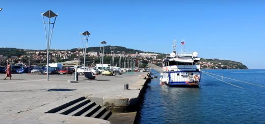
Students' answer: The city of Yeisk. (slide 10.11)
- Yeisk - a city in the Krasnodar Territory, a regional center; is on the shore Sea of Azov at the mouth of the Yeya river, at the base of the Yeisk spit. The area where the city of Yeisk is located has been inhabited by various tribes since ancient times, as a very comfortable spot for fishing. The Yeisk spit, which juts out 7 kilometers into the sea, forms a convenient, albeit shallow, natural harbor. In 1792, the Black Sea Cossacks, under the leadership of their koshevoy ataman Zakhary Chepegi, stopped at the Yeisk fortress town, and after wintering, left 200 Cossacks here, while they themselves moved into the depths of the Kuban steppes to the Kuban River. In March 1848, the Russian government issued a decree establishing on the site of the Yeisk fishing settlement of the Nortovsk town of Yeisk. The name is translated in different ways: from the Tatar yayya, which means Ivan (Russian peasants have long settled here); the second meaning also comes from the Tatar her - "overflowing, shallow river". The Nogays called her Yane, which means "Ivan" in translation.
2. Hydronyms - proper names of any water bodies of rivers, lakes, seas, streams, river banks, etc.
Our journey continues. Tell me, guys, what kind of water body will we talk about now? (the teacher reads out the etymology of the name of the river Eya):
FROMThe most abounding and long river Azov-KuBansko lowland... The river appears to have given names to many place names. BeforeXviiiin. in place modern city the village of Khansky town was located (Chebakleya - from the Turkic "bream" and "river"). Having traveled about 320km the river to the west of the village of Staroshcherbinovskaya, flows intoestuary.
Students answer: this is the river Eya. (Slide 12,13)
Indeed, this is the river Eya. Let's find out what its name means:
Her - the name of the rivertranslated in different ways. The most widespread version is from the Tatar "yayya", meaning Ivan, since long ago Russian peasants and fishermen settled here. The second, less common version, is translated from the Tatar "her", meaning "overflowing, shallow river". Strabo calls It the Big Rombite, i.e. big river rich in flounder.
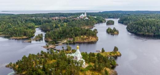
- Now the most beautiful lake Krasnodar Territory, its name is Kardyvach.(slide 14,15)
Kardyvach - Mountain Lake in the Krasnodar Territory; is located at the source of the Mzymta River. Lake Kardyvach is one of the most beautiful places in the entire Western Caucasus. According to Tskhomaria, Kardyvach is a modified Kar Bash - "snow head". This is not true, since kar (kara) among the Turkic peoples means "black"; moreover, in this part of the highlands of the Western Caucasus, Turkic toponyms are not found at all. But if we make an exception, then we can assume that the translation of the toponym is based on the Türkic kar (a) - "land", i.e. - "top of the earth". At Sh.D. Inal-Ipa, the lake is called Mzymta-Adzykh, where adzykh is "an old (ancient) spring (lake)", i.e. - "the lake from which the Mzymta flows", which is confirmed by the reality.
3. Oronyms - proper names of any relief elements of peaks, ridges, mountains, gorges, gullies, depressions, hillocks, etc.
In the Western Caucasus, part of which is located within the Krasnodar Territory and the Republic of Adygea (hereinafter referred to as the Kuban), there are a large number of mountain ranges, in the system of which there are many peaks that have names, as well as unnamed ones. But almost every name for a ridge or peak can be said:
All mountains, yes mountains.
And each one conceals a secret.
Caucasus as a textbook
Still to be overcome.
And everything about him is so new
That my head is spinning.
Color pictures are beautiful
But how incomprehensible the words are.
And again on the road ... we hasten to find out the secret of the name of Mount Fisht.(slide 16.17)
Fisht - Mountain peak in the Krasnodar Territory; is located in the system of the Main Watershed, in the upper reaches of the river. White, Pshekhi. Height - 2867 m. Translated from the Adyghe, as "white frost", "snow-white", "white head", where fy - "white"; shtyn - "freeze" (Adyg.). The westernmost glacier of the Main Watershed lies in the area of Fisht; on its southern slopes there is one of the deepest karst cavities of the Krasnodar Territory - the Soaring Bird ”, depth 525 m. Between the peaks of Fisht and Pshekho –su there is the highest waterfall in the region (165 m), which is one of the sources of the river. Pshekha.
it beautiful place, with its rich history. Our journey continues rapidly and another amazing place that we will visit and reveal the secret of its name isMount Tsakhvoa. (slide 18.19)
Tsakhvoa - mountain peak in the Krasnodar Territory; is located on the territory of the Caucasian State Biosphere Reserve, in the Tsula berd-mezhdurechie of Tsakhvoy and Bezymyanka (basin of the Malaya Laba river), in the Herzen ridge system. Mount Tsakhvoa is the highest point of the Krasnodar Territory, its height is 3345.9 meters. The glacier of the same name lies on the northwestern slopes of the summit. Oronym is translated from Abkhazian-Abaza, as "sharp peak".
4. Summing up the results of the lesson and assigning marks. (5 minutes.)
It's time to get back from the trip. Tell me, what impressions, experienced on the way, left the most vivid memories? What new have you learned in the lesson? What is your mood after the trip?
Remind me what toponyms are and what types of toponyms have you met?
Would you dare to take another trip like this? And in which areas of the region would you go on your own?
Those guys who actively participated in our journey receive A's for the lesson. You are all great.
I took all the materials for our trip from the dictionary:Author - Tverdy A.V. Toponymic dictionary of the Caucasus, this source will help you, in preparation for the next trip to our region,and what it will be, you will find out by writing down your homework.
5. Homework. ( 3 min)
We will divide into creative groups in rows as you sit. And each group will carry out their task.
So,first group should prepare an information booklet for tourists about the origin of the names of the resort cities(they choose themselves, no more than five names) ; the second group is cooking a presentation on the secret of the names of our two seas and any river in the Krasnodar Territory (no more than six slides of the presentation); third group prepares information sheets with a story about the history of the names of caves, gorges, ravines of the Krasnodar Territory (names are chosen by themselves, no more than five).
(Slide 20).
Our language is very rich, our land is amazing and we are a part of all this wealth and miracle. Study and take care of all this. Thanks for your work!
Olga Chizh
Symantic classification of toponymic names of oikonyms, oronyms and hydronyms of Krasnodar Territory
Download:
Preview:
INTRODUCTION ……………………………………………………………………3
Chapter I. Toponymic features of geographic objects ……… .4
1.1. Toponymic layers ……………………………………………… .4
1.2. Hydronyms …………………………………………………………… .... 6
1.3. Oikonyms ……………………………………………………………… ..11
1.4. Oronyms …………………………………………………………………… 15
Chapter II. Analysis of the semantic classification of topographic names ………………………………………………………………………………………………………………………………………………………………………………………………………………………………………………………………………………………………………………………………………………………………………………………………………………… ..19
2.1. Schedule of the semantic classification of hydronyms …………………………………………………………………………………………………………………………………………………………………………………………………………………………………………………… 19
2.2. Schedule of semantic classification of oikonyms ………………… .... 19
2.3. Schedule of semantic classification of oronims …………………… ..20
2.4. Schedule of semantic classification of toponyms ………………… .... 20
References …………………………………………………………… 22
Introduction
Relevance of the topic.Humanitarian and environmental research is aimed at studying the true life of peoples, to familiarize with folk traditions, rituals, creativity and culture. In the modern unified world, a person strives for self-identification, seeks and studies his ethnic roots in order to feel special, with a deep history and his own cultural traditions. And knowledge of other cultures and ethnic characteristics allows him to compose a holistic picture of the multifaceted world of peoples and nationalities, unique in their individuality. The most complete and holistic study of the relationship between ethnos and nature is possible only with the help of toponymy. It is the etymology that can tell about the origin of the word, including the geographical name.
The purpose This work is an analysis of the ethnographic data of Krasnodar Territory, based on toponymic names. To achieve this goal, it was necessary to solve the following tasks:
- identify the sequence of toponymic layers in the Krasnodar Territory;
- study the available literature;
- to evaluate the totality of hydronyms, oikonyms and oronyms;
- carry out a semantic classification.
Research objectis the territory of the Krasnodar Territory, andsubject of researchvariety of toponymic names, different ethnic groups.
Chapter I. Toponymic features of geographic objects.
- Toponymic layers
The toponymy of the Krasnodar Territory concerns the field of linguistics and has been little studied from a geographical point of view.
Our region is exceptionally rich in toponymic names. The first and most ancient layer of these names belongs to the ancestors of the Circassians and their descendants. The second, less ancient, was left by the Cimmerians, Scythians, Sarmatians and Alans. The third - the most recent toponymic layer was deposited due to the appearance of the Goths, Bulgars, Komans and Russians. Inside each of the toponymic layers, there are layers of names that were formed at different times. In the foothill and mountainous regions of the Krasnodar Territory, there are also hybrid, bilingual names created by the Adygs by adding their own different words to the borrowed foreign language word. This huge toponymic material has not yet been studied. Studying it will give important additional information about the ancient settlement and migration of ethnic tribes across the territory of the Krasnodar Territory, about the nature of their material and spiritual life in the past, and most importantly, it will help to establish the relationship between ethnos and nature.
Toponymic data will provide a significant service to history ethnic languages, since the etymological meaning of an obsolete word is often hidden in a geographical name.
Over the past millennia, our region has been invaded by various tribes and peoples, which could not but affect the toponymy of geographical objects. First, these were the Cimmerians mentioned by Herodotus, then the Scythians (from the 7th-8th centuries BC) and the Sarmatians (from the 3rd century BC to the 2nd-3rd centuries AD). What language the Cimmerians spoke is unknown, although there is reason to believe that these were tribes linguistically close enough to the later Scythians, who spoke languages and dialects of the ancient Iranian type, close to Ossetian. The Sarmatians (later the linguistic descendants were called Alans) were also the closest linguistic relatives of the Scythians.
From the end of the IV century. AD The Scythian-Sarmatian group of steppe nomads was driven out or absorbed by the Huns, whose language was close to the Turkic and Mongolian groups, in contrast to the Indo-European - the Scythians. Since then, the domination of the Türkic-speaking tribes has been established in the steppes: Avars, Bulgars, Khazars, Pechenegs, Polovtsians - right up to the domination of the Türko-Tatar hordes, which was formed as a result of the Mongol-Tatar invasion of the 13th century. In the second half of the XIII century. Turkic elements were finally driven out of the Northwestern Caucasus.
There are also many Slavic, Ukrainian, Greek names... The toponymy of the Krasnodar Territory is rather complicated. It captures traces of different eras and linguistic layers, reflects the multinational composition of the population. Nations speak languages that belong to different language groups:
- Adyghe-Abkhaz and Nakh-Dagestan (Adyghe, Circassian, Kabardian, Avar, Dargin, etc.);
- Iranian (Ossetian);
- Turkic (Kumyk, Nogai, Balkarian, Karachai);
- Slavic (Russian, Ukrainian).
For a comprehensive study of toponymic names, a semantic classification is required:
1.2 Hydronyms
Hydronym is the proper name for a river, lake, stream, swamp, source, well.
1. Abrau - a lake in the Krasnodar Territory; 26 km from Novorossiysk. The Circassians Abrago - "Failed".
2. Agva - a river in the Krasnodar Territory, a tributary of the Sochi River. From Abkhaz akua - "rotten".
3. Agura - a river in the Khostinsky district of the city of Sochi, Krasnodar Territory. The etymology of the hydronym goes back to the Adyghe agure - "middle river".
4. Albashi is a steppe river of the Krasnodar Territory. The name is associated with the Turkic language - "red head".
5. Beysug - the river of the Krasnodar Territory flows into the Beysug estuary. From Turkic - "princely river".
6. Bzych is a mountain river, a tributary of the Shahe River. Etymology from Ubykh - "cold water".
7. Bugundyr - a river in the Abinsky region, originates on the northern spurs of Mount Shize. The origin of the name is Turkic - “crooked channel”.
8. Dysh is a small river that originates from the slopes of the Pshaf ridge. Translated from Adyghe - "gold".
9. Ile - a river in the Seversky region, originates on the slopes of Mount Ubin-Su. From Mongolian - "sparkling, brilliant".
10. Inpsi is a mountain lake in the Tsakhvoa river valley. Translated as - "big water".
11. Kamla is a small steppe river, a left tributary of the Pshish river. At the heart of the hydronym is the Adyghe - "reed".
12. Kardyvach is a mountain lake in the Krasnodar Territory. The etymology of the hydronym is "snow head".
13. Kiziltashsky - estuary in Temryuk district... From Turkic - "red stone".
14. Kirpili is a steppe river of the Krasnodar Territory. From Tatar - "pavement".
15. Kuafo is a left tributary of the Abin River. From the Adyghe - "bright, clean valley".
16. Kudepsta is a river of the Black Sea coast. Translated from Adyghe - "serum".
17. Kuksa is a river in the Labinsky region. From Nogai - "blue water".
18. Makopse - the river in Tuapse region, originates on the slopes of the Bolshoi Pseushkho mountain. From Adyghe - "blue water".
19. Marta is a small river that originates on the slopes of Mount Koth. In Adyghe-Abkhazian rivers means “steep slope”.
20. Mzymta is the most large river on the territory of the Krasnodar Territory, flowing into the Black Sea. Semantics - "born in the snow".
21. Nak is a small river near Gelendzhik. At the heart of the hydronym is Adyghe - "naked", "skinny".
22. Nebug is a river in the Tuapse region. Etymology - "wide-eyed".
23. Psebe is a mountain river in the Tuapse region, a left tributary of the Nechepsukho river. From Adyghe - "high-water".
24. Psezuapse - a river in the Lazarevsky district of the city of Sochi. From Shapsug - "good-natured".
25. Psenafa is a steppe river of the Krasnodar Territory and Adygea. From Adyghe - "open water".
26. Psenodakh - a lake in Adygea. Hydronym from Adyghe means "beautiful well".
27. Psiy is the right tributary of the Shakhe River. Hydronym from Adyghe means "evil river".
28. Psou - a river on the border of the Krasnodar Territory and the Republic of Abkhazia. From Abadzekh - "long river".
29. Teshebs is a mountain river in the Gelendzhik region. From Adyghe - "golden water".
30. Urushten is a left tributary of the Malaya Laba. The etymology of the Ossetian is "white water".
31. Khobza is a small mountain river in the Krasnodar Territory. From Shapsug - "beautiful river".
32. Hosheps is a mountain river in the Tuapse region. From Shapsug - "beautiful river".
33. Adagum - a small steppe river in the Krasnodar Territory, flows into the Varnavinsky discharge channel. The name goes back to the Turkic etymology, where hell - "island", qum - "sand".
34. Gunayka is a river in the Tuapse region. The toponym comes from the Adyghe - "valley of the caves".
35. Dzikhcha is a mountain river in the Krasnodar Territory. From the Abkhazian - "fresh source".
36. Doguab - a river in the Gelendzhik region, originates from the southern slopes of the Kotsekhur ridge. From the Adyghe - "solar river".
37. Zybza is a small river that flows into the Kryukovskoe reservoir. Named from the Adyghe - "lonely river".
38. Kabak - a river in the Tuapse region, a left tributary of the Tu. From Adyghe - "cave valley".
39. Kaverze is a large left tributary of the Psekups River. The name goes back to the Adyghe - "swan".
40. Kudako is a left tributary of the Adagum River. From the Adyghe - "oil valley".
41. Kuzheps - a river in the Tuapse region. Etymology from the Adyghe - "pear tree".
42. Kutayka is a right tributary of the Nechepsukho River. From the Adyghe - "a herd of wild boars".
43. Makartek - a small stream, the right tributary of the Dysh River. From the Adyghe - "hay field".
44. Matsesta is a river within the Greater Sochi. From the Abkhaz-Abaza - "fire water".
45. Mezyb - a river in the Gelendzhik region. Hydronym from Adyghe means "a lot of forest".
46. Mekertuk is a small river in the Krasnodar Territory. From Adyghe - "deep apple kut".
47. Miguta is a small steppe river in the Krasnodar Territory. The Persian translation is "misty river".
48. Mishoko - a river in the Maykop region, a left tributary of the Belaya River.Translated - "bear valley".
49. Neberdzhai is a river in the Crimean region. The literal translation is "predatory eagle".
50. Psekups is a river in the Krasnodar Territory and Adygea. The presumable translation is "river of the valley of the blackclaws."
51. Pshenakho is a mountain river in the Tuapse region. The Circassians have a "spring valley".
52. Sosyka is a left tributary of the Ei. From Turkic - "rotten", "smelly".
53. Tuba is a mountain river in the Tuapse region. From Türkic - "hill, hillock".
54. Abba - a small mountain river in the Krasnodar Territory, a left tributary of the Kichmai River (the Shakhe River basin). Oooabbe - “Allah” is the local god of the Ubykhs.
55. Kalaly is a left tributary of the Yegorlyk River. Hydronym from Tatar means “fortified place”.
56. Kanuk is a left tributary of the Khodz River. From Adyghe - "guest".
57. Kurdzhins - a river in the Absheron region, a left tributary of the Belaya river. At the heart of the hydronym is the Adyghe - "Georgian river".
58. Nagish - a small mountain river in the Lazarevsky region, the right tributary of the Psezuapse river. Translation - "omen, landmark".
59. Napsoshok is a small river in the Tuapse region. From Adyghe - "a beam of horse tears".
60. Pslukh is a mountain river in the Krasnodar Territory. Etymology - "pasture river".
61. Pshish is a left tributary of the Kuban. The Circassians have a "prince".
62. Sekua-river in the Tuapse region. Etymology is “my valley”.
63. Sipsil - left tributary of the Apchchas river. From Adyghe - "my river".
64. Khakuzhif - the right tributary of the Psif River. At the heart of the hydronym is the Adyghe - “old place of residence”.
Ethnotoponyms:
65. Adegako is a small mountain river in the Seversky District of the Krasnodar Territory, the right tributary of the Shebsh River. At the heart of hydronym ethnonym Adyghe.
66. Adegoy - a river in the Abinsky district of the Krasnodar Territory, the left tributary of the Abin river. The hydronym is based on ethnonym Adyghe
67. Zhane is a mountain river in the Gelendzhik region. Named from the Janeyev tribe.
68. Khatyps - a small mountain, right tributary of the Psekups. Hydronym goes back to the name of the people.
69. Abin - a river in the Krasnodar Territory, originates from the northern slopes of the Kotsekhur ridge, flows into the Varnavinsky discharge channel.
70. Tlyabgu - left tributary of the Kaverze River. The etymology of the hydronym is difficult.
1.3 Oikonyms
Oykonym is the proper name for any settlement (city, village, village, farm, etc.)
Names characterizing the features of the object:
1. Abuzy is a tiny farm on the territory of the Goryacheklyuchevsky City Council. The toponym is based on a proper name Abu and zy - "One", "lonely".
2. Anapa is a resort town of the Krasnodar Territory. The toponym goes back to the Adyghe etymology - "table", "edge", "nose".
3. Bolshoi Kichmai - Shapsug aul in the Krasnodar Territory; in the right bank of the Shakhe River. The name is of Turkish origin - "sandy river".
4. Guzel-Dere - resort village The Black Sea coast. From Turkish - "beautiful gorge".
5. Kamennomostsky - a settlement in the Maikop district. Named because of the stone bridges in the canyon of the Belaya River.
6. Kodo is a settlement in the Tuapse region. The etymology of the oikonym from the Adyghe means “abyss”.
7. Madik is a tiny farm in the Tuapse region. Semantics - "little finger".
8. Najigo is an aul in the Tuapse region. From the Adyghe - "coastal valley".
Names characterizing the natural conditions of the area:
9. Altmets is a small village in the Krasnodar Territory, north of the village of Dagomys. Etymology from the Adyghe "wild forest".
10. Benokovo is a village in the Mostovsky district, not on the left bank of the Khodz river. The etymology of oikonym is "valley of thorns".
11. Gostogaevskaya - a village in the Anapa region. Translated from Adyghe - "fir".
12. Guamka is a settlement in the Absheron region. Translated from the Adyghe - "the smell of mistletoe."
13. Kelermesskaya - a village in the Giaginsky region of Adygea. From Adyghe - "cherry forest".
15. Maratuki is a tiny farm in the Absheron region. Semantics - "sunny place".
17. Messozhai is a village in the Tuapse region. Translated - "dogwood meadow".
18. Psebay is a settlement in the Mostovsky district. From Adyghe - "a lot of pears".
19. Saukdere is a settlement in the Crimean region. From Turkic - "cold gorge".
20. Taman - a settlement in the Temryuk region. From the Adyghe - "swamp", "lake".
21. Tuapse - resort town on the Black Sea coast. Etymology is "two-flux".
22. Shedok is a settlement in the Mostovsky district. From Kabardian - "swamp gully".
Names characterizing the life and culture of the population:
23. Apsheronsk is a city in the Krasnodar Territory. The etymology of the oikonym is “the fortress of Apshera”.
24. Armavir is a city in the Krasnodar Territory. Armavir is the capital of the ancient Armenian kingdom.
25. Babarluk is a village in the Tuapse region. Armenian etymology is “testev's garden”.
26. Dzhanhot is a resort village in the Gelendzhik region. From Circassian - "happy person".
27. Zhorezh - aul in the Lazarevsky region. The toponym means - "cross", "old". It dates back to the period when the Shapsugs professed Christianity.
28. Kaladzhinskaya - a village in the Labinsk region. From Turkic - "small fortress".
29. Kalezh - an aul in the valley of the Ashe river. From the Adyghe - "old fortress".
30. Lygotkh - aul in the Tuapse region. The toponymy is based on the Adyghe - "old ashes".
31. Magri - a village in the Tuapse region. Named from the names Maria and Gregory.
32. Mamayka is a resort village on the Black Sea coast. Translated as - "Mamai's fortress".
33. Chemitokvadzhe is a resort village on the Black Sea coast. Presumably - "aul of red cows".
Ethnotoponyms:
34. Bagovskaya - a village in the Mostovsky district. The name is from the Abkhaz-Abaza tribal formation.
35. Bzhid - a village in the Gelendzhik region. The name is from bzhedukhs.
36. Vardane is a resort village in the Krasnodar Territory. The name is from the Ubykh tribe.
37. Verkhnebakansky - a village in the Krasnodar Territory. Translated from the Turkic - "fortress of the Nogais".
38. Kaplanovo is a village in the Krasnodar Territory. Named by the name of the Nogai princes.
39. Sochi is a resort town on the Black Sea coast. Etymology from tribal names.
40. Tuba - a farm in the Absheron region. By the name of the tribal formation.
41. Ubykh is a small farm in the Krasnodar Territory. By the name of a warlike tribe.
Names of incomprehensible semantic meaning:
42. Altubinal - a small farm in the Tuapse region of the Krasnodar Territory, on the left bank of the Pshish River. The etymology of the oikonym is difficult.
43. Baybaris is a tiny village on the left bank of the Urup River. The meaning of the name is not clear. (incomprehensible semantic meaning)
44. Dzhubga is a resort village in the Gelendzhik region. There is no exact translation.
45. Mishuk - a farm in the Gelendzhik region. The etymology of the toponym is unknown.
1.4. Oronyms
Oronym is the proper geographical name of mountains, hills, ridges, mounds, intermontane hollows, gorges, mountain ranges and other orographic objects.
Names characterizing the features of the object:
1. Azishtau - mountain range in Adygea. Translated as "road in the mountains."
2. Aishkha - a mountain range between the valleys of the Bezymyanka and Mzymta rivers. Oronym translates as - "evil", "unkind".
3. Assara is a mountain peak on the border of Krasnodar Territory and Adygea. Translated as "small".
4. Big Pseushkho - a mountain peak in the Tuapse region. The toponym is translated as "transparent river".
5. Zhemsi - a mountain range in the Krasnodar Territory; in the right bank of the Psezuapse river. Translated from Bzhedug - "umbrella".
6. Kopitskari is a mountain peak of the Krasnodar Territory. Translated from Armenian - "rough stone".
7. Bald - a mountain peak in the Tuapse region. Between the Kabak and Ponezhin rivers. Named for its external sign.
8. Papay is a mountain peak in the Krasnodar Territory. From Adyghe - “many peaks”.
9. Pochepsukho - a mountain peak in the Tuapse region. From Adyghe - “the beginning of a mountain river”.
10. Sardepe is a mountain peak in the Krasnodar Territory. From Türkic - "yellow hillock".
11. Semashkho is a mountain peak in the Tuapse region. Adyghe etymology oronyms - "big mountain".
12. Fisht is a mountain peak of Adygea. From Adyghe - "white head".
13. Tuishkho is a mountain in the Tuapse region. Oronym from Adyghe - "two mountains".
14. Tsakhvoa - highest point Krasnodar Territory. Oronym from the Abkhaz-Abaza - "sharp peak".
15. Tsyndyshko is a mountain in the Temryuk region. Oronym from Adyghe - "head of a raven".
16. Chugush is a mountain peak in the Main Caucasian ridge. Adyghe name - "top of the earth".
Names characterizing the natural conditions of the area:
17. Abago is a mountain peak in the Krasnodar Territory on the territory of the KGPBZ in the left sources of the Molchepa River. The name is based on two elements: "livestock" and "multiply".
18. Agepsta is a mountain peak on the border of the Krasnodar Territory and the Republic of Abkhazia. Height 3261m. Oronim is translated from the Adyghe as “the river of mountain goats”.
19.Azip - a mountain peak of the Tuapse region of the Krasnodar Territory. Translated as "iron mouth".
20. Akaragvarta is a mountain in the Krasnodar Territory between the Mzymta and Tsakhvoa rivers. At the heart of the oronym is the Abaza element - "a corral for cattle".
21. Bolshoi Tkhach - a mountain peak in the watershed between the rivers Khodz and Belaya. Translated from Adyghe - "cold ridge".
22. Goyth - Mountain pass in the Tuapse region. From Shapsugsky - "ridge with small forest".
23. Dzhemaruk - a mountain peak of Adygea in the territory of KGPBZ. Translated from Karachaev - "mountain of ulars".
24. Dzykhra is a mountain peak in the interfluve of the Mzymta and Psou rivers. The literal translation from the Abkhazian is "mountain, abundant in springs."
25. Kotkh is a mountain range of the Krasnodar Territory. From Adyghe - "boar ridge".
26. Markoth is a mountain range in the Krasnodar Territory. From the Adyghe - "Ozhinovy ridge".
27. Mezetsu - a mountain range in the Tuapse region. Oronym from Adyghe - "ox forest".
28. Oblego is a mountain range in the Gelendzhik region. From Adyghe - "serpent".
29. Oshten is a mountain peak in the Maykop region of Adygea. From the Adyghe - “where the snow gets stuck”.
30. Psegef is a mountain peak in the Krasnodar Territory. The Shapsugs have a “mountain driving out water”.
31. Pshada is a mountain peak in the Krasnodar Territory. The translation is based on Abkhaz-Abaza - "windless".
32. Suetkha is a mountain peak in the Krasnodar Territory. The etymology of the name is "kind ridge".
33. Tugosh is a mountain peak in the Tuapse region. The meaning of oronim is "wolf mountain".
34. Chapluk is a mountain range in the Tuapse region. The Adyghe name is "red land".
Names characterizing the life and culture of the population:
35. Adjara is a mountain peak in the Krasnodar Territory. Height 2836m. From the Abkhazian - "cross".
36. Outl - a mountain peak at the sources of the Psezuapse and Azhu rivers. From the Adyghe "gaevaya foot hunting".
37. Akhun is a mountain peak in the Krasnodar Territory. The name is from the ancient Adyghe deity - Akhyn.
38. Juago son - the name of the northern spur of Mount Fisht. From the Adyghe - "star monument".
39. Turkey - a rocky mountain peak in the Tuapse region. Distorted Adyghe - "Indian mountain".
40. Kadosh - a cape in the Tuapse region. Etymology lies in religious beliefs.
41. Kazan-Bryzgan is a mound in the Labinsky region. The Nogai translation is "broken cauldron".
42. Plyakho - a mountain peak in the Tuapse region. Apparently from the Adyghe - "observant".
43. Khantuk is a small mountain in the Anapa region. Oronym from Adyghe - "place of the khan".
44. Hasegosh - a mountain range in the Tuapse region. Oronym from the Adyghe - "ridge, divided into a site."
Ethnotoponyms:
45 Abadzekhskaya - a mountain in the Krasnodar Territory in the Kotkh ridge system, south-west of the resort city Hot key... Named from the Adyghe tribe inhabiting the valley of the Psekups river.
46. Abadzesh - a mountain in Adygea, in the region of the high-mountain plateau Lago-Naki. The name of one of the ethnographic groups of the Circassians is based on.
47. Agoy is a mountain in the Tuapse region of the Krasnodar Territory, in the system of the Main Watershed. The name is associated with the Adyghe tribal formation.
48. Aibga - a mountain range in the Krasnodar Territory, the watershed of the Mzymta and Psou rivers. Goes back to the self-name of the Abkhaz tribe.
49. Shapsukho is a mountain peak in the Tuapse region. By the name of the tribe.
Names of incomprehensible semantic meaning:
50. Nexis is a mountain in the Gelendzhik region. The etymology of oronym has not been established.
Chapter II. Analysis of the semantic classification of topographic names.
2.1. Schedule of the semantic classification of hydronyms:
This graph displays the main features of toponymic names, which consist in the fact that most of the hydronyms have names associated with the characteristics of the object and characterizing the natural conditions of the area. This is due to the fact that in the Krasnodar Territory there is a huge number of rivers and lakes, diverse in appearance and origin. Consequently, the people inhabiting the territory of the region gave names that characterize the object.
2.2. Schedule of the semantic classification of oikonyms:
The results of the semantic classification of oikonyms differs significantly from the classification of hydronyms, since the share of ethnotonyms and toponyms characterizing the life and culture of the population increases here. This is due to the fact that settlement most often they assigned a name that characterized the way of life and features of the economic activity of the population.
2.3. Schedule of semantic classification of oronyms:
According to the classification of oronims, it can be concluded that, as in the first classification, a large proportion of toponymic names belongs to those that characterize the natural conditions of the area and the features of the object.
2.4. Schedule of semantic classification of toponyms:
- Names that characterize the features of the object;
- Names characterizing the natural conditions of the area;
- Names characterizing the life and culture of the population;
- Ethno-toponyms are names derived from the names of tribes and clans;
- Names of incomprehensible semantic meaning.
OUTPUT: With the help of this graph, it can be concluded that thanks to ancient history the settlement of the Krasnodar Territory by various ethnic groups and the richest variety of natural conditions, one can trace the relationship between man and nature. However, white spots still remain in toponymy. And now modern generations are faced with the primary task of a detailed study of the history of their small homeland.
Bibliography:
- Waterfalls of the Krasnodar Territory as objects of tourism and excursions. A.A. Samoylenko. Krasnodar 2010
- The history of the Kuban from ancient times to the end of the 19th century. V.N. Town Hall. OIEI "Perspectives of Education". Krasnodar, 2000
- Caucasus in names. A.V. Tverdy. Ed. Platonov. Krasnodar, 2008
- Map of the Krasnodar Territory and the Republic of Adygea. Scale 1: 1,000,000 Reference and cartographic publication. Issue No. 1, 2011
- Kuban collection III (24). A.M. Avramenko, G.V. Kokunko. LLC "Book": Krasnodar, 2008.
- Interethnic relations: theory, practice and the problem of the Kuban. M.V. Savva. Krasnodar, 1993
- General geographic regional atlas of the Krasnodar Territory and the Republic of Adygea. Scale 1: 200000 3rd edition, additional, 2003
- The nature and economy of the Krasnodar Territory. P.F. Riesel, Krasnodar, 2004
- Native Kuban pages of history. Edited by V.N. Ratushnyak OIPS "Perspectives of Education". Krasnodar, 2003
- The mystery of place names. G.T. Chuchmay "Kuban textbook". Krasnodar, 1999
- Tourist routes of Adygea and Krasnodar Territory. A.I. Vilyakhovsky. OJSC "Afisha", Maykop, 2006