National roads scattered all over Norway are called real pearls for a reason. Allowing a different look at the picturesque nature of the harsh country, these highways are of great interest to tourists.
The best way to discover an unfamiliar country
An exciting car trip is a great way to get to know the country better. I must say that it was the Norwegian architects who have recently loudly declared themselves, having installed unusual art objects along the tracks, emphasizing the exceptional beauty of the local landscapes.
National roads that combine nature and design into a single whole is a unique project of the state, in which local and foreign specialists are involved.
The most picturesque highway
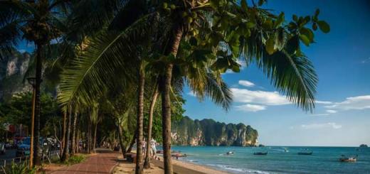
In 1989, a new road was opened - Atlanterhavsvegen (Atlantic Road), recognized as the most picturesque in the world. The highway, which runs along the western coast, is more than eight kilometers long and passes through numerous islands of the ocean located between settlements. The Atlantic Road (Norway) is an unusual section of a two-lane highway.
The history of the emergence of the popular tourist highway
The miracle of Norwegian engineering is a rather powerful road route with bridges that are over 23 meters above sea level. The main line running through the Eide archipelago was planned to be used as a railway line, but at the beginning of the 20th century this idea was abandoned due to the complexity of laying tracks.
In 1983, large-scale work began, interrupted by many problems and unfavorable weather conditions: it is known about 12 powerful hurricanes that hit this site. After six years, the Atlantic Road (Norway), declared the best highway for travel, was opened. Within a year, all the funds invested in the construction paid off.
Part of the cultural heritage
We can say with full confidence that the highway with a width of more than six meters has become part of not only the country's infrastructure, but also the cultural heritage. Atlantic Road (Norway) includes eight bridges and four panoramic observation decks.

The most visited landmark of the state in Northern Europe is a favorite place for tourists who dream of taking a ride with the breeze through the amazing structure of the century with unique architecture, illusory effects, and amazing views of the ocean.
The Atlantic Road (Norway), the photo of which shows its steep bends, is equipped with spare pockets, where you can easily park your vehicles and go to the rocks to fish.
The bridges of the road arouse incredible interest among visitors. For example, Storseisundet is popularly nicknamed "drunk" and reminds everyone of the well-known roller-coaster ride: at a certain angle it seems that a structure similar to a springboard breaks off right in the sky, and such an optical illusion delights and terrifies travelers. According to the tourists themselves, to travel along the road, you need really strong nerves.

By creating a structure 260 meters long, the architects pursued the idea of attracting the attention of travelers, and in addition, it was necessary to provide convenient access for ships to land. Sturseysundet Bridge, which offers a breathtaking view of the ocean, is a truly unique structure that does not inspire confidence in first-time travelers on the Norwegian road.
Atlantic Road (Norway): reviews
The guests of the country admit that the zigzag highway is not only admirable. Special feelings arise during a furious storm, when the rolling waves, wanting to swallow tourists, crash next to the road. During an extreme journey, adrenaline is released into the bloodstream, and emotions are off the charts. This is not only a beautiful road, but also one of the most dangerous. So, in 2003, a tourist from Israel was washed into the ocean by a huge wave, but despite the tragedy, the highway attracts millions of visitors to the country.

Thanks to the stunning bridge structures, passengers during the ride do not see where the Atlantic Road (Norway) ends and begins, and such an unusual journey, combining the romance of adventure and thrill, will be remembered forever.
Many people point out that along the highway there are cozy hotels where you can relax and enjoy the bad weather from the window of a comfortable room. In addition, the area is ideal for diving, and diving enthusiasts from all over the world stay here during the summer. Fishing tours organized by sports centers are also very popular.
Tours to Norway
The Atlantic Road (Norway), intended for visitors, has been of great interest for many years. The Fly & Drive tour allows everyone to get acquainted with the main attractions of the northern country, which, according to legend, is home to trolls.
This is a unique opportunity to visit the main cities of the Scandinavian state, see picturesque fjords with your own eyes and drive along mountain serpentine roads, including the most picturesque of them.

If I were to list the most beautiful places every traveler should visit, the top ten would undoubtedly be the Atlantic Road in Norway. Winding several kilometers along the islands and skerries, the road leads to the ocean coast. Built at the end of the last century between small islands, it was instantly recognized as "The main Norwegian building of the 20th century".
The British The Guardian awarded the track first place in the category of the most scenic roads in the world, and it is well deserved. But its main feature is in the magic bridge. When you go along it, you get the impression that this is Lezeppellin's "Stairway to Heaven" and approaching the middle, you instinctively group yourself, getting ready to jump ...

Road from Alesund towards Molde. Ahead is a mountain with "teeth marks": it seems that a fairy-tale giant bit her right at the top:
3. 
Another ferry goes to Molde for 1700 rubles (217 kroons):
4. 
The ship and the cabin are small:
5. 
In Molde itself, we did not particularly stay long. Last time the town seemed boring and unremarkable to me. We limited ourselves to climbing to the observation deck and took a couple of shots:
6. 
We parked next to a funny car. I deliberately stood next to my Discovery to catch up with her. The machine turned out to be almost two times shorter:
7. 
In 2007, when I came here for the first time, there were no drones yet and it was impossible to estimate the scale of the road in one shot:
8. 
The highway is almost 8.5 kilometers long and consists of several roads and large bridges, viaducts:
9. 
Until 1970, a ferry ran between the islands, but even then it became clear that the waterway could not cope with the growing flow of cars. It was decided to pave the road. We designed and planned construction for several years, the beginning was laid in 1983:
10. 
The construction was challenging. For six years, the road has experienced 12 powerful hurricanes (fortunately, there were no casualties). In the period from 1989 to 1999, the Atlantic Road was toll, then, when the construction fully paid off, it was opened to all motorists:
11. 
Storsezandet Bridge is the longest and most famous bridge on the Atlantic Road:
12. 
Locals call it the "Drunken Bridge" because it does not stand like ordinary bridges - exactly - but meanders left and right, up and down. If you look at it from a certain angle, it seems that the top is directed upwards and cars passing along the roadbed are about to take off into the sky:
13. 
The Storsezandet Bridge is also the highest point of the entire route. It is raised above the water to a height of 23 meters. The construction of the bridge was made in order to allow ships to pass under it:
14. 
On this day we lived in an excellent hotel just 2 kilometers from Storsezandetsky bridge. I took a few photos from the copter right from the hotel room, since modern drones can fly within a radius of 2.5 km. True, I did not take into account one thing: to the bridge, he flew in the wind at a speed of 12 meters per second, and back - twice as slow. There was a risk that the battery would run out, but nothing happened:
15. 
The hotel is located on an island and to get to it, you need to take a little boat ride:
16. 
Departure for the island of Hoholmen to the Håholmen Havstuer cottage village takes place every hour. Moreover, this is not just a "water minibus", but a historic restored ship. Please note that the rudder is not in the center of the boat, but on the side, like the Vikings:
17. 
The boat only accepts passengers. Cars must be parked in the parking lot near the pier. Parking, by the way, is free:
18. 
Our hotel on the island:
19. 
20. 
A hotel in Hoolmen cost about 12,500 rubles per family per day (1,590 crowns). A large cottage with 5 bedrooms (sleeps 8) was booked for us, with a bathroom and a large living room:
21. 
The bedrooms are small but very cozy:
22. 
View from the window:
23. 
Track of the day can be downloaded
A unique stretch of road that leads along the edge of the ocean. In 2005, the road was recognized as the "Engineering Feat of the Century" in Norway. This is the most beautiful road that I have seen in my life. And this is not the only engineering feat of Norway that will be discussed in this article.
The Atlantic Road connects Averøy to the mainland through a series of small islands and islets. Eight bridges have been built on a stretch of road just 8274 meters long. The Atlantic road was opened in 1989 and is absolutely free, toll and expensive at the moment is the passage through the Atlantic tunnel, they also take money to enter Kristiansund, this is the fee that many consider to be the payment for entering the Atlantic road.
It so happened that almost a whole day of travel in Norway was devoted to the Norwegian engineering genius. We woke up in Valdal, moved towards the Atlantic road from the side, I described it and the surrounding landscapes in a previous article.
Fare: Troll Road - Atlantic Road - Atlantic Tunnel
Since tourists often travel exactly this route: Troll Road - Atlantic Road - Atlantic Tunnel (any of these sections of the route is an engineering miracle), I will give a calculation of the fare.
In general, it turns out to be quite an expensive pleasure. The map contains links to Norwegian sites where you can check the fare, click on the red labels.
These are footage taken on the way to the Atlantic Road. Luckily, the Troll Route is completely free, but the Molde-Vestnes ferry service had to be paid for.
The blue dot on the map is the Trollkyrkja - Trollkirche. This is not a long hiking route to the cave, the walk back and forth will take about 3 hours, you must take a flashlight with you, the cave is dark, only at its end there is a very beautiful hall with a waterfall.

 Unloading the Molde-Vestnes ferry
  Bridge In Molde, this is not the Atlantic road yet, although it is very similar
 Atlantic Road things to do
On the Atlantic Road, much will depend on weather conditions. We were lucky the weather was great, the views are amazing. But even in clear weather, a fairly strong wind blows on the Atlantic Road. Along the road there are 4 observation decks with parking lots and tourist information boards. There are places where you can leave the fishing rod in the sea right from the shore or from one of the bridges, and there will be quite deep sections right in front of you. The sea water was clear, fish, jellyfish and seaweed were clearly visible. One could even sunbathe on the rocks on the leeward side.
The fish laughed at us again, it even swam for the bait, but was too lazy to swallow it, the more successful fishermen standing nearby said that the bite was over, the tide was out. The bite in the fjords depends on the ebb and flow of the tide. As the experience of our trip, already coming to the end, has shown, in order to catch fish, you need to allocate time for fishing, you just don't catch fish in between times.
 We found such a place to leave the fishing rod
 There is the possibility of renting a boat, diving and even camping right on this road.
From the history of the creation of the Atlantic Road
The Norwegians began to think about the construction of this road at the beginning of the 20th century, then it was supposed to make it a railway, but the real project began to be prepared only in 1970, and construction began on August 1, 1983. The road was opened on July 7, 1989. Over the years of construction, 12 hurricanes swept over the future road. The construction cost was NOK 122 million. To reimburse them, the road was toll from 1989 to 1999. The middle bridge, which leads to nowhere in the most spectacular frames, was made the highest so that ships could freely sail under it.

The Atlantic Road is one of the 10 most dangerous roads in the world. During a storm, waves often roll over sections of the road, but this is not the worst thing. Hurricane winds can have much more dire consequences.
There were times when cars were literally blown off bridges, especially strong winds are dangerous for trucks. I can't resist inserting someone else's video. It seems to me that it is much more fun to watch such adventures on video than to take part in them. It's scary, after all.


Atlantic tunnel
The Atlantic tunnel connects the islands of Averei and Kristiansund, the depth of the tunnel reaches 250 meters, which makes it one of the deepest underwater tunnels in the world, the length is about 5,727 km, the slope is quite significant, take care of your brakes, a grand tunnel, carved into granite rocks, there are several points for calling emergency help.
There is only one way to save money on the passage of the Atlantic Tunnel: take a ride on the free Atlantic road, turn around and go in the opposite direction. The Atlantic Tunnel is, of course, an engineering miracle, but the cost of travel is disappointing. And the passage through the tunnel itself, in general, cannot cause any emotions. We in St. Petersburg take the subway almost every day, no one considers it a tourist attraction.
In principle, Kristiansund is not a must-see city, except for the sculpture of a woman with a bang there is nothing to look at. Most of all, we were surprised by the paid parking next to the Remi supermarket on the waterfront of the city.


After leaving Kristiansund, we decided to look for a campsite. As it rained badly, drove into the campsites and asked for a house, but alas, there were no free houses, so we had already moved more than 100 km from Kristiansund, there were no free houses anywhere decided to put up a tent in
What is Norway's Atlantic Road famous for? How to get there and what to see. Where to park your car and how to find observation decks.
The mysterious name "Atlantic Road" hides a two-lane highway in the Norwegian governorate of Møre og Romsdal. According to the British newspaper The Guardian, this road in Norway was recognized as the best and most picturesque among the tourist highways in the world. This is the opinion of many guests of the country who were fortunate enough to be here.
The construction of the Atlantic Road began in 1983, but it was not completed in the shortest possible time. Therefore, the construction was ready only by the summer of 1989. During this period, the builders have seen 12 hurricanes. As a continuation of the 36-kilometer tourist road no. 64, the new 8.27 km road was awarded the title of Norwegian Building of the Century in 2005.
Today the highway winds like a roller coaster and runs along several bridges linking the islands between two settlements - cities Molde and Kristiansund... The highest of the bridges is named Sturseisunde... It was built at a height of 23 meters, especially for the passage of ships under it.
When is the best time to go to the Atlantic Road
Many travelers flock to Norway's Atlantic Road in autumn when the weather is windy. During a raging storm, breaking straight onto the track, the waves create an incredible sight.
In bad weather, the Atlantic road does not inspire confidence

Landscapes become brighter during warmer months.

The panoramic photo makes it easier to imagine the uniqueness of the Atlantic Road.
Along the track there are observation platforms equipped with special platforms for fishing. Thanks to these facilities, you can watch local birds as well as seals. Whales, unfortunately, are rare in these waters, so not everyone can see them.
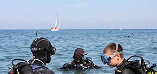
Fishing tours and cycling trips are organized during the summer months. Coastal waters with strong currents are suitable for diving. Therefore, tours for divers are often organized in the vicinity of the Atlantic Road. Surfing enthusiasts are also not uncommon in Hustadwick Bay.
What to do and what to see
For most travelers, a stop at one of the viewpoints on the Atlantic Road is just one of the entertainment on the way to, or Tromso. One or two hours are enough for everything.

The pier in the hamlet of Håholmen Havstuer near the Atlantic Road
But if the terrain appeals to you, you can deviate from the ornate highway and take the nearest Hoholmen island, the area of which does not exceed four hectares. Tourists go there by boat, leaving their car in one of the parking lots (they are free and absolutely safe).
The only settlement on the island is a small village with an untranslatable name. Håholmen Havstuer... As in the 18th century, in the village you can settle in partially preserved, partially restored huts and feel like a Vikings. For centuries, the inhabitants of the island of Hoholmen were engaged only in fishing, probably having achieved perfection in this business. Today these traditions are carefully guarded - albeit for tourist purposes. There are traditional taverns in the village where you can taste the freshest fish dishes in Norway!
#one. Håholmen Havstuer

Such houses are waiting for you in Choholmen. Atlantic Road views, sunsets, fishing and more romance guaranteed! By the way, do not worry about comfort - the rooms have all the amenities, high-quality beds, mattresses, plumbing. It is better to keep silent about breakfast at night, looking, who has been to Norway, in the course of how satisfying and generous the food is there. Only one herring of 3-5 species.
To summarize: is it worth the ride
Norway's Atlantic Road is a must see destination. The dream of everyone who is not indifferent to seascapes and loves to travel by car (and most importantly - did not forget to rent this very car). The building, unique in design, fits perfectly into the landscape.
However, in some places ferries have already been replaced by bridges, which pleases - the bridge is much more convenient and faster. Although, of course, not so romantic. :-)
So we got to the Atlantic Road. This road, frankly speaking, is not quite a standard structure. It is located on two small archipelagos, consisting of dozens of tiny islets and villages. From above it looks like this:
The idea of connecting these islands has been wandering in the minds of the Norwegians for a very long time. At the beginning of the 20th century, there were even projects on how to implement this plan, but in the 30s they were given up. However, in the late 70s, the Norwegian authorities returned to the idea of building this road, and in 1983 construction began. It lasted 6 years, during which the builders survived 12 hurricanes - these places are in no way obscured from the open ocean, so the weather here leaves much to be desired, especially in autumn. As a result, the road was built - its length is a little more than 8 kilometers, but 10% of them the way goes over bridges, which were built by as many as 8 pieces. In 2005, the road was declared "The Norwegian Building of the 20th Century", and the Guardian magazine named it "The Most Significant Road in the World."
Naturally, I could not miss it, especially since the hook turned out to be quite small. :-)
When we arrived at the start of the road, the whole area was shrouded in fog. A huge number of small islands, mostly uninhabited, could be seen through the veil.
Deciding to wait for the fog to subside a little, we walked around the neighborhood. The nature there is harsh, the vegetation is stunted. The bright red berries, which we initially mistook for lingonberries, turned out to be tasteless bearberry.
Bells are everywhere in Norway. :-)
One of the sides has already cleared, the sun came out.
Finally, the fog began to dissipate, and it was already possible to make out the Storsysundet Bridge, which the locals call the "Drunk Bridge", and the tourists - "The Road to Nowhere."
Why "drunk" - it becomes quite clear if you look at the whimsical bend of this 23-meter bridge.
But if you go along it, then at a certain point it seems that the bridge is simply unfinished - it breaks off like a springboard. And a few more tens of meters - and you will fall into the water.
On the other hand, it looks like a completely normal bridge:
How do you like this angle? :-) From the outside it is hard to believe that ordinary cars drive along these curves, and not roller coasters.
We were quite lucky with the weather - after all, we were there in the middle of summer. But in the fall, the period of hurricanes begins, and then a trip along this road turns into a really dangerous attraction. Giant waves are coming from the open sea, completely crossing the road. It looks something like this (the photo is not mine):
We, marveling at the man-made miracle, drove further along our route, enjoying the beautiful views.
Norway trip report navigator.