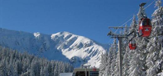
Mount Upper Djinal is a place that is recommended to visit for everyone who came to. Its height is 1541 m. And the distance to the city itself is 14 km. Not far away, 8 km away, is the village of Kichmalka (Kichibalyk), named after the river of the same name. You can often hear the question: from what language does the name come from? This is the Karachai-Balkarian language, translated from it kichi - "small", balyk - "sturgeon". It also offers a beautiful view of the Northern Elbrus region.
What can you see at the peaks?
- There is a meteorological station at the very height.
- Ahead there will be a large plateau with hills, gullies and the Kichmalka river valley.
- The Anar-Syrt ridge is located behind the river.
- On the north side of Elbrus there is a gorge of the Malka River.
- Not far from it is the Kinzhal plateau and the top of Mount Naushidze with rocks.
- On the north side there is a group of laccolithic mountains.
- Elbrus, its chains of peaks and spurs will be seen on the horizon.
- In clear weather, you can see Kazbek in the distance.
Such a panorama leaves no one indifferent. Many people take great photos here to keep the experience alive. The peak can only compete with Bermamyt in terms of viewing latitude. The Djinal ridge includes a huge number of caves. They can also be seen on the slopes of the summit, covered with subalpine steppe vegetation. Cuestas are composed of Cretaceous sandstones and limestones.
Some tourists, having checked in, try to find out how to get to the sights. Leads here a tourist route which begins in the city itself. It runs through the park, Kurzelenstroy and a country road. Next, you need to go along the Dzhinal ridge. The area is hilly and leads to the village of Kamennomostskoye in the east. You can return via a country road that follows to Essentuki.
Jinal
The path to Mount Dzhinal leads through the park, the Kurzelenstroy household plot and further along a country road.
From about halfway, Jinal is already visible, which is highest point the ridge of the same name (1541 m). There is a meteorological station at the top of the mountain.
From the heights of Jinal, there is a wonderful view to the south. Far below, in the foreground, stretches a huge hilly plateau, indented by the deep valley of the Kich-Malka river and gullies. Behind Kich-Malka, from west to east, stretches the low, with soft outlines Anar-Syrt ridge. Behind it, to the north of Elbrus, the deep gorge of the Malka River turns blue. To the left are the steep cliffs of the high plateau Kinzhal, and to the left is the rocky peak Naushidze. In the background - Elbrus, its spurs and a chain of snow-capped peaks of the Main Caucasian ridge.
In the north, among the hilly plain, rises a group of gorlakcoliths: in the foreground Dzhutsa, Yutsa, in the background - Beshtau, Mashuk and other rocky and domed peaks of Pyatigorye.
The panorama that opens from the Djinal leaves a great impression. In terms of species, it is slightly inferior to Bermamyt - the best panoramic point in the distant environs of Kislovodsk. And even surpasses it in the breadth of view. On clear days, in the mornings, you can see Kazbek from Jinal.
The border between the Stavropol Territory and the Kabardino-Balkarian Autonomous Soviet Socialist Republic passes through the Dzhinal Mountain.
The ascent to Jinal can be started along a country road or, to shorten the path, along the slopes of subalpine meadows. The road can be seen from afar. It branches off to the left of the road leading along the Dzhinalsky ridge to the large Kabardian village of Kamennomostsky.
You can also return in another way - along the country road leading to Essentuki. The distance from Kislovodsk to Dzhinal is 18 kilometers.
Tourist routes from Kislovodsk
Mount Jinal
The path to Mount Djinal goes through the park in the direction of Pervomayskaya glade, where you go to the asphalt road and go to its end on the border of the park. Further the road is unpaved. It leads through hilly terrain along the Djinal ridge. On the way, on the Kurzelenstroy personal plot, it is recommended to stock up on water, as the area is waterless up to the Djinal. Dzhinal is visible from about halfway, which is similar to the Wild Boar Mountain, located northeast of Kislovodsk in the Dzhinal ridge system. The height of Jinal is 1542 meters above sea level.
The ascent to Mount Djinal begins from the fork in the road to the left, which is clearly visible from afar. The road leading along the ridge connects Kislovodsk with the village of Kamennomostsky, located at the confluence of Malka and Kich-Malka. On Mount Jinal there is a former meteorological station where tourists usually spend the night.
From the heights of the Jinal opens amazing view South. Far below, in the foreground, there is a hilly plateau cut by the gorges of the Kich-Malka River and deep gullies of its tributaries: Tara-Kol, Sullu-Kol, Ullu-Kol, etc. Beyond Kich-Malka, from west to east, a low one stretches, the Anar-syrt ridge with soft outlines. Behind it, from Elbrus to the north, a deep gorge of the Malka River stretches. To the left are the steep cliffs of the high plateau Kinzhal, and even to the left is the rocky peak Naushidze. In the background is Elbrus, its spurs and a chain of snow-capped peaks of the Greater Caucasus Range. But in all its glory, Elbrus can be seen only in the morning, in the early hours, when the first rays rising sun will play on its eternal snows, subtly changing shades from pale pink to silvery white.
In the north, among a hilly plain, a group of laccolithic mountains rises: in the foreground Dzhuts and Yuts, in the background Beshtau, Mashuk, etc.
The panorama that opens from the Djinal mountain leaves a great impression. In terms of species, it is slightly inferior to Bermamyt - the best panoramic point in the distant environs of Kislovodsk. And in terms of breadth of horizons it even surpasses it. On a clear morning, you can see Kazbek from Djinal. Through Mount Jinal there is a border between Stavropol Territory and the Kabardino-Balkarian ASSR.
It is better to return to Kislovodsk along the Dzhinal ridge. This path is much more interesting in terms of species, especially if there is a clear, good weather... From the building of the former meteorological station, take the direction to the triangulation tower, visible in the distance in the north-west, at one of the heights of the Dzhinalsky ridge, and walk towards it along the mountain meadows. From this noticeable landmark, continue on your way to the mountain Large Saddle, from which a good path already begins, leading through the Red Sun into the city.