Uncover all the secrets of the Kuril island of Matua
One of the priority projects of the Russian Geographical Society today is an expedition to the island of Matua. Despite several months of painstaking work on its research, there are still many mysteries. Tunnels and underground structures have not been fully explored. It remains to be seen where the dishes of the Japanese imperial family and empty fuel barrels came from on Matua, and much more remains to be done.
Recently, TASS reported that several teams of scientists from Vladivostok, Moscow, Kamchatka, and Sakhalin Island will work as part of an expedition to Matua, which will take place from June to September.
Currently, the headquarters of the Pacific Fleet has completed the development of a detailed survey plan for the Kuril Island, the personnel and the necessary equipment for exploration work have been determined as part of the expedition to Matua Island in 2017. This year the composition of the expedition will expand significantly. Several teams of hydrogeologists, volcanologists, hydrobiologists, landscape scientists, soil scientists, submariners, prospectors and archaeologists from Vladivostok, Moscow, Kamchatka and Sakhalin will work at once on Matua Island, "said the head of the information support department of the Eastern Military District (VVO) press service for the Pacific Fleet (Pacific Fleet) Captain 2nd Rank Vladimir Matveev.
According to him, now the psychologists of the Pacific Fleet are completing the professional psychological selection of military personnel participating in the future expedition, who undergo special tests and programs in order to establish the degree of stress resistance and the level of performance in extreme conditions, the psychological compatibility of the future members of the expedition and to assess the moral and business qualities of servicemen.
Matua is an island in the middle group of the Great ridge of the Kuril Islands. The length is about 11 km, the width is 6.4 km. During the Second World War, one of the largest naval bases in Japan was located on it. In 1945, the island was ceded to the USSR, and the Japanese base was turned into a Soviet one. The island has preserved many fortifications, mines, grottoes, two runways, which are heated by thermal springs, so they can be used all year round. In 2000, the base was mothballed and Matua Island was officially deserted.
In 2016, the first joint research expedition of the Ministry of Defense of the Russian Federation and the Russian Geographical Society to Matua took place, in which servicemen from the Eastern Military District and the Pacific Fleet took part. More than 200 people were involved in the expedition. The Ministry of Defense was interested in the island as a possible base for the forces of the Pacific Fleet. Then an extensive network of tunnels was discovered on Matua, as well as a sunken Japanese light fighter Mitsubishi Zero, released in 1942.
The second research expedition to Matua will take place from June to September 2017, it is planned to collect materials for the preparation of an atlas-identifier of marine life in the water area of Matua and neighboring islands. Also, the researchers have to create a reconstruction of the activity of the Sarychev Peak volcano in the late Pleistocene, including historical eruptions, and to map the island. In addition, it is planned to conduct an inventory of species of marine aquatic organisms, compare the biota of adjacent water areas to assess the state of biodiversity and identify possible migration routes and interpenetration of flora and fauna elements in the North Pacific Ocean.
In September last year, the correspondent of tvzvezda.ru Alexander Stepanov visited Matua. Here are excerpts from his reportage "The Mystery of Matua Island: When the Japanese Fortress Will Become a Russian Base".

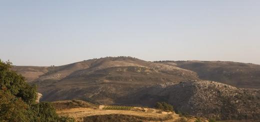
From a bird's eye view, Matua Island seems to be a small spot - 11 kilometers long and six and a half wide, two-thirds of the island's area is occupied by the active VOLCANO - Sarychev Peak. The island is not at all adapted for life. Harsh climatic conditions: constant winds and rains in summer. Sunny days, one or two, and missed. Here, even in June, snow whitens on the slopes of the hills. The snow cap adorns Sarychev Peak all year round. This volcano is famous for being one of the most active active volcanoes in the region. The burrows at the Sarychev peak are steep - you cannot call him sleeping. Eruptions, although short-lived, are frequent and strong.
Despite all natural disasters, the Japanese during the Second World War turned the island into an impregnable fortress, where there were underground tunnels, an airfield, and even a railway. The garrison on the island exceeded three thousand people. In general, the Kuril Islands were used by the Japanese as a strategic barrier to exit from the Sea of Okhotsk to the Pacific Ocean. A whole network of various military defensive fortifications was erected here.
Getting to the island by air takes a fair amount of luck. The so-called windows - small gaps - very rarely open over the island, and people sometimes have to sit at the airfield for several days to get through this window that has opened for a short time. The closest airfield from which you can get to Matua is on the island of Iturup. It is about 500 kilometers. And if suddenly the weather over Matua deteriorates after the "turntable" has almost flown to the island, then you have to return to the base on the remains of fuel. As the helicopter pilots say, "with adventures."
When approaching the island, you can see that it is dug up by coastal fortifications. Trenches originating at the very edge of the water. The pillboxes and pillboxes, hollowed out in the numerous hills of the island, look with empty loopholes towards the sea. It is noticeable that the island really resembles a fortress rising directly from the sea. In mid-June, Matua is about seven degrees Celsius and a piercing wind. You have to warm yourself in winter: jackets, sweaters, boots with high ankle boots. An expedition of the Ministry of Defense of the Russian Federation, the Russian Geographical Society, the Eastern Military District and the Pacific Fleet has been working here since May under the leadership of the Deputy Commander of the Pacific Fleet, Vice Admiral Andrei Vladimirovich Ryabukhin.
Despite the fact that in September 1945 the island passed to the USSR, no research was really carried out on it. The current expedition is called upon to unravel the secrets of the least explored island of the Kuril ridge. And there are a lot of secrets here. The researchers have three main tasks: to study the military-historical component of the island, to study the volcanic activity of Matua and to understand how to develop a military infrastructure on the island.
The scientific group of the Russian Geographical Society is engaged in routine, but very necessary work on the island - it makes maps of the island: landscape, geological and soil. Samples of soil and plant species are taken. The second group is looking for artifacts left over from the Japanese. So, in June, the search engines lifted the wing of a Japanese 1942 aircraft and brought it to the camp. Also, objects were found that can tell about the life of Japanese soldiers: ammunition, dishes, clothes, household items. The members of the expedition even climbed Sarychev Peak, where two flags were hoisted - the Russian Federation and the Andreevsky flag of the Navy.
The ascent to the VOLCANO is not just a hoisting of flags, the expedition members tried to understand on which sides the eruption with a plume was going. From a height, you can clearly see where the island has changed its structure, geography, where new beaches have appeared. They found out how the Japanese barriers, including anti-mudflow outflows, blocked the path of the mud going towards the Japanese barracks. I am interested in one of the leaders of the expedition, a full member of the Russian Geographical Society, Andrei Ivanov, whether Matua is really a mystery island where the secrets of Imperial Japan are kept, or is this idle speculation of journalists.
“Journalists love to ask questions about riddles,” the scientist smiles. - Of course, it is still difficult to thoroughly study what is left of the Japanese, to understand where the myths are and where the reality is. We managed to find out that the legends that there is an underground city on Matua, built by them at the end of the Second World War, are well-grounded. We found quite a few entrances that lead underground, all of them blown up or blocked up. We dug out one such entrance and found numerous underground passages and storage rooms behind it, which were connected to the above-ground system of trenches and trenches by special passages. This is not a legend, it really is. "
At the same time, the main goal of the expedition is not to guess the Japanese puzzles, but to make a comprehensive assessment of the territory in order to understand how suitable it is for development, whether the mudflows and tsunamis will wash away the new infrastructure of the island. The expedition is also interested in how the Japanese garrison solved the issues of life support, because, as it turned out, there are no water sources on the island.

The head of the expedition, deputy commander of the Pacific Fleet, Andrei Ryabukhin, told the Army Standard that the Japanese used exclusively melt water, which is formed due to the melting of snow on the volcano. Therefore, many old Japanese filters for water purification are found on Matua, which were invented by the head of the 731th detachment in Manchuria, Shiro Ishii (a Japanese doctor who conducted inhuman experiments on people and developed bacteriological weapons). They involved two types of cleaning, coarse and fine. Rough with brushes removed all dirt and debris from the water. During thinning, water was driven through ceramic filters under pressure, then it went through trenches into special containers.
Part of the system was carried out in the region of the mountain system, and part of the Japanese set up near the lakes that were formed during the period of snow melting. Pumping stations were installed next to them. By the way, due to the fact that there were many rats on the island that also used water, strong antibiotics were found here, which were literally flooded with underground hospitals. The tablets prevented injury to personnel. At the same time, the members of the expedition argue that there was no production of bacteriological weapons on the island. After all, if something went wrong, the Japanese garrisons in the Kuril Islands would have perished themselves.
The island was needed primarily as a huge storage and security base for a long line of communication that ran from "big" Japan to the islands of Paramushir and Shumshu, where large garrisons were stationed. Only American submarines and surface ships posed a threat to the safety of this route. Since the Allied aviation could not actively bomb the islands due to the flight range, the main emphasis was placed on protection from the fleet. Therefore, a large airfield with two lanes was built on the island, where fighter aircraft and bombers were based.
Also, up to ten thousand people could be on the island in order, if necessary, to strengthen the Japanese garrisons on the northern islands of Shumshu and Paramushir. I ask Ryabukhin: did the expedition manage to understand how the defense of the island was built?
“We figured out the system of communications and fortification of the Japanese, understood how the defense structure of Matua was built,” he says. - A feature of the structure of the island is a large number of valleys - long gorges, in which they concentrated their warehouses. A road system was developed on the island. It was of a serpentine type and led to where the individual garrisons were stationed. A warehouse and barracks were equipped near the garrison, as well as positions for defense - trenches, pillboxes. So far, we can only guess how the delivery of food and ammunition to the positions was carried out. It is already clear that road transport and railways were developed on Matua. "
Of course, the search engines have not yet found the railway itself, only traces of it are found. One can only guess where it went - these are tunnels cut underground and, like arteries, crossing the island. The fact that it worked is also evidenced by numerous finds: trolleys rusted from time to time, fragments of rails. In addition, brass or bronze fuel lines were laid throughout the island.
Search engines find characteristic fittings and pumping parts, but the containers where the fuel was stored have not yet been found either. In addition, the expedition found out how the Japanese built their barracks. They were collapsible and consisted of a metal frame and wood. All pillboxes on the island were also sheathed with wood.
The Japanese airfield is now in a rather deplorable state, it has been badly damaged by air raids and natural disasters. Now there are several helipads equipped there. However, in the future, its restoration is possible. Of course, the main question is: do we need this piece of land, absolutely unsuitable for normal life?
“Since last year, the Sea of Okhotsk has become our inland sea,” says Andrei Ryabukhin. - This is our sea. And here, so to speak, there are many open doors. And everyone wants to enter them. But with what intentions they enter these doors - good or not, you cannot immediately understand. In order to reliably protect our territories, we must make efforts so that later we do not regret that we did nothing. There are still loopholes, and they must be eliminated, including the creation of Russian bases. For the time being, it is planned that the Pacific Fleet subdivisions will be located on the island, which will ensure the protection of state interests. "
At the same time, the vice admiral believes that there is no point in restoring Japanese infrastructure on the island.
“Now, in modern conditions, it is expensive and inexpedient to go underground, build cities and railways there. - he continues. - Again, all the underground communications that we open are very dilapidated. They are crumbling, dilapidated. The structure of the soil here is peculiar, including very fragile rocks. What the Japanese dug here was very topical for that time, now it is no longer there. "
Conclusions about whether the armed forces need Matua, whether a base will appear there, will be made already this year. And there is a high probability that our troops will still be located on Matua.
A detachment of the Pacific Fleet, including the large landing ship "Admiral Nevelskoy", the killer ship KIL-168 and the rescue tugboat "SB-522", delivered the participants of the joint expedition of the Russian Ministry of Defense and the Russian Geographical Society, as well as more than 30 units of various technology.
Matua Island is located in the middle part of the Kuril ridge and is significantly removed from the populated areas of Sakhalin and Kamchatka. The size of the island is 11 kilometers long and 6 and a half wide. It is characterized by an abnormally cold climate with a large amount of precipitation. On Matua there is one of the most active active volcanoes in the region - the Sarychev volcano. A powerful layer of historical and cultural heritage has been preserved here, which is divided into Ainu, Japanese and Russian. In addition, the northernmost point of distribution of Corded Ware - the archaeological culture of the Neolithic "Jomon", is located on Matua.
This year the scientific staff of the expedition has significantly expanded. Hydrogeologists, volcanologists, hydrobiologists, landscape scientists, soil scientists, divers, prospectors and archaeologists from Vladivostok and Moscow, Kamchatka and Sakhalin will work on Matua Island. The Expeditionary Center of the Ministry of Defense of the Russian Federation, the Russian Geographical Society and the personnel of the Pacific Fleet are taking part in the project.
In the course of the work, materials will be collected for the preparation of an atlas-identifier of marine inhabitants of the water area of Matua Island and neighboring islands, as well as video recording of the bottom relief at diving sites for the analysis of hydrographic characteristics.
The activity of the Sarychev Peak volcano over the past 100 thousand years will be reconstructed, and the level of its current activity will be determined. This is necessary to assess the volcanic hazard of the area and form a long-term forecast.
In addition, work will continue on the search and study of objects of historical military equipment and fortifications during the Second World War. Archaeological work will be developed to identify and study monuments of history and culture of various eras, including the Ainu.
Based on the results of the 2017 expedition, materials will be prepared on the prospects for further development of the island: maps of natural hazards have been drawn up, an analysis of alternative energy sources, the chemical composition of natural waters, and potential soil fertility has been carried out.
In 2016, the Russian Geographical Society, together with the Ministry of Defense of the Russian Federation, organized an expedition to Matua for the first time. Its purpose was to study the artifacts of the Second World War and compile a historical and geographical portrait of the island.
The second large-scale expedition of the Ministry of Defense and the Russian Geographical Society will go to the Kuril island of Matua in 2017. This was announced on Wednesday, September 14, by the commander of the Pacific Fleet, Admiral Sergei Avakyants, at a meeting of the media club.
The Japanese began to develop the island in the 1930s and attached exclusively military importance to it. "The island served as a springboard for further expansion and capture of the Kamchatka Peninsula. A unique system of underground structures connected by a single system of tunnels was created. Underground structures are a separate topic that requires deep study," said Admiral Sergei Avakyants.
According to him, underground structures are divided into two types: fortifications and structures of unknown purpose - rectangular, square and round, up to 150 meters long.
"Initially, there was an assumption that these are warehouses, but everything was taken out of them. And if these were warehouses, then any material traces would have remained. Moreover, it was discovered that a high-voltage cable is suitable for these premises, and the power supply system allowed to supply up to 3 thousand volts there. Naturally, this is an excess voltage for storage facilities. But, obviously, some work was carried out in these structures, "- quotes the head of the TASS expedition.
The admiral also said that the same high-voltage cable was found on the slope of Sarychev volcano. "The volcano is alive, the volcano still breathes. Powerful eruptions occur every 25 years. Remains of an old road leading to the volcano's mouth have been found. From a helicopter, you can see the characteristic entrances to underground structures from the water surface. Serious deep-sea exploration of the northern and northwestern parts of the volcano is needed. ", - Avakyants emphasized.
He noted that during the expedition, dishes were found with symbols characteristic of the imperial family - stars, that is, the island was visited by the highest military-political leadership of Japan during the war, and the garrison was given exceptional attention.
"If on all the islands the Japanese garrisons fought fiercely, to the last soldier, then the island of Matua surrendered last, but surrendered without a fight. The garrison numbered 7.5 thousand people and, which is not typical for the Japanese army, did not put up any resistance," the commander said. “We concluded that the garrison fulfilled its main task - removed all traces and all the facts that could lead to the disclosure of the true nature of activities on this island,” he continued.
According to the admiral, the expedition also studied the volcanic activity of the island and discovered the remains of an ancient paleovolcano dating back several million years. "Thus, the version requires confirmation that the Kamchatka Peninsula, the Kuril Islands and the Japanese Islands were a continuous strip of land," Avakyants noted.
The commander of the Pacific Fleet believes that Toporkovy Island, which is presumably connected to Matua by underground tunnels, also requires further study. “With the permission and instructions of the President of the Russian Geographical Society, in 2017 we are conducting a second expedition with the involvement of a wide range of specialists from the Academy of Sciences, the Russian Geographical Society and the Moscow State University. including underwater. And, besides, it is necessary to conduct archaeological research ", - concluded the admiral.
The command of the Eastern Military District the possibility of a prospective basing of the forces of the Pacific Fleet on the island of Matua.
The Zvezda TV channel filmed the documentary “Matua Island” about the research expedition of the Russian Geographical Society and the Russian Ministry of Defense. Experts went to the island back in 2016 and for many months they have been collecting materials about its natural, historical and cultural heritage. Why exactly Matua was interested in the Russian Geographical Society and what secrets the island keeps - in the material "360".
From no man's island to a mothballed military base
Matua Island belongs to the middle group of the Great Kuril Ridge and belongs to the Sakhalin Region. However, this was not always the case. The Ainu, the most ancient people of the Japanese islands, are considered the original population of Matua. In his language, the island is called "hell's mouth".
For a long time, Matua existed on its own, and only in the 17th century the first expeditions went to the Kuriles. It was visited by the Japanese, Russian and Dutch, who even declared the land the property of their East India Company.
By 1736, the Ainu converted to Orthodoxy and became Russian subjects, paying the residents of Kamchatka yasak - a tax in kind in the form of furs, livestock and other items. Russian Cossacks regularly visited the island, and the first scientific expedition arrived at Matua in 1813. The island's population has always been small: in 1831, only 15 inhabitants were counted on Matua, although then the census counted only adult men. In 1855, the Russian Empire officially received the right to the island, but 20 years later Matua came under Japanese rule - that was the price for Sakhalin.
Shortly before World War II, the island became the main stronghold of the Kuril ridge. A fort appeared on Matua with anti-tank ditches, underground tunnels and trenches. An underground residence was created for the officers in the hill. After the outbreak of the war, Nazi Germany supplied Matua with fuel. The island became one of Japan's key naval bases. In August 1945, a garrison of 7.5 thousand people surrendered without firing a single shot. Matua passed to the Soviet Union.
Until 1991, there was a military unit on the island. During this time, not only historians, but also politicians were interested in Matua. US President Harry Truman, immediately after the end of World War II, proposed to Joseph Stalin to cede the island for a US naval base. Then the leader of the USSR, either jokingly or seriously, agreed to exchange Matua for one of the Aleutian Islands. The question was closed.

The Russian border outpost was located at Matua until 2000. Then the entire naval infrastructure of the island was mothballed, and the inhabitants left it. Matua is now uninhabited. The small island, 11 kilometers long and just over six kilometers wide, still holds many secrets. Members of the Russian Geographical Society and employees of the Russian Ministry of Defense went to uncover them.
Secrets of Matua
In September last year, the commander of the Pacific Fleet, Admiral Sergei Avakyants, told reporters about the results of the first expedition to Matua. It started in April and lasted almost six months. The expedition was attended by Defense Minister and President of the Russian Geographical Society Sergei Shoigu.
Research on Matua took place for the first time since 1813. According to Avakyants, many underground structures have been found on the island. Some of them definitely belonged to the fort, but the purpose of the rest has not yet been clarified.
Initially, it was assumed that these were storage facilities, but everything was taken out of them. And if these were storage facilities, then any material traces would remain. Moreover, it was discovered that a high-voltage cable was suitable for these premises, and the power supply system allowed up to 3 thousand volts to be supplied there. Naturally, this is overvoltage for storage facilities. But it is obvious that some work was carried out in these structures.
Sergey Avakyants.
Among the unusual finds is a high-voltage cable on the slope of Sarychev volcano. Nearby are the remains of an old road that leads to the mouth of the volcano. At the same time, from the helicopter, the members of the expedition noticed the entrances to the underground structures. What exactly is in the volcano is still unknown. The experts were also interested in another question: why the garrison surrendered without a fight in August 1945. This behavior is not typical for Japanese soldiers, which speaks of a well-thought-out plan. “We concluded that the garrison fulfilled its main task - removed all traces and all the facts that could lead to the disclosure of the true nature of activities on this island,” the admiral explained.

Photo: RIA Novosti / Roman Denisov
Last year, the members of the expedition decided to study the collected materials, and a few months later return to Matua to reveal other secrets of the island. What else will surprise the Russians with a small piece of land that has gone from no man's land to a secret Japanese fort, time will tell.
The second joint expedition of the Ministry of Defense and the Russian Geographical Society to the island of Matua has ended. Its participants - historians, archaeologists, ecologists and hydrographers - told at the next meeting of the Russian Geographical Society about their amazing finds discovered on this small but very mysterious island of the Kuril ridge, reports the correspondent. IA SakhalinMedia.
Participants of the second joint expedition of military and scientists to the Kuril island of Matua summed up the results of their work. At a regular meeting of the Sakhalin Branch of the Russian Geographical Society, they made reports in which they told what new secrets the island had revealed for them and what findings gave rise to new questions.
Opened the meeting Chairman of the RGS department Sergey Ponomarev... He noted that cooperation with the Pacific Fleet has provided new opportunities for exploring the Kuril Islands.
“In the expedition, the most expensive thing is transport delivery to the Kuril Islands. But the fact that Sergei Shoigu headed the Russian Geographical Society, allowed to organize such joint projects with the Ministry of Defense. The military is also heading to Matua for their research purposes. And they take our scientists with them. We use this cooperation to our advantage. Our research concerns history, archeology, ecology. This versatility helps the comprehensive exploration of the islands, both on land and at sea, ”said Ponomarev.

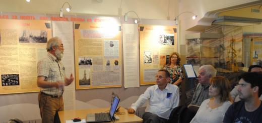
Meeting with members of the expedition to Matua. Photo: IA SakhalinMedia

Meeting with members of the expedition to Matua. Photo: IA SakhalinMedia

Meeting with members of the expedition to Matua. Photo: IA SakhalinMedia

Meeting with members of the expedition to Matua. Photo: IA SakhalinMedia

Meeting with members of the expedition to Matua. Photo: IA SakhalinMedia
He recalled that Matua is a very interesting island from the point of view of local historians. It is located in the middle of the Kuril ridge and was previously used by the Japanese as a staging post on the north-south route, as well as a powerful naval base and airfield.
Local historian Igor Samarin during this expedition he continued his last year's work. Its main task was to restore the scheme of the Japanese permanent firing structures on the island. Last year, such a map was drawn up, but, as it turned out, the island is fraught with many more discoveries.
“This year, quite by accident, our military colleagues discovered the emergence of a ceramic pipe from the ground. They lowered an impromptu video camera into it - a smartphone with a flashlight, and found a room there. At a depth of three meters, there was a concrete structure adjacent to an artillery rangefinder post. It turned out that there was a fire control command post under the ground. From there, with the help of electronics, commands were transmitted to the guns, ”said Igor Samarin.
Also, one of the tasks of this year was the study of the Japanese command post on one of the heights of the island. Samarin's group dug up this concrete structure and got inside.
But scientists made the most interesting discoveries by studying small, not always obvious details. So, next to one of the soldiers' barracks, we found a lamp shade. Igor Samarin explains: according to the testimony of the Japanese military themselves of those years, the naval sailors lived better than the infantry and they were the only ones who had electricity. So the found lampshade reinforced the belief that it was the sailors who lived in the barracks on the island.
“Many ordinary things were revelation. They found a beer bottle, the most common one, but on the bottom - the date of manufacture "18 S 8". For a knowledgeable person, this is simple - August 16, according to European chronology - 1941. There were 25 such bottles found on the island. From them it was possible to determine the time when the bottles were delivered to the island. It turned out that the first supplies of provisions began in 1938 and ended in 1943. And in 1944, the blockade of Matua Island by American submarines began, ”Samarin continued his report.
Scientists also paid attention to the Japanese kitchen heaps near each dugout. Bird bones were found among the waste. As it turned out, the Japanese actively used local hatchets for food. They also ate mice - voles. Even a natural exchange was established - one mouse cost two cigarettes. The skins of rodents were transported to the metropolis for making gloves from them.
In total, historians brought 86 items of the Japanese and Soviet period from the island - from children's booties and utensils to fuel barrels and handicraft stoves.
Also, scientists managed to solve another mystery that the Matua Islands kept since the Second World War. For more than 70 years, the fate of the American submarine Herring, which sank two Japanese ships off Matua, was unknown and conflicting information remained about it. Hydrographers, led by the captain of a large hydrographic boat, Igor Tikhonov, combed the entire water area of Dvoynaya Bay using a multi-beam echo sounder. And an object very similar to a submarine was discovered in the area of Cape Yurlov at a depth of 110 meters. What to do next with this discovery will be determined by the military.
As part of the expedition, the researchers also studied the more ancient period of the island's history. So, the group archaeologist Olga Shubina discovered on the island more than a hundred pits from the ancient dwellings of the first inhabitants of the island. Most likely they belonged to the ancient Ainu who lived here 2.5-3 thousand years ago. Scientists have carried out excavations at the sites of finds and marked the boundaries of archaeological sites.
At the end of the meeting, the chairman of the Sakhalin RGS Sergei Ponomarev said that scientists had created a working group dealing with the unification of geographical names on the island of Matua.
“Many objects of Matua still bear Japanese names or“ folk ”Soviet ones. The group is preparing a proposal for the official naming of about three dozen bays, capes and heights, so that when drawing up maps and diagrams we can use the same designations and understand each other, ”said Ponomarev.

