As part of the Pickup Club trip to Besov Nos, our team, due to their active participation in the life of this wonderful club, decided to once again visit this center of pilgrimage for jeepers.
Departure photo:
In anticipation of the departure, it turned out that one of our comrades needed to call on the road to the city of Babaevo, to the local department of the traffic police, for a certificate on a recent case of rights. In this regard, it was decided to break through the Babaevo-Vytegra route, along forest country roads and clearings, which was done. We hung around for a long time, poked into dead ends, but nevertheless we drove to Vytegra, and, moreover, with practically no losses, except for a flying table that was not fixed in my body, which landed the glass of the kung at the next peak. Fasten the shmurdyak stronger!
We arrived at the place of the Pickapclub camp, near the village of Karshevo, which is the last point of civilized country roads before Besov.

We ate, drank, slept, woke up, lowered the tires and drove to Karshevo-Besov Nos SS:

The road was, as usual, interesting, moderately dry:

and moderately wet:


What is interesting about the Devils Nose, 17 kilometers of the road to it offer the jeep a lot of various obstacles, here and maneuvering between stumps and trees, and deep ruts with high-quality mud, and geometric ambushes with overhanging wheels, and there is even a little stone trial.


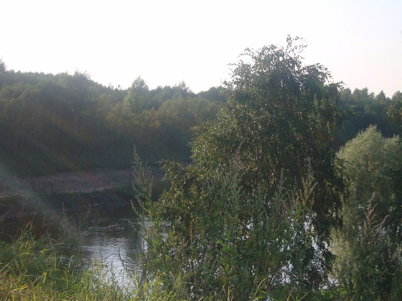
We got to the bank of the Onega, and there, as always, it was beautiful:


We camped at our favorite place - between Besov and Peri Nosami, put up an awning

Well, they laid the table:
If anyone is interested, then this is a tourist table that is standard in any car, its name is a radiator, it's a pity the photo has not been preserved
I won’t post a lot of photos of Besov Nos himself, those who were already know what is there, and those who haven’t been - let them see everything live better:


We bought ourselves, drank vodka, evacuated the broken car back to Karshevo, walked for glory, it's time to move back. But, instead of the usual rubilov Besov-Karshevo, we wanted to drive the previously untrodden route Besov-Shalsky (the one that is residential).
In the abandoned Shalsky we went strictly to the north, in a swampy forest we stumbled upon an uazovod, this man deserves a separate paragraph:
He travels alone, on a stock UAZ patriot, without a winch, without a zip, without tracks and without a clear understanding of all the risks arising from such preparedness. We saw him in the forest near a Patrick raised by Jack, noticing a column of 10 Japanese pickups, he asked us without batting an eye if we had a spare tie rod for the UAZ ... because he bent his own. Disappointed that we didn’t have a zip for the UAZ with us, he complained that it had been broken for 2 days already, and asked for a passenger to Shalsky, deciding to find traction there and !!! mechanic, ready to go back with him 15 km through the wilderness without a single path in order to install it on the UAZ. Of course, we were surprised, but we took the boy with us. On the way, they asked, what if in Shalsky there is no tie rod for the Patriot and crazy mechanics? Well, he replied, then I'll hit the road to Moscow for traction and installation instructions. 7 km before Shalsky, in complete wilderness, he decided to get off and walk straight through the forest. Unusual person...
PS. Later, we figured him out through a blog on the drive and found out that all his adventures ended happily.
But let's get back to our column, having passed the woods, we went ashore behind Peri Nos and went along the wild coast:

Our path led along the coast, with periodic visits to the forest, going around cape after cape, we really liked the coastal hills, which there was no way to pass: And one of the most impressive hills:

Along the route, we encountered upland bogs a couple of times and a lot of stone trials on wet, moss-covered rocky tongues. After the trial, they again went to sand bar and the last 4 km went without any problems. On the way, they dropped the fat on a tree, hushed up the l200 door, tore a couple of winches. Having left for Shalsky, they pumped up and decided to go without parking to Pudozh, to the hotel, in order to taste the delights of civilization, which they had been deprived of for almost a week.
As a result of the trip - reconnoitered new road from / to Besov Nos, it is very interesting and diverse, and most importantly, not rolled up by jeeps to holes, unlike the Karshevo-Besov path.
Many thanks to Taiga and the Surveyor from the Pickup Club, who rode with us and actively photographed the whole process.
Sincerely,
On this page:
Cape Besov Nos of Lake Onega is widely known in narrow circles as a place that every self-respecting jeeper should visit. Dozens of real men every summer storm the Onega forests and swamps in unison. In other circles, Besov Nos is famous mainly for its Neolithic petroglyphs, which we went to (more precisely, sailed) to see.
A trip to Besov Nos has become a byword among fans of off-road shit climbing. The very first pictures for the query “demons nose on a jeep” in Google are beautiful:

No, it didn't break, it's his suspension.

Well, etc. and so on. No, this is not our car =))

This fascinating pastime is best characterized by a dialogue read in some report:
Why do you need so much gasoline?
- Yes, our motorboat turned over, all leaked out.
How did it turn over?
- Yes, I collided with the UAZ and rolled over.
We have no more questions.
Particularly gifted people drive right along the banks of the Onega to the Murom Monastery - this is a new chic. It's even more interesting:

Although we accidentally had a jeep with us for all jeeps, it was not at all prepared for such swims. So, as the last suckers, they had to sail on the same motorboat. In principle, you can also walk to Besov Nos on foot, along the jeep road to the place is only 15 km.
How to get to Besov Nos
All roads to Besov Nos start in the village of Karshevo, about 40 kilometers south of Pudozh. Half of the population of this village trades in the delivery of everyone to Besov Nos on motorboats.

It costs an average of 1000 rubles. from a person.

Sailing along the river is quite far, about half an hour one way.


Finally, the river flows into the Onega, and we shake ourselves out of the boat.

From the mouth of the river to the actual Cape Besov Nos, you still need to walk three kilometers along the sandy beaches of Onega.

On the high capes, the entire pine forest was broken by the 2010 hurricane. From it, throughout the North, there were areas of literally mowed forest.

Devils Nose
Here, finally, is the Devil's Nose.

It is a granite "foreheads", gently descending into Onega. On this granite and you need to look for petroglyphs.
The most famous of the local petroglyphs is the so-called "bes": its legs are clearly visible in the photo below.

And the rest is poorly visible, because the weather turned out to be cloudy and unsuitable for looking at petroglyphs.

For good reason, you need to go to Besov Nos in sunny weather: in the light scattered by clouds, petroglyphs are very poorly visible. And a local guide will not hurt: some drawings are difficult to find without outside help.
This is how the Bes looks like if you draw its outlines with chalk.

It can be seen that the figure was carved over a large crack that split a granite boulder. Perhaps the ancient natives considered this crack to be something like an entrance to other worlds.
In general, despite the fact that Besov Nos is the largest “deposit” of petroglyphs in all of Fennoscandia (Scandinavia, Finland and Karelia), the Onega petroglyphs are very poorly studied, almost completely undeciphered, and it is not really known who and why carved all this into stone in the Neolithic era.
To the right, an Orthodox cross is carved on top of the Bes. This is the work of the monks of the nearby Murom Monastery, who actually discovered the Onega petroglyphs a couple of hundred years ago.
Well, around Bes there are many other drawings of animals, fish and incomprehensible figures.


Previously, a lighthouse worked on the cape, now in the era of GPS, no one needs it and is abandoned.

And all around were untouched pine forests. The places are simply magical and of course you need to go here for a week or two with a tent, and not for a couple of hours.

Peri Nose
There are petroglyphs not only on Cape Besov Nos itself, but also on neighboring ones. The nearest of them is Cape Peri Nos, a kilometer away. We go there along the coast.

On the way, we refresh ourselves with pasture. What I like in the north is that all the “gifts of nature” grow there at once: in the forest there are raspberries, blueberries, lingonberries, blueberries, cloudberries, and mushrooms at the same time. Cranberries, however, later.


Peri Nos is a few stone headlands protruding into the lake, which also have petroglyphs.

Here the plots and style are different and nothing is clear at all. Who is this? Some birds.

Lots of simple icons and geometric shapes.


Our boatman gave us 3 hours for everything, and this was not enough. We haven't seen everything yet, but we already have to go back.
In the middle of the 19th century, a professor at the University of Tartu, geologist Konstantin Grevingk, discovered many drawings carved on stones on the rocks on the eastern shore of Lake Onega. Since that time, people have become aware of the existence of the Onega petroglyphs - one of the main attractions of Karelia.
Rock paintings in Karelia can be found in several places, but the most famous are the White Sea and Onega petroglyphs. The first are located near Belomorsk near the sea coast, others are on the eastern side of Lake Onega in the Pudozh region of Karelia. Onega petroglyphs were carved about 5-6 thousand years ago, when the territory of modern Karelia was only inhabited by primitive tribes. These petroglyphs are so unique that they are included in the list of objects along with the famous Kizhi world heritage UNESCO.
Unknown artists used stone chisels to carve images on coastal rocks for many years and even centuries. To knock out such drawings on granite rock, which only a diamond drill will take, is difficult for a modern person, not to mention our ancestors from the Stone Age. Scientists have established that the authors of the petroglyphs used a piece of quartz as a chisel, using the second piece of stone as a hammer. To date, more than a thousand images are known, ranging in size from a few centimeters to four meters. They are concentrated on a rocky section of the coast 20 km long.

Almost half of all known images were carved on the capes Besov Nos and Peri Nos. These places are removed from travel roads and popular tourist routes, therefore, not all tourists who come to Karelia on vacation can look at petroglyphs.
Primitive artists on the shores of Lake Onega most often depicted birds and a little less often animals. There are also images of people or supernatural beings. Some of the Onega petroglyphs have not yet been deciphered, and scientists can only assume that ancient people painted on the stones.

The most famous Onega petroglyph is the image of the "Demon" on the Besovy Nos. A huge (more than 2 meters in height) disproportionate figure of a humanoid creature is carved on a rock, and a deep crack lies in the middle of the image. Next to the "Demon" images of a catfish or burbot and a lizard or otter are carved. For several millennia, this petroglyph remained unchanged, and only in the 19th century the monks of the local monastery decided to "neutralize" it and knocked out an image of an Orthodox cross over its left hand. In this form, this petroglyph now appears before researchers and tourists coming to Karelia.
Why ancient people carved these images on stone, scientists can only speculate. Perhaps they were used in rituals. Some even believe that sacrifices could be held on the Demon Nose. Other researchers consider our ancestors less bloodthirsty, and petroglyphs, according to their version, could serve as a kind of observatory, with the help of which the movement of celestial bodies was calculated. By the way, it is worth admiring the petroglyphs just before the appearance of the stars. The images are best seen in the last rays of the setting sun. In this light, the relief of the rock appears along with the slightest crevices.

How to get to the Onega petroglyphs:
Petroglyphs on Lake Onega, unlike the White Sea ones, are located away from popular tourist routes. Therefore, few tourists can see the unique stone writings with their own eyes. You can get to Cape Besov Nos both by water and by land. In the first case, the easiest way would be to rent a boat in the village of Shalsky. The village is located just 10 kilometers from Besov Nos.

In order to get to the petroglyphs by land, you will need a prepared off-road vehicle. First you need to get to Pudozh - this is the regional center, then tourists will have a 35-kilometer section, first to the village of Karashevo, and then along a forest dirt road to the very cape. The journey will turn out to be quite exciting, because there are abandoned villages along the way, and the road itself can add adrenaline to the blood, so you need to go on a prepared jeep with a winch, several jacks and, preferably, experience in trophy raids. In general, there are many such impassable roads in this region and jeep tours in Karelia are very popular. Such a vacation will allow you to get to know Karelia from a completely different side and look at such hidden places that, at times, the locals themselves do not know about.

If the path to the Onega petroglyphs seems too long, you can simply visit National Museum located in the very center of Petrozavodsk. Its funds contain a piece of rock with real petroglyphs, brought from the eastern shore of Lake Onega.
What to see nearby
Onega petroglyphs are located in the Pudozh region of Karelia. For a long time it was considered a remote territory, located on the edge of the republic, and even getting a court was quite difficult. Now the federal highway connecting Karelia, the Arkhangelsk and Vologda regions passes through the territory of the district. Every year it will get better and better, so the flow of tourists here in the coming years will only increase.
This area is special. Traditionally, a predominantly Russian population settled here, whose life acquired its own special features. All this can be told in the local history museum of the district in Pudozh. Due to its position, the area has managed to preserve the unique nature untouched by civilization. Here is the largest park in Europe wildlife"Vedlozersky", and pilgrims will be interested in visiting the Murom Monastery, founded in the 14th century.
At the beginning of summer, the thought came to roll on DEMONS NOSE. After studying the primary sources, talking on the forum, somehow time passed unnoticed. August has come. Having prepared everything, having checked it, on an early foggy morning on August 11, the expedition consisted of: Mitsubishi Montero Sport 3.5 "Behemoth", crew: me, wife Elizabeth and daughter Alexander. SAFE China car, assembled by Gzhel potters, China. Crew: Vitaly and his wife Irina. We started towards Onega.


The sun came out and the ride became more fun.


Four hours later we made a halt for breakfast.


Gasoline ran out imperceptibly, and in this situation we were once again convinced that it was impossible to believe the signs.


Normal gas station after 15 km. Lukoil. So time passed imperceptibly, and we drove through Vologda almost without incident. The traffic police treated with understanding, showing only interest. In general, you must admit, it’s nice, damn it, when you go and everyone looks at your creation with admiration.


As I already wrote, having passed Vologda, we went to Vytegra.

Life flows, people collect something, which means that the collective farms are working. Landscapes outside the window change: rivers, fields, lakes, forests - in a word, beauty.


On the way to Vytegra, a Chinese had a breakdown - the rear am was unscrewed. Fixed quickly and forward.
And finally VYTEGRA.

Known since 1710 as the village of Vyanga and with it the Vyanga pier, at the confluence of the Vytegra river. Vyangi (Karelian vengi "stream, small river, channel"). A trade route from Arkhangelsk to Petersburg passed through the pier. In 1773 the village was transformed into the city of Vytegra along the larger (receiving) river Vytegra. The etymology of the hydronym Vytegra has not been established, but the -egra format makes it possible to classify it among the ancient Fino-Ugric names characteristic of the North of the European part of Russia. The revival of the economic and cultural life in the first half of the 19th century. associated with the opening (1810) of the Mariinsky canal of the Mariinsky water system with a system of locks. The town is small, but I was struck by the many sports fields, cafes, shops and shops. Having refueled with the right gasoline at Lukoil, we drove towards the city of PUDOZH.

It was first mentioned in 1382 as the village of Pudozh, then - the Pudozh churchyard. county town Olonets province became May 16, 1785 by decree of Catherine II. From the end of the XVIII century. at the mouth of the river Vodla operated several glass factories, from the end of the 19th century. - sawmills. Development of a deposit of titanium-magnesium ores, granite (Kashina Gora, known since the 19th century, - gray and pinkish-gray granite was used when facing buildings and embankments of St. Petersburg, Moscow)
- In the central part of Pudozh, quarters of residential buildings of the 19th - early centuries have been preserved.
- Numerous "Onega" petroglyphs - rock carvings of the Neolithic and Bronze Ages (about 800 near the mouth of the Vodla and on the capes of Lake Onega).
- Demons Nose (Ancient cave drawings, a reconstructed Stone Age settlement)
- Ilyinsky churchyard (Wooden building of the end of the 18th century)
This is true historical reference. Our goal is Karshevo village.


And finally, the Border.


Joyful Vitaly.
(don't pay attention to the numbers, it's not true)

Let's go ahead.


Since we were not moving very fast: km 70-80 an hour, then, as you understand, it was getting dark: somewhere around the beginning of the 8th. We reached the village quickly and made sure that a map to Bes was not needed, since there was a direction.

You can see traces of the standard. In short, we are moving in the right direction.

Since Shribikus - he is a child - shot against the headlights, it turned out a bit dark.

and so good. We drove about 4 km.


Having reached a large and, as it seemed to us in the darkness, a terrible puddle, we decided to spend the night, and in the morning, full of strength, quickly reach the cape.

We set up camp, had a quick bite to eat and sleep. In the morning, at 7 o'clock, the female half discovered deposits of all usefulness and began to collect and absorb it all. While all this was going on, a cyclist appeared out of nowhere, like in a fairy tale, from under the ground. We talked, compared the equipment and asked to say hello to the Bes and that we would be there soon, and on that they parted.

After the cyclist, Vitaliy provided all possible assistance.

After breakfast, what God sent, we gathered, and to explore the puddle.


Having studied the puddle, having decided how to get there, let's go. The navigators conducted video and photography.


“We’ll go straight ahead and we’ll all be here,” Yura said, because the bike passed, which means we’re there too, Vitalik thought: “However, I doubt it.”

Beloved adjusts the camera.


Easily overcoming the puddle, we went further, I’ll say right away that there were no goals quickly - for example, there were no goals to fly in 2 hours. Walked, our girls picked raspberries, strawberries and blueberries. In short, we rested in nature, not forgetting to move towards the intended goal.

Just beauty.


Each puddle was examined for snags and other troubles.


Our fighting friends.


After driving 5 km through potholes and puddles, there was a nuisance with a Chinese friend. Although we passed and examined all the puddles and ambushes for foreign objects, logs, stones, etc., somewhere we missed something, and, as a result, we broke the tie rod, bent the stabilizer bar. Stood in the parking lot and began to repair the Chinese.

The Chinese look very nice. In this situation, a rack jack, bought on the eve of the trip, was very useful.


Here is a slightly enlarged picture of the breakdown.

It was a good log. Filmed and dismantled for 2 hours. During this time, our familiar cyclist from the Cape and two motorcycle tourists passed. Just in case, they asked, if possible, the locals to sail on a boat in order to quickly swim to the village and try to repair it. It didn't work.


With the help of my mother, some keys and a hand winch, we removed the tie rod and, realizing that there was nowhere to wait for help, the connection was not working, we drove the Behemoth towards the village to look for where to repair the traction. On the pier in the village, we accidentally met the Head of the District Administration, and he advised us on a very good craftsman Alexander Petrovich. A.P. lives: pos. Krasnoborsky, at the store; 3 large garages and a large private white brick house. Opposite - two houses 2-storey, 16 sq. telephone. +7 921 702-24-19. from Karshevo min 10 to go.

Vitaliy and I were absent for 3 hours (the way there and back takes 45-50 minutes), the rest of the time was traction repair. Petrovich's hands are simply golden. He did everything super, invited me to stop by on the way back and check the condition of the car. Our girls, while they were waiting for us, set up camp, cooked dinner, just royal, well done. Returning, in an hour we gathered the Chinese and had a rest. The photo below is where we were being repaired.

In the morning we got ready and hit the road, a little more carefully, as we looked at the draft, how it would behave after the repair.


After making sure that everything is in order with traction, it became calmer. There are 4 serious ambushes ahead - according to velo-, moto-tourists. We got to the first one.


We studied, looked, outlined how to go. They crawled.


On examination, he didn’t see and missed a fallen tree, the result was he rested, dug in, swans.


On the left along is a log that was pulled out. Vitalik rolled into the old track and got stuck, he had to swan through the entire swamp (in a bunch - 3 ropes).


Elizabeth - my wife - got tired of sitting in the car (get in, get out, go take a picture, etc.), made a staff and went ahead of the rest to measure the fairway of the puddles.

And we followed her like a pioneer.

And finally, we arrived at the stream.

A very nice place, we thought.

All around are traces of a struggle for life.


We decided how to go boom, only I was too lazy to fix the logs and add new ones, for which I paid with a run at the exit. After themselves, everything was corrected, planted, and Vitalik calmly drove. All Russian maybe, damn it.


We drove through this byaka, drove to the village, or rather, what was left of it.


Only 400 meters left and we are there.


The finish line with elements of running, for some reason the sand is very viscous, worse than clay.

We drove, playfully, a ditch.

That's all. Here is the treasured shore. But for some reason, the joy passed very quickly, the goal was achieved - everyone became sad. A very strong wind, waves and all that blew from the water.


Then everything is like everyone else: we drove up to the cape, looked around, picked up a parking lot, set up a camp, a festive dinner, acquaintance with neighbors and archaeologists.


traces of an early civilization.


Cultural program - cinema viewing.

In the morning we all went in search of petroglyphs.

We studied everything both left and right. They found everything and everyone, one might say they quenched their informational hunger, merged with mother nature. The places are simply awesome, in words, like Tyutchev, I can’t say mind ... but there is a fotik - he tells everything. A little beauty, I think, will not hurt.


 and, most importantly, we are getting to the place for which all this was done and passed: DESOV NOSE and, of course, DEVIL itself.

On the eastern shore of Lake Onega and in the lower reaches of the Vyg River (before it flows into the White Sea), there are petroglyphs - unique monuments of monumental art of the Neolithic era (4th - 2nd millennium BC).
Besov Nos is the central and longest of the rocky capes, as if organizing the entire surrounding space, like a high church or a bell tower in an old village, but only it is in a horizontal plane, protruding 750 m into the lake. Naturally, the bays washing it are more extensive. At the base, the cape is very narrow, less than 100 m, then noticeably widens, and somewhere in the middle part it still slightly bends in a south-westerly direction. On it is a cap of a dense forest, but at the very top and everywhere along the water's edge, bedrock rocks are exposed.
The cape serves as a reliable landmark; It is no coincidence that a lighthouse was erected at its tip. From here you have a great view of the neighboring capes and islands. Opposite, behind a narrow but deep strait, there is a nameless elongated granite island, also an excellent place to view the coast, but from the side of the lake.
At the tip of Besov Nos, the elemental power of the lake is especially clearly felt. With terrible force, shaking the rock, waves crash here during a storm. Here, thunderstorms are perceived in a special way, awakening uncertainty, fear and anxiety. But more often the cape is hospitable in its own way. If the wind is not frontal, then in the bays on one side or the other you can always hide and wait out the bad weather. The very different state of the cape, sometimes idyllicly calm, sometimes capriciously severe, could not help but pay attention to the ancient masters, who chose it as a place for their amazing creations.
In the central part of the lower tier, the famous “triad” that laid the foundation for the entire complex is carved - three gigantic figures in relation to all other images, which are very famous: an otter (lizard), a demon and, finally, a catfish (burbot). Their length is respectively 2.56; 2.46 and 2.65 m. These are the largest images of the entire complex. In the center is a colorful figure of a demon, dissected by a longitudinal crack into almost two proportional parts. A feeling of great surprise and vague fear is caused by a monster with a square contour head, inside of which the mouth, nose and eyes are roughly outlined, with one eye shown as a round spot, and the other as a circle with a dot in the center. The demon has a thin, only slightly wider cracks, a long neck, arms spread out to the sides and bent at the elbows with five long spread fingers, a massive block-like body with a slight expansion downwards, legs strongly spaced and bent at the knees, disproportionately thin and short, like the arms. A small sharp-angled ledge sticks out on the right side. The edges of the crack already familiar to us are deliberately chipped, perhaps even before the "birth" of the demon. From the name of the cape and the nearby village, it follows that the image of the demon was entrenched in the idea of some kind of evil, unclean force, maintained for centuries. It is no coincidence that the left hand of the demon is covered by a Christian cross with the monograms of Christ on both sides of the upper end and an oval above them. It was most likely knocked out by the monks of the Murom Monastery, which was located 25 km south along the coast, clearly testifying to their hostile attitude towards the "pagan" image of the demon.


Having finished the inspection of the cape, and, as you understand, having photographed the traces of the ancestors, we decided to leave the spinning with Vitaly, just for pleasure. No sooner said than done.


A local Kuzmich, sailing past us on a boat, said that we would not catch much, as the wind was changing, and the weather and the fish would go to a distant cordon. In principle, we were convinced of this very soon, the whole beginning deteriorates almost before our eyes. Yes, I almost forgot, the catch - okushki grams of 300-400 did not suffer and were released into their native element, that is, to Onega.

So it was good, but it became a little sad. Began to attend disturbing thoughts about the way back, if anything.

And a few words about the forest along the banks of the Onega. During the day, of course, everything is fine and beautiful, but as soon as dusk falls, it’s just some kind of horror, where are Spielberg and King with their horror stories in the pavilions, our taiga is the worst at night, I think you will agree. Lichen garlands, moss hanging from the branches, bizarrely curved trunks and branches, juniper bushes sticking out, and snags in the glow of a fire and the light of a lantern, and in the moon with partly cloudy.


In the evening, a breeze began to blow from the water, the sky was increasingly covered with clouds of a very ugly appearance with a hint that everyone would be washed away at night. Flashes of lightning with peals of thunder were periodically seen in the southwest. The local Kuzmich did not deceive, the shaman of figs. We sat at the table, watched the cinema, drank tea, and discussed tomorrow - what if it rains. Meanwhile, the child was engaged in a stunned sunset, armed with a camera.


And another child found a lighthouse, which was 16 km from us.

MORNING. At 5 o'clock there was a strong thunderstorm, consisting of two parts, plus a heavy wind. At certain moments, our tent probably had a desire to fly away with 4 pines, for which it was fixed. According to my estimates, 2-2.5 cm of rain poured out on us. And the bank of Onega met us like this.


Just a storm. And in addition to everything - small-small, like 2 bags of cereals, rain. We began to gather at 10 am, when we were completely convinced that this weather anomaly was for a long time, and, most importantly, that the road was getting “better and better” every hour. Water was collected for those needs: to wash the windows there and so on, it will come in handy on the road, we decided.


When everyone gathered, put things in order on the planet, had a bite to eat, and with God's help moved towards the house. The road met with viscous mucus and a large number of puddles.


Swans once in a swamp: flew across the rut and all - on the belly. But there was another ambush that we learned about in the same swamp. It turned out that China's sheruz was also broken from the impact, in addition to damage to the tie rod. In the swamp, this came out: without load, the front worked, and under load, the crunch knocks out this 4x4 drive. In a word, life has become more fun.


And the rest of the way, almost all but the straight sections, the hippopotamus dragged the Chinese on a rope.


When towing, there were difficulties on the detours: trees and everything that is slippery, falls through. But we coped with the bad weather and breakage, and worthily emerged victorious. Minus: our girls got wet and cold, in view of which there are almost no photos of the way back, thanks to them and for the available ones. They are great with us - our fighting girlfriends. We are high, but they endure and smile. Here it is - the last puddle and that's it, then almost Kutuzovsky, and behind it the asphalt, in a word - civilization.

Farewell look.

We are picking up an inhabitant of the Karelian taiga.


Having left the open space, for some reason the rain stopped and the sun began to peep through the clouds. Having reached Alexander Petrovich together to check the Chinese. After inspection and slight adjustment of the camber, it was concluded that the welded rod is much cooler than the old one. Petrovich kindly invited us to spend the night and take a steam bath. Many thanks to him for this. In the morning, if not strangely clean and rested, full of energy, you can say. Saying goodbye to Petrovich's family, we drove home to the house 870 km. . Yes, lay out the phone and information about Petrovich, he himself suggested, saying that your guys travel often, you never know, I will always help. Call.

We're going home

1. The road Moscow - Vytegra - Devils nose 2.5 days with breakdowns and sloppiness.
2.Nature study of the surroundings of Bes and rest 2.5 days
3. Road Demons nose - village Karshevo 6 hours.
4. The road of the village. Krasnoborsky - Moscow 16 hours, with rest, car washing, sloppiness.
CAR BREAKDOWNS.
CHINA tie rod, stabilizer link, shurus, broken wheel drive, scratches and dents as expected.
HIPPOPOTAMUS additional light bumper died, rear wedge calipers, slightly soaked, the plug on the belly came off, watered the generator sobered up the current 100 km. from Vytegra, torn wires and tubes on the bottom.
All cars reached Moscow on their own. The crews are alive and well preparing for new journeys.
PS Dear teammates and jeepers of other clubs, a huge request in such reserved places, but in any, use bark protection, do not be lazy. And clean up your trash. It's just a wish.
Good luck in the open spaces without roads.
In the previous part, we, having overcome the three hundred-kilometer section of our journey, passing Kirillov, Ferapontovo and Vytegra, stopped for the night near the village of Oktyabrskoye, which is on the border of the Vologda Oblast and the Republic of Karelia. The further route, in theory, led us through Pudozh to the Sovereign Road - a path laid from the Nyukhcha pier on the White Sea to Povenets on Lake Onega by order of Peter I. Total length roads - about 260 km.
After have a great holiday, which invigorated the soul and body, at breakfast we all somehow suddenly suddenly decided that here we have the legendary Devil's nose at our side and it's probably worth stopping by on the way to the White Sea. Not that we were prone to such eccentric adventures, but some excitement made us think about this little "detour" in our route. Even at home, I laid the Devil's nose, as an additional point of interest, capable of diversifying the "routine" road with a little adventure.
> Morning camp cooking. 
Geographically, Besov Nose is a rocky cape protruding 750 meters into Lake Onega, located between Capes Perry Nose and Kanin Nose and being part of a belt of coastal outcrops of crystalline rocks. In the historical sense, the capes Besov Nos and Kanin Nos are, preserved to our time, monumental paintings of primitive man. The gloomy stone shores of these capes bear groups of patterns of varying complexity - petroglyphs. The sets of petroglyphs of Capes Kanin Nos and Besov Nos are among the largest on the Onega coast, they include about 100 images. In the petroglyphs of Cape Besov, the image of an anthropomorphic creature, called the Bes because of the depicted growths on the head, resembling horns, stands out. The size of the image is about 2 meters long and it is surrounded by many smaller images depicting birds, people, drawings from everyday life. Petroglyphs are monuments of monumental art of the primitive era and date back to the 4th-3rd millennium BC.
In the jeep-tourist sense, Besov Nos is a transit point for all car travelers in Karelia. There are two roads to Cape Besov Nos. One through the village of Karshevo, along the Chernaya River. Another goes along the eastern shore of Lake Onega from the village of Shalsky. Most of the road through Shalsky runs along the sandy beaches of Onega, several times going into the forest in order to overcome three small capes that cut the coastline of Onega. In our case, the most optimal, from the point of view of the travel logic, was the route Karshevo - Besov Nos - Shalsky. Remembering numerous stories and videos about the heroic battles of jeeps on the roads to the Besov Nos, we were aware that our cars were in an insufficiently prepared state and in the event of an insurmountable obstacle, we would have to go back.
In all scenarios, it turned out to be very, very interesting. Suddenly, after breakfast, it turned out that everyone was already mentally prepared to rush to the Demons and were in a state of mild euphoria, which accompanies the beginning of a real adventure. We quickly packed up camp and headed out on the road. The asphalt part passed without any difficulties. IN Last year the roads of Karelia have risen to a new level and a small section, 40 kilometers long, is overcome quite easily. Then there was a small section of a broken field road and, having overcome Karshevo, we found ourselves in front of a raised barrier. Further, having overcome the shaky bridge, we began to go deeper into the thicket.
> The road after the last village takes on a wilder look. 
> A bridge of a very sad appearance, which aims to stop travelers from rash acts and restricts entry into the territory of the "Demons Nos" nature reserve. 
In the deep forest I remembered my first acquaintance with the nature of this northern land. Karelia, for the first time, greeted me with northern summer weather - it rained non-stop for a day and the wind blew, then it rained for half the day, and it was cloudy for half the day, and on the third day it was dry, sunny and beautiful. Then the cycle of three days was repeated and this continued for 14 days that I spent in Karelia. On the next trip, we met as "old" friends and all 15 days it was sunny and warm, it rained a couple of times, but otherwise it was dry and beautiful. It seemed that the local spirits checked me in the difficult conditions of bad weather and discomfort, and when they saw that I was not afraid of the hardships, they graciously allowed me into their lands. And once my friend, originally from Petrozavodsk, having heard my story about how I first came here, said such a strange phrase - Karelia, this is the land where the gods walk the earth. For some reason, these simple words stuck in my soul and since then the Karelian land has become a land of miracles for me.
> In places the road becomes unusually wide. 
> Prepared ambush places are winches. 
> Less prepared find detours ambush places. 
As soon as we were in the forest, a sense of the fabulousness of the surrounding world immediately came - pines and giant birches rise all around, growing here for more than a dozen years, untouched fields of blueberries and lingonberries spread around, here and there you can see colonies of mushrooms - porcini, russula, boletus. And the feeling is relentlessly haunted that someone invisible is watching every step, as if the owner of the forest is peering at the guests, trying to understand as soon as possible what to expect from them. And moving deeper and deeper you understand that there is something to take from such hostility of the local forest owner. Here and there you can see traces of thoughtless attempts to drive right here - the trees are cut with winch cables, which were tied without bark-protective slings, the road is literally “blown up” by lovers to press down the gas pedal, when the SUV is already obviously helplessly dug into the ground, spontaneous miniature dumps of technical garbage are periodically found. It should be noted that in the evening, having crossed the Devil's nose and setting up camp, we fell into prostration when we saw huge heaps of garbage all around, most of which was clearly left here by tourists who came here for "cultural rest". But that was later, and until then the presence of someone invisible did not leave for a minute.
> The road winds parallel to the Chernaya River, and therefore views of the water and the autumn forest often flicker from the side. 
> Most often, especially ambush places have detours. 
> Views of the smooth surface of the river and the crimson of the autumn forest are fascinating. 
> On the opposite bank you can see " Bald Gora" at the base of Mount Kalya (71 meters, by the way). 
> You have to drive carefully. 
> Often have to stomp through the puddles-it is not possible to determine the patency by eye. 
> Meet the first reminding of a raging hurricane-the butt of a fallen tree is noticeably higher than the car. 
> The road goes somewhere up the stone. When you drive on such a road for the first time, you experience very unusual sensations. 
Overcoming pits full of dirty water, overcoming local swamps, the bottom of which consisted of white clay, we crawled forward. The whole team spent almost the whole day on their feet - they had to carry cables, measure fords, help each other in overcoming difficult terrain, circle around the car when there was a slalom among tree trunks and stumps. Already in the late afternoon, pretty tired, we got to the shore of Lake Onega. To tell the truth - I couldn't believe it exactly until we went down to the sand of the beach. Only when the dense still air of the forest, saturated with the smells of grasses, trees, the sounds of birds and animals, was replaced by fresh and clean moist air that had flown in from the Onega - only then did the understanding come that we had overcome this road and we came to the banks of the Onega. There was only a kilometer to Besov's nose. In order to take our time and calmly walk around, we decided to go for a walk to Cape Kladovets, look at petroglyphs, drive a little deeper and set up camp in order to leave the inspection of Besov's Nose the next morning.
> ahead of Onego! 
> The smallest guard of the team jumped out to stretch his paws after a whole day of shaking in a stuffy car over pits and potholes. 
> The coast of Lake Onega is predominantly sandy, sometimes interspersed with stone capes.

In the vicinity of Cape Kladovets, we met two surveyors of a very mysterious appearance, who were conducting some kind of observations or surveys in part of the terrain. And besides these two, we also met a wonderful cheerful shaggy dog of a beige color, it is not clear where it came from. Sobakin deftly galloped over the stones, rushed among the mast pines that cover Cape Kladovets and looked very joyful and contented with his life. It seemed to us that in what form the local spirit of the forest should live, so we decided to treat him with tasty treats so as not to anger us with our presence. The spirit of the forest turned out to be very friendly and peaceful - the sky cleared, although heavy gray clouds hung in the sky all day, the setting sun came out and the wind flying from Onega began to subside. In order to somehow call the cheerful spirit of the forest in the form of a dog, we called him Chuy. Chuy cheerfully galloped after us, showed us petroglyphs, rolled on the rocks of the cape.
> Here it is-the cheerful spirit of the Chui forest. 
> Petroglyphs of Cape Kladovets. Unfortunately, most of the stone rock (!) Was taken away for souvenirs. 
> Petroglyphs of Cape Kladovets 
> Petroglyphs of Cape Kladovets

After wandering a little more, we returned to the cars and drove off to set up camp. The day coming to an end was rich not only in new emotions, but also in the harvest of mushrooms. Having built a delicious dinner, we decided to sit a little, chat about this and that. The restless Chui spun around the camp, got a portion of evening delicacies, was very pleased with them and wished us good night and rushed off somewhere at dusk to settle down for the night.
> In the distance you can see Cape Karetsky. 
> Pleasant fatigue disposed to a quiet pastime.

> The red disk of the sun sank in the endless expanse of the great Onego. 
> "Noble Dony" for a leisurely evening conversation help in the power part of camp cooking. 
The morning greeted us with wonderful weather, conducive to a short walk. After a quick breakfast, a group of enthusiasts set off to conquer Cape Besov Nos. The road from the mainland to the tip of the Besov Nose makes it possible to feel the power of nature and the power of a hurricane that hit the cape a few years ago - mighty pines turned out of the ground, tall, more than a man, butts of giant pines are seen here and there. Having made our way through the windbreak, we came to the old non-working lighthouse, saw the blackened coastal cliffs of the cape below and walked along them, carefully moving from one stone to another. After some time, the first petroglyphs appeared, the number of which increased as one approached the center of the entire group of images - Besu.
> Windbreak blocked the road to the Devil's nose. 
> Non-working lighthouse, hinting that the Cape of Devils Nose is already close. 
> Cheerful spirit Chui accompanied us on this walk. 
> The same Bes. 
> Petroglyphs of Cape Besov Nos. 
> Petroglyphs of Cape Besov Nos. 
> A monumental canvas for painting our ancestors. 
> Chui kept a close eye on things to be calm 
On the way back to the camp, we decided to go along the coast - although a little longer, but the views are wonderful. When we got to the camp, the second breakfast was already prepared and leisurely preparations were going on. Indeed, it was not worth it to linger too much - we had an unknown road to Shalsky, the state of which was unknown and which could also end with an insurmountable obstacle that could turn us in the opposite direction in the direction of Karshevo.
> View from the camp on the Devil's nose. 
Schematically, the road to Shalsky can be divided into three special stages divided by runs along the sandy coastline of Onega. And although our way back was somewhat longer than the arrival from Karshevo, but thanks to the long journeys along the banks of the Onega, we hoped to get to civilization as soon as possible. Indeed, coastline runs made up about 60 percent of the way, but we remembered the remaining 40 percent of the way for a long time.
> The team is ready to move forward. 
The first special stage began immediately after the Shalsky tract (? in many sources it is listed as the former village of Besonosovka) and consisted of a difficult mud road, limited by the fact that it was actually cut through a windbreak and often changed directions. By the way, our cheerful spirit Chui stubbornly accompanied us to the exit ashore. While we were moving ashore, he remained in the forest, sitting on the ground, and as soon as we were on sandy beach Onega, he looked at us, wagged his tail and, wishing us a good road to the house, rushed off somewhere into the forest on his forest business. The second special stage was a little more difficult, because stone thresholds of small height and an abundance of stumps of all stripes were added to the mud road. The third special stage began with a hill, 20 meters high and 45-50 degrees climb, which had to be overcome on winches. Then the road retained all the previous features - stone rapids, stumps, dry rocky rivers, mud and additionally more stones appeared. After we again found ourselves on the sandy beach of Onega, several kilometers of the beach road along the sand awaited us, the finish line of which was the village of Shalsky.
> The road again pampered with views of the forest, painted with golden-purple flowers. 
> The first stone rapids appear. 
> overcame such stone mountains.
> There are still fields of moss all around with crimson lingonberry drops and blueberry blots. 
> Periodically there are hunting lodges, in some incredible way nestled on the rocks. 
> In some places, to go along the beach, you have to overcome such braids. 
> There is no photo clearly showing the steepness of the slide, so it's just a view through the eyes of a pilot.

> Stone rapids have become familiar. 
> Stone trial, from a certain point, ceased to strain. 
> Stony banks of the Onega. 
As soon as we stopped in the center of the village, dark heavy lead clouds covered the sky (although this could have happened earlier, only we didn’t notice), and the way back to civilization was somewhat difficult, so I didn’t want to fool around with spending the night in the field. We had a little drive to Pudozh and there, we decided to look for a guest house with beds, a hot shower and clean linen. Replenishing fuel supplies at the TNK dispenser, standing on the outskirts of the city, they spotted unobtrusively spread out business cards of a local guest house. We decided to go to it - we never regretted it. The house stands in the depths of Pudozh, on a dead-end street, there is silence and tranquility all around, behind the site on which the house stands, the Vodla River winds. Having parked our cars in the yard, we took out especially valuable things, some of the products and went to rest.
> A little bit of beach vegetation. 
> Asphalt and civilization - as if he was on another planet, especially after two days at one with nature and the team. 
And ahead of us were kilometers of the Karelian grader, the Osudareva road, repairs and the western shore of Lake Onega.


