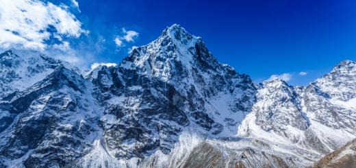
Today I will talk about the ascents of 2017 to the tops of Tabin-Bogdo-Ola (4082 m) and the Russian tent (4117 m), which are located in the massif of Tabin-Bogdo-Ola, in the south of Ukoka in Altai. I go to these vertices almost every year since 2009. In the plans, we usually stand the top of Tabin-Bogdo-Ola (whose name we sometimes cut to Tabin) with a height of 4082 m, but under the conditions of good weather and time stock, we usually manage to climb also onto the second top of the Russian tent 4117 m which is located in a kilometer from the first one. In this year, a group of nine people was collected for this, but at the last moment the four of the nine refused, and as a result, a group remained from five out of five. All five of different cities, I used to know each other, everyone has different physical training and experience, and different motivation. Nevertheless, we all rose to both vertices that I consider a completely successful result. Climbing begins from the camp at an altitude of 3000 m, where we come from jasator, accompanied by a horse caravan, which is lucky. This path takes five days, and it is very important, since during this time everything is "tapping" physical form, get acclimatization and turn into a team. It is usually ascent usually at 6 am. The first 30-40 minutes we go along the stone Moraine, then we dress the cats, become in the bundle and go to the glacier. When we walked on a flat part of the glacier, the wind caught up into the Russian tent and Tabin cloud hats. As the cracks rise to the zone, the caps have become more dense and the wind intensified at the top, occasionally blowing the lumens. At some point we discussed whether to stop climbing, and try again the next day in the hope of better weather . In general, the script of 2016 was repeated, when we rose into the Russian tent, stood there a few minutes under the hurricane wind in dense cloudiness and went down. There was a small difference that the wind sometimes swept the clouds over the Russian tent and the top opened at 30-40 seconds. I suggested this decision to postpone to a height of 3600 m, until the stopping on the stones, after which the hardest site begins - a protracted lift up the slope with a sufficiently large bias, where it is impossible to fully relax. The glacier and the crack zone we passed relatively quickly, and this gave hope that we will also overcome the last plot. While we sat on the stones and drank tea, it became definitively clear that it was only on the Russian tent to go, since it was breaking over him in the clouds, and the top of the Tabyan was all the time tightly scutched with clouds. Here at the prival, one of the participants of Olga, offered to stay and wait for our return from climbing, but I found some kind of necessary words for her, and she went with us. Usually on the last protracted rise we overcome in pace 50 steps we go, a minute rest - restore your breath. And with increasing height, these rest becomes longer. This year there was almost no snow and it was easy to trop on this site, and everything went, including Olga quite well. The last plot before leaving the stones is relatively cool, but several tens of meters remain from them. When we reached these stones, I am surprised at the top of human figures, I thought it was most likely Mongolian climbers, since there were no enthusiasts from our side. It turned out to be partly so. Yes, they came from the Mongolian side, but these were our compatriots from Novosibirsk. They did traverse from the Potanina Glacier. Today they started from the top of the cities of the heroes of 3911 m, after the Russian tent planned to go to herd and descend down to their camp on the Potanina Glacier. They were also surprised to see us, and also what we go to the snow and came out today with the "Zelenki". For some time we spent on top together. There was a strong wind, there were almost no lumen in the clouds, and the plans for climbing also at Tabin seemed very ghostly. Novosibirsk went down on the saddle between the Russian Shatter and Tabin, and we stayed at the top for some time, wanting to wait for the lumen and look down from the top. And we waited for this lumen. Moreover, it was not short-term clearance, and the global-cloudy rose, first the whole dock was visible, then the small peak, and then Tabin. The Novosibirsk went on it, as it became clear that the weather is changing for the better. All these changes occurred in just 10-15 minutes. The wind is very dulling, the sun shone and did not want to leave the top, I waited for the frame of the ascending bundle in Tabin and waited. There was still plenty of time, and we also decided to go back to Tabin. Having passed the saddle, Olga once again tried to stay there and wait for us, but I was again found that she was to say, and she continued ascent. Now I will not remember what I lured her :). From the saddle to the top of only 80 m in height. To go along the steps that the Novosibirsk was mad were just pleasure. When we came to the top of Tabin-Bogdo-Ola, cloudy rose even higher and already opened Kiytyn (4374 m) - highest point Mongolia and the whole array of Tabin-Bogdo-Ola. In addition to these types, and making vertex pictures, we went down, the weather starts up again. The most dangerous area on the whole descent was a stretch of descent to stones by 3,600 m, since there was almost no snow here, and the slope is quite good. We passed it quite quickly and without incident, and the further descent also passed without excesses. In the camp we were already hours at six in the evening, so all the climb took about twelve watches. I want to say many thanks for all the participants of this climb, as well as the spirits of the mountains that gave us the opportunity to stand on these two vertices and let go with the world.
Mineral sources - place of worship of the local population
Address: Argen-Suu, Maymin district, Chagan-Uzun
Travel on a personal trading, walking on foot.
Argen Suu -<Золотой ключик>The water contains silver and copper improving metabolic processes in the body. The largest bazer of souvenirs in the Altai, cafe, bridge over r. Katun to the Turquoise Katun competition under construction and Tavdinsky caves (the bus - 50 rubles, passenger car - 25r., Pedestrian - 5p.).
Tavdinsky (from some sources of Taldinsky) caves are located on the left bank of the r. Katuna in the area of \u200b\u200bthe village. Lime. The caves in the rock are several, the moves are branched, from the lower tiers you can get to the top. Cave holes stretch almost 3km. Relatively small grottoes (the length of the largest 150m), through corridors and arches. In the caves in the summer excursions are held. The shortest excursion takes about two hours, you will show the caves of the Dragon Nostrils, there are "Fifth Dragon Ticker", "Fools" Cave and, very popular in women, "Stone of Desires".
The state monument of nature was announced by the source of Argen-Suu on the Chui tract, in 7km from the village of Merzherok. Stop it here was the good tradition of Gorny Altai Guests.
It has several titles: "Arzhap-Suu", "Shawan", "Golden Key". "Argen-Suu" literally denotes "mineral water" (Suu in translation from Altai - water).
The source is located at the bottom of the steep side of the valley p. Katun in the extreme western round of the ridge of the IOLO. Here, the sorry almost arrogantly approaches the river bed.
In the area of \u200b\u200bthe source, the climate is rather soft. average temperature January -13 degrees with, July 18 degrees C. often blowing hair dryers. The average wind speed in the winter months is 4-5 m / s. In summer - 1-2 m / s. The annual precipitation amount is about 500 mm.
Source downward, scattered type. Water flows out of the fractures of indigenous rocks in several places and in 20-30 m forms a single stream.
The source water was attributed to the hydro-carbonate class calcium-magnesium group: in addition, the source water was found: silicic acid (12.2 mg / cubic meters), strontium (0.34 mg / cubic meters), zinc ( 0.12 mg / cubic meters).
In the 1990s, Tomsk NIIKIF was made attempt to attribute the water of the source for the content of organic matter (sorg. 4.1 - 14.4 mg / cubic meters) to the VIII group of mineral waters, weakly mineralized with an increased organic substance content. The representative of this group is water type "naphtur" (Truskavets). Silver has been determined in the water source.
Water hydrocarbonate-calcium magnetic.
Spring "Argen-Suu is a state monument of nature, located 7 km from Mergerok at the 477th kilometer of the Chui tract, immediately for the new bridge leading to the Turquoise Katun tour account.
Water in the spring is saturated with silver, copper and other mineral impurities, and in connection with which the long time is stored and, most importantly, has a beneficial effect on improving metabolic processes in the body. The water contains a large amount of bivalent iron, and this is much larger than in the sources of Essentuki and Borjomi!
Next to the source, the cafes of the same name, built of stone in the style of vintage castles. Here you can see the so-called shaman trees decorated with white ribbons. Argen-Suu is a place popular among tourists. Along the road, you can purchase a variety of Altai souvenirs: wood products, berers and stone, as well as video tapes and CDs about Altai.
Argen - healing source.478 km Chui tract. Argen-Suu (Southallt.- "Holy Water") - Spring, a monument of nature. It is located on the right bank of Katun, not far from the village of Manzherok. Republic of Altai. Water comes out of the root slope of the valley r. Katun at an altitude of 340 m. The source is located in the extreme western round of the ridge of the IOLO, in the depth spinder area and comes out of rock cracks in several places and after a couple of tens of meters, forms a single stream. It has several names: "Arzhap-Suu", "Shoker", "Golden Key". This is one of the most popular sources of mountain altai. Water source hydrocatalog-calcium-magnesium with silver content (so-called " living water") and 4 ml / l bivalent iron (" dead water "), the content of which is greater than in sources of Essentuki and Borjomi. Water also contains copper and manganese, is long stored for a long time and, most importantly, has a beneficial effect on improving metabolic processes in the body. Temperature Water - 7-8 ° C. Local residents consider the source saint.Arzhan-suu popular place. Next to it are cafes and souvenir benches. Around the shaman-trees decorated with white ribbons. This is the ancient custom of the Altaians in honor of the local gods. Almost all the holy places of Altai look like (springs, passes). You can only bind a clean tissue with 20cm long and 5cm wide, the fabric must be necessarily only light tones: white, yellow, blue or pink. Next to the source of Argen-Suu is a car bridge on the left bank of Katun, leading to the Turkuzovaya Katun Turkomple.
The source is 8 km from the village. Martherok Miminsky district in the Chui tract. It comes out of the indigenous slope of the valley r. Katun at an altitude of 340 m. He has several names: "Arzhap-Suu", "Shawan", "Golden Key". "Argen-Suu" literally denotes "mineral water" (Alt. Suu - water).
Since 1961, he was considered the only silver-containing source of the Chui tract, which served as the basis to approve it in 1978 by the monument of nature of the mountain-Altai Autonomous Region. The status of the monument of nature was confirmed by the Decree of the Government of the Republic of Altai dated 02/16/1996
A unique picturesque landscape causes the recreational value of the object, the source is a monitoring point of the dynamics.

The source is located at the bottom of the steep side of the valley p. Katun in the extreme western round of the ridge of the IOLO. Here, the sorry almost arrogantly approaches the river bed. Runged into a metal pipe, the source crosses the Chuyet path and is the right influx of p. Katun. The source exit area refers to the field of depth fault, which disseminates the vendkembrene base of the northern wing of Katun anticlinorium. According to the Katun River, alluvia stripes, the foundation of the flood, and inappropriate terraces are stretched. Water-based rocks are limestone and metamorphic basalts, overlapped by sandy and loam.
In the area of \u200b\u200bthe source, the climate is rather soft. The average temperature of January -13 degrees C, July 18 degrees C. Fenes often blow. The average wind speed during the winter months is 4-5 m / s. In summer - 1-2 m / s. The annual precipitation amount is about 500 mm.
Source downward, scattered type. Water flows out of the fractures of indigenous rocks in several places and in 20-30 m forms a single stream, with a flow rate of 6-10 cc / s. The fluctuation of the flow rate between the main seasons of the year is 1-2 cubic meters / s.
The study of the source began in 1961 E.V. Checheneva. Later, in 1982, according to the hydrogeological department of "Geominvod" and the Moscow Research Institute of Resortology and Physiotherapy (MNIKIF), the water of the source was attributed to the hydro-carbonate class of the calcium-magnesium group:
In addition, the source water was found: silicic acid (12.2 mg / dm3), strontium (0.34 mg / dm3), zinc (0.12 mg / dm3).


In the 90s, Tomsk NIIKIF was attempted to attribute the water of the source for the content of organic matter (sorg. 4.1 - 14.4 mg / dm3) to the VIII group of mineral waters, weakly mineralized with an increased content of organic substances. The representative of this group is water type "naphtur" (Truskavets). Based on this, a conclusion was made about the need to complete the identification of the water of the source and carry out in-depth studies of the functional composition of organic substances of water with the identification of their genetic nature. In the water of the source were identified: antimony, copper, lead, zinc, bismuth, silver.
Since 1992, the hydrochemical regime and the chemical composition of the water of the source are systematically studied by the Research Chemical Ecological Laboratory of Gaga.
Water hydrocarbonate-calcium magnetic.
According to 1998, in the water of the source, there are: NH4 (1.2 mg / dm3), NO3 (5.6 mg / dm3), N02 (0.04 mg / dm3), phenols and other substances of anthropogenic origin, which indicates about the worsening of it ecological status.
According to N.B. Yermakova, in the vicinity of the source, pine large-grained grain-tranne-orlyak forests are represented. Ancient with admixture of birch; The undergrowth consists of a cherry of the cherry, Ryabin Siberian, viburnum of ordinary, Tolody Dubravklisny. In a grassy tier, the most abundant:
orlyak ordinary, female jar, acronite North, as well as cereals - Vaiki:
cane, dull, boring messenger; Sources: Arnell, BigBextay, sick ordinary, Krylov's dressing, Voloshoid extority. There are also a non-bellic species that have a relict range from Pa Altai: Oatmeans - Far Eastern, giant; Paris Twister.
On the shores of the source, in a forest array of large mammals, a hare-white bang. Among the insectors there are: ordinary and average burzobs several types of volatile mice, mostly night; Three types of forest bevels, voles, chipmuncture and forest mouse. From the reptile, an angular lizard and ordinary viper was common. Birds are presented mainly by sparrows. Among the diverse insects attract the daytime butterflies. Pretty Mahaon, a variety of nymphalids, whitening. In open areas and along the road at the beginning of the summer, a hawthorn is numerous. Here you can find floral peepholes and offshore roadside.There is a legend in which one hunter was mortally wounded in the mountains of Marala.
But the beast did not fall, but quickly crushed away, as if life was not going to leave him. The hunter noticed on the head of the wounded gross horns with precious stones and rushed after him, not wanting to miss such treasures.
Having expired in blood, the wounded maral reached the source of Argen-Suu and rushed into the water. While the hunter came down from the mountain, the wound was dragged at the beast. Maral jumped out of the water and rushed away faster than wind. The hunter was very surprised at this and threw dried smoking water. Fish came to life and floated, moved fins. I threw a hunter into the water skull. I snapped the otter and floated just like Harius.
Then I understood the hunter that the source of Argen-Suu power and life gives everything.
Visit mode:
Tedned recreational
An organization responsible for security.
Monument of Nature of the Republic of Altai - Source Argen-Suu is located at the Chui tract 8 kilometers from the village of Merzherok. The source is located to the left of the tract. Next to him along the road installed in large quantities trays with Altai souvenirs, where you can buy products from ceramics, wood, berers and stone, national clothing and musical instruments, cards, postcards, video tapes and discs about Altai. Here the cafe "Argen-Suu", famous for the film Vasily Shukshin, "lives such a guy."
The source of Argen-Suu is also called the "Silver Source", "Holy Source", "Sheafer Key". It comes out of rock cracks in several places and after a couple of tens of meters, forms a single stream. In addition to high silver content, the source water is saturated with copper and other mineral impurities, it is kept for a long time and has a beneficial effect on the metabolism in the body. And the content of bivalent iron in the water Argen-Suu is noticeably more than in the well-known sources of Essentuki and Borjomi. Unfortunately, according to research, recently in mineral water The source increases the content of anthropogenic origin, which indicates the deterioration of its ecological state. Near the source constantly stops vehicles, contributing to environmental pollution by lead and petroleum products. In the peak of the summer tourist season, the number of source visitors sometimes reaches 1000 people per day.
Next to the source of Argen-Suu is a new car bridge on the left bank of Katun, leading to the Turkuzovaya Katun Turkomple. Further on the tract is the "Globus Plus" turbase.