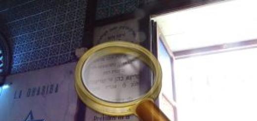
Dakhovskaya cave, she is dirty, located in the vicinity of the village of Dakhovskaya, in two and a half kilometers from the mouth of the Dach River, at the base of the Kuesta Gasta. It is among the so-called Unacozovskaya caves - faults located in the rocks of the Unhung Khod Range: Meandrovaya, dusty and a number of shallow grottoes. Almost all caves are located in the rock area of \u200b\u200bthe traits finger. The Dakhovskaya cave is apart, on the western slope of the Unacosis Range.
The cave leads a wide entrance, which is located at an altitude of about two meters from the trail. Entrance inside the Dakhovskaya cave has a height of 70 centimeters. Almost immediately at the entrance, the cave ceiling begins to drop sharply, then it is possible to go a bit of a 20-meter corridor, the height of which increases and forms the first room, with a length of about 50 meters ending with narrow Lases. It appears first skewers. It follows the second hall, where stalactites grow on the varieties of the cave.
In the first room, a man's parking was discovered by the Mustier era. In 1957, the parking lot in the Dakhovskaya cave studied the archaeologist Alexander Alexandrovich Furosov, the largest specialist of the archeology of the era of primitive. Parking of primitive people, found in the cave, dates from the Epoch of the Early Paleolithic. The cave parking lot of the village of Dakhovskaya - the first cave monument to the paleolyte found in the downturn. The cultural layer detected in the cave (50-70 cm) contained flint tools of labor: a stone ax, rubble and arrow tips. Also in the Dakhovskaya cave were found bones of animals (bison, mammoth, giant and noble deer, a mountain goat and a cave bear, hamster, hare, wolf, cave hyena, a forest cat, Tigrol and Badger).
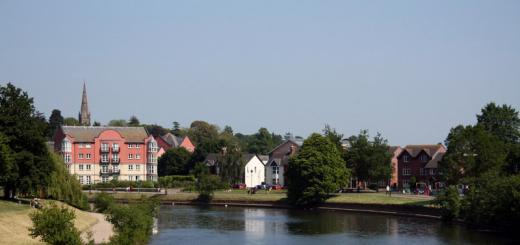
Raw cave. Paul, walls and ceiling of Dakhovskaya are covered with a thick layer of clay, so it is necessary to take replaceable clothes. The entrance to the cave is located a large observation deck, which overlooks the village of Dakhovskaya, Dahgucheskaya Polyany, the mountains of Trident and Gut, the Azish Tau Ridge, the White River.
In addition to Dakhovskaya, the Uanakozovsky caves include:
Cave Tunnel I, Cave Tunnel II are through slots or passages in the rock. So, the entrance to the tunnel I is located opposite the inlet in the cave of the grotto, and the output is opposite the inlet opening of the cave Tunnel II.
Cave grotto It is located on the left of the rocky protrusion of the finger, somewhat away from the main trail. The cave has the height of the ceiling to 5 meters, the length of about 30 meters. At the end of the main stroke there is a LAZ into a small room.
Dusty or Unacozovskaya cave Located right along the trail at a distance of about 500 meters from the damn finger in the north-west direction. The cave entrance in the form of a huge triangular crack with stone rods after the entrance. The cave is absolutely dry, as a result of which it is very dusty - everything is in dust, and the floor is covered with a very thick layer. The length of the cave is meters 30, however there is information that its length is greater, since the available LAZ displays in another room.
Cave Balcony It is located between the caves dusty and the grotto above the path at an altitude of about 10 meters. The cave has an entrance in the form of a rectangle and two moves left and right, which quickly end in small halls. Right-hand
Has a passage to lower levels.
How to get to the Dakhovskaya cave. The path to the cave of Dakhovskaya begins on a labeled path, which begins to the right of the Dahobov bridge in the village of Dakhovskaya. Follow the mountain to the rocky array, and then move on - past the walls, to the cave itself. For the inspection of the Unacozovsky caves, you can get under the board of the ridge from Hajoha walk or to the side of the farm cheerfully car to the outskirts of the forest for a quarry and on foot on a flat landscape.
Coordinates:
Latitude: 44.239167
Longitude: 40.219167
By car.
On the highway M4, M159. Distance 1560 km. Time on the way - 22.00 h.
By plane.
Of the airports "Domodedovo", "Vnukovo" or "Sheremetyevo" by flights to Krasnodar or Rostov-on-Don. The distance from Rostov-on-Don to Dakhovskaya - 380 km, from Krasnodar - 197 km. Next, you can use taxi services. Time on the way - 2.28 h (from Krasnodar) and 6.30 h (from Rostov-on-Don). Or pass by bus to Maykop.
By train of long distance.
From Kursk, Kazan and Paveletsky railway stations on trains to Krasnodar or Belorechensk. Travel time from 19.27 hours to 33.00 hours. Next - by bus to Maykop. From Maykop to Kamennikovoy (railway station "Hajokh") - on suburban train or bus. And from Kamennikovostsky to Dakhovskaya - by taxi (7 km). Time on the way - 0.10 h.
From Maykop
By car.
On the highway M4, M159. Distance 197 km. Time on the way - 2.48 h.
On the suburban train.
At the train, the next from Belorechensk to the station "Hajokh" in the village. Kamennikovsky (twice a day). Time on the way - 1.30 h. From Kamennikovsky to Dakhovskaya by taxi (7 km). Time on the way - 0.10 h.
By bus.
From Maykop there is one direct bus flight A day to Dakhovskaya and several to Kamennikovoy. Time on the way 3.20-340 h.
Walk through the village of Dakhovskaya and its surroundings
A walk through the ancient Cossack village and the surrounding scenic foothills can be started in the center of Dakhovskaya near the Church George Victorious (Club st., 2). The old temple was built in 1864, two years old since the founding of the Cossack fortification on the site of the former Circassian Aul. The village was an advanced line during the Caucasian War. The temple erected the money of the Cossack troops from the oak bar on the stone foundation. In the 1930s, when the state led to the fight against religion, this church was closed, turning it into a warehouse. Today, the temple of George Victorious occupies a re-equipped building of the former rural store.
Inside the Church George Victorious
From the church you need to go about 0.7 km along the main autotrass (A159) to the north, towards Maikop. Here through the river Dah is laid Dakhovsky Most. The name of the river in Cherkessky sounds "Dahhe" and in translation means "beautiful". Stone Bridge in 1906 built Cossacks and local residents. His durability and durability is explained by the fact that an egg protein was added to the solution that fastened the masonry. On the old bridge, you can still cross the river. But for preservation historical monument Nearby built a modern concrete bridge.

Dakhovsky Most
Below the village, over the left side of the Valley of the River White rises asian Tau Rangewho extended 25 km. There are many karst funnels and caves in it, the formation of which is caused by the slanting ridge by mountain rocks - dolomites and limestones.

Asian Tau Range
Approximately 2.5 km north-east of the estuary of the Dakh River Located Dakhovskaya cave. Before entering it with observation deck You can see the village houses, the spacious Valley of the White River, the top of the trident and the spurs of the Asian Tau Ridge. The entrance to the cave is low - only 0.7 m. After 20 m of the corridor, two large rooms are opened, the arches of which are covered with limeths. During the study of the cave, which was held in the middle of the last century under the leadership of Archaeologist A.A. Formosova, a primitive person was found here. People lived in these places in the Epoch of the early Paleolithic. In the cultural layer, scientists discovered the bones of ancient animals, as well as silicon tools of labor and tips.

Cave Dakhovskaya
About 0.7 km south of the cave is Stone Iron, named so for its shape. This huge fragment of a cliff, having about 50 m in length and a height with a three-storey house, broke off during the artillery shelling of the Germans in 1942.
From the south-west of it is well noticeable, towering over the valley rock damn finger, located in the mountain ridge of un-goat. The route to this monument of nature begins near the old Dakhovsky bridge. Initially, you need to follow the path up the Dacha valley, and then, on the fork - turn towards the thoughts of the finger.

Rock damn finger
And you can complete the walk through the neighborhoods of Dakhovskaya, driving on the Maikop Highway - Guzeripl a little more than 10 km south from the village. Here, in the Valley of the River Belaya there is a picturesque monument of nature - Granite canyon. It stretches for 4 km. A gorge formed in the rocks has a depth of 0.2 km. Tesnin compresses the river, forming raging thresholds on it. In the south of the granite canyon from afar is visible mount Trzzubets, crowned with high towers.

Mount Trzzubets
Another surprise from the cycle "Opening of America" \u200b\u200bMother Nature presented us in the form of a ridge of un-goat. How many times we dangled past him along the way in Lago-Naki, Hamushki, Guzeripl, Thach, examining from the window of the car his characteristic rocky comb, and get acquainted closer only now. Probably it is one of the peculiar features of the human character: something nearby, at hand, to transfer for later, and even be unreasonable to be considered insignificant and not paying special attention. I will not say that until now I did not have any idea about this ridge. The first living local touch touch occurred 5 years ago in the rocky fault of the Mishojo gorge. Then on the Internet regularly slipped the info about Dakhovskaya cave, the rock of the dams finger, etc. But stereotypical thinking was not in a hurry to seriously focus on this topic and, now and the case threw it somewhere in buffer zone: Yes, then, somehow next time. Now, in practice, I was convinced of my wrong: I gave it a few hours of impressions "above the roof." In my memory, this is one of the best one-day radial. Once again, I made a conclusion for myself: everything should be tastefully trying to touch tourism.
The Ridge of Un-Goats (go and be afraid - with Starogrech.) Streeting along the highway for many kilometers, it very longs accompanied by everyone traveling along the way from Hajoha to Guseripl, attracting attention to him crowned in the upper part of the yellow ripped cliffs belt. Linearly stretching along the wooded body of the ridge by approximately the same strip, resembling a fortress wall, they are a highlight and uniform of the Un-Goat.

Opposite the Un-Goza, on the opposite bank of the White, his twin brother broke, the Asian Tau Ridge ( Guiding) With a similar rock belt on the painter. Due to these stretched distance, the ridges continuously hops its stony shores the White River, harmoniously blowing the landscape of a beautiful spacious valley.
At first, I assumed that the translation of the "go and be afraid" is due to the unsafe of the place, the possibility of inappropriately rumble from the cliff, or to go to some crack, the failure, which is abundant here. But the history of the name is more intriguing. It turns out since ancient times the slopes of the ridge served as a convenient landfill to organize robbing towers on merchants and traveling, headed by the White Valley through the mountains to the sea. Apparently, some Circassians in Hajochi on the slave market were sold to the Turks into slavery kidnapped on the eve of the prisoners, while others were preparing the raids and exemption at this time, without missing the benefit from realized transactions with the Turks (perhaps the most utopian version). Nevertheless, the fame of un-goat not so much due to its legendary past, how much is its size. This is the most extended ridge of Adygea, who spread the territory of its spread of Also to Karachay-Cherkessia. It must be assumed that the uncharted secrets he keeps in itself not yet enough. However, again fucked ...
For the old bridge over the river Dakh ( Beautiful "With Adyg.) In the Mountain Cossack Stanice, Dakhovskoy immediately becomes a clearly stuffed path.
In the construction of the bridge in the lime-sandy solution of the Cossacks was added egg protein. Eggs collected all the Dahovsky world. Therefore, it stands on eggs quite confidently so far.

The trail takes up and goes up and goes on a clean forest without a undergrowth, with a lot of fat oaks, which is why it is so pleasure. However, this segment of the route is by no means walking and pulls on an hour of stable lifting. On the way, does not dry up the spring, exacerbating in any weather a clean and tasty driver. Finally, the exit from the forest to the rocks of a huge, whipped from the main stone wall called Iron, or Dakhovsky collapse.
Iron on the left, in the middle. Above him, in perspective, rocky ridge of the Asian Tau. Above, on the horizon, the sings of the Lagonak ridge. And just below the rocky ridge, the road is clearly visible to the side of the Lago Naki turbase, the plateau and in the ridge of the Valley of the Kurdjipse River.


Only approaching the bee of rocks, observe their real scale. From the bottom, from the road, they naturally look more miniature.
That's right, Luda. Remove me. You are on you alone.

If the wall turn left, then after a while you can get to the Dakhovskaya cave. I planned to collapse to the right, examine several caves of the corridor type on the way, not to mention the abstract number of all kinds of grottoes, then climb the back of the ridge from the rock of the blacks. After dinner, go to the side of the newly launched on the un-goat Savransky cableway (first and so far the only one in Adygea), pop up on a couple of upper species platforms and, scratching the route, fall back to the highway or rope on the rope or on its two.

Soon, right under the wall, another spring was met. So water to drag with you is not at all.
Looking at this suede slot, unambiguous associations will arise that

In this active walk I liked everything absolutely. But the most indelible impression produced a family of grottoes. Moreover, not so much their number as the quality of some representatives of the family. Such exotic formations, and even collected geographically in one place, I probably did not see.
So, turning to the right, we suggested almost along the horizontal path along the distance somewhere in the distance of the rock wall. On the right we accompanied the falling forest. A confusing abnormal weather leopards, now he is again gymwently awakening and the offensive of spring, feeding the sacred signs uncharacteristic for winter singing birds and in some places that have woken up first arches.

I feared that the complete absence of snow would draw us a gray-depressive sad landscape. But the bright sun wonderfully transformed everything around and painted into unusual interesting colors of some Martian shades. On the way we encounter the fortune stone, under which, observing the tradition, it is necessary to take pictures. Otherwise, Fortune does not see.


Stand, but what am I ...?


After a rather long procession, approach a large cone-shaped crack in the wall. This is a dust cave.

The front of the cavity at the entrance is so called. "Pregnant" volume and impressive.

But behind this promising start, a sharp narrowing of the corridor was followed, which took into several small extensions-rooms. Nate, respectively, no. Everything is quite uniform. On the floor really a lot of dust.


In general, with "beer" will go. You can look. Literally meters after 70, just above the main trail, we immediately met three more caves located next to each other. One of them is Meandrovaya, dusty, with the difference that the walls of her far-room sparkled by some pearl-like gloves. And on the ceiling, hacking down his head, the mistress of the cave dreamed.
Entrance to NEY

On the photo of the glitter is not visible, but looking at it, you can notice.

But the two other cave tunnel-1 and tunnel-2 seemed to me more interesting. One of them was a long through a corridor slot with access to the opposite side of the rock.


Upon exit from the end-cutting out, a small gap and immediately again a gap with a corridor.


This crack is characteristic of the fact that it is from somewhere on top highlights with daylight, which is why it can be wary without lanterns as in his own chulana.


Where did you drag me, the popyan ...?!


Literally meters after 100-150 from the caves, following these beautiful cliffs

we are approaching another interesting object - the ring ring (he is the arch, it is the window).


The entrance to the grotto is valid in the form of an arches formed by the complete absence of the ceiling (or roofs). It looks original, as if part of the destroyed ancient constructions


The rear wall of the grotto, scarily illuminated by the sun, stuck with icicles.


Immediately behind the ring on the left, breaking the cliffs with smooth output to the top of the ridge
On the right on the horizon, after the next bend, a promising continuation of the un-goat range, with the same cliffs at the top.

to the rock of the blacks finger (the second name of the bell tower, the third Heavi Metall is mine).


Photo Rocks Side

The three caves described above are in the exact finger.

Side shot of a finger made from this scalney


Well, will we finally ever dare ever today, or not ...?!

View of the village Dakhovskaya and the Range of Asish-Tau.

"Now I am ready to even stay here and live" - \u200b\u200benthusiastically exclaimed the vaga after the completion of the procedure for feeding food.

Performing inspiration, we pulled out: "Kuban, you are our homeland ..."

Transferring the Spirit, headed along the ridge on the dirty, podrakishly after the morning frost road. Then OT. roda road"Tetis" to the module again stumbled over a labeled path, next to the cliff. Along the way, they regularly turned on seductive branches to overview species.


Lyapota ...!

The species platforms alternated with through-column-wallad grotes of unrealistic fantastic forms and species.


And this polished by many yawas Nora derives to the edge of the abyss. Because there is a slipping on the edge and not quite safe.

Grota desires On fate, it was pleased to find it in the century of 21st in the accurate next to the cable car, and therefore it was naturally graduated by the sad fate of the transformation into a civilized excursion object. Currently, it is boiled from the metal structures over the openness of some kind of nonsense balcony


We were refused to ride on the rope descent, as tickets are sold only in both ends at the box office at the bottom of the highway. The half service is not provided here. NOU problems! Peshkodral lonomuli on the inclined right under the crank.


Flouring 40 mud minutes, pulled out from the forest on the highway from the Dakhovsky chapel.

I was shocked by terror, locally arranged here a hundred years ago by Krasnopussemi Commowers.

As a spoon of conception at the end of such a positive event.

Pih e r and d and x about in with to and i
Exactly a year later, in January 2017, returning from Guzeripl, we have again visited un-goats again and this time I left the iron left to the Dakhovskaya cave. Second, and perhaps the most suitable name Dirty. What to say? Alas, the impressions are diametrically opposed compared to last year's walk. In other words, if you want to get frustrated, flashes on the ears in the mud and ask yourself a question: what I do here, then you are here.
Already by itself the path under the cliffs from the iron to the cave turned out to be more wild and unpleasant than in the direction of the cave of dusty and finger. True, there is another, more free option: from the module from above, from the opposite side, a well-marked and distinct trail is suitable. Most likely this route is priority than the one on which we shoved.
"Where are you leading us, susanin-hero? Go in FIG, I myself here first ...!" Reentener evergreen wild sheer

As if the trunks of the real tree of this shunting and his all-pervantal countless branches are spread by a grip to the cliff and creating a single organism with them. Amazing spectacle.


I called the Zhabra Ihthyander

Well, finally she, Roda ...

The cave leads a long and very low corridor, which forces climbing to the first hall on the karachets, fours, or a goose step, to anyone. The corridor itself is moderately dry and in principle did not cause excessive psychological rejection.

Having missed the first room, you can straighten up all the growth and look around. From the walls and the ceiling dripping moisture, which accumulates respectively on the floor. Hence such an ubiquitous dirt. Humidity is very high. That is why my fotik immediately fought and instead of the pictures I gave a solid flutter. Yes, and there is nothing to rent. Natok Gulkin Nose.

Behind the first hall follows narrow, 70 cm. And quite a long LAZ, which takes into the second large hall. The length of the last allegedly 50 m. According to the descriptions, in it and focuses the main beauty of the cave. However, this is all intrigue. Get there units. After all, this LAZ is needed on the belly on a vague, unpleasant fat. Expensive fee for dubious pleasures. But you can be guaranteed to be sealed by Schwarzenegger in the film Predator, having sodged himself before the fight with a mud mud camouflage. But he had a motivation existing. Do we need it?
In general, it turned out in a bad fairy tale, when a well done hunted behind the beauty, she overtook her, but suddenly, an angelic face was not suddenly under the veil, and Grimas is miserable old women. Well, it happens. Bad result is also the result.
This is not Rio de Janeiro.

I love you, Adygea, the more, the more I know ...

When I learned that the length of the un-goat ridge was more than a hundred kilometers, it did not believe it! After all, as it seemed to us, we passed a big and interesting part over a few hours, and it is clearly not a hundred kilometers. But after examining the card carefully, I was established in this information. He really does not end in those radial route that we have passed, but goes further towards the republic of Karachay-Cherkessia. But to get acquainted with its main beauty, it is not necessary to pass the entire length of the ridge, it is enough to master 7-8 km. The height of the Un-goat Ridge is on average from 800 to 1000 meters above sea level. Near the village of Kamennicorovsky Ridge is limited, as well as the same names of the Gorge and the White River. And it is from the Kamennikovsky that we keep our way. We got a radial route, that is, where we start it there and go back, but a little different way.
He took about 6 o'clock, and the length of it was 7.5 kilometers. Having passed such a route, you can visit various grottoes, the rock of the trail, the cave Dakhovskaya, dusty, meander, and also ride on the cable car.
The UA Range is a karst limestone and in connection with this rich in caves and grottoes. His name from ancient Greek means "go and be afraid", which is associated with the fact that the robbers hid in the caves, who attacked the trading caravans sent to the sea. And through Hajoch (Rufaggo, Adygea's waterfalls), as we remember, one of the threads of the flock path ran. And also in some caves were found parking of primitive people.
How to get to the un-goat ridge
You can go to this popular daytime route now at least from two sides. From the village of Dakhovskaya, from the old Dakhovsky bridge across the river Dah goes Path on the ridge. She displays the iron to the rock. From the rocks of the Iron you can turn left and walk to the cave Dakhovskaya. And if you turn right, you can see the caves of dusty, meander, and a few more grotts, climb the rocky area of \u200b\u200bthe ridge and inspect the rock of the trail to the finger, and then walk towards the cable car and find the grotto and parking of an ancient person. Last, by the way, we could not find, turned soon. And the second option: to get to the cable car, which is opposite the turn to Lago-Naki, climb on it and stroll along the ridge to the rocks of the traits finger, go down from the ridge and visit all the sights described above.
We have a second option seemed more logical. First, it is always interesting to ride on the cable car, and most importantly, if you reach the rocks of the traits, you will not feel the strength to descend from the ridge and go all the way on foot, you can return again to the crank and descend comfortably and beautiful view, because for the descent you paid already when the lift. And secondly, even if you do not want to go down the rope, then on foot your path will run mostly under the hill, you will spend less strength, and in the end you will come to the same cableway, if you left there your car.
Where to live on vacation?
Booking system Booking.com. The oldest on the Russian market. Hundreds of thousands of accommodation options from apartments and hostels to hotels and hotels. You can find suitable option Accommodation, at a good price.
Without booking a hotel now you risk overpaying then. Book accommodation through Booking.com.
Pedestrian Range on the UA Range
From parking, we go to the cable car and pass by the chapel installed in the memory of the repressed Cossacks.
The cableway was built in 2015 and its length is 1265 m. The height set is about 450 m. And still ride on the cable car - it's every time a little holiday, some kind of forgotten feeling from childhood, how to ride a big carousel! 

This time this holiday cost 500 rubles per person for lifting and descent. Not the cheapest holiday, well, okay. Already when climbing on a cable car, a wonderful view of the rope's tract opens, as well as the Lago-Naki plateau, in our case everything is still in the snow. 
And I also liked that the roller goes below the crown of the trees, and there is a feeling that you move in a tunnel from the trees. In the summer it will probably be a green tunnel. 
We arrive. 

Immediately upon arrival, we meet a travel post. It seems to be everything clear, but as we have slipped past the parking lot of an ancient person, I will not mind your mind! 
We start the path on the path, which leads to the first observation site, as well as I understood, if you go down to the intermediate terrace, then to the grotto of the ancient person. 
A panorama opens from the observation deck: the village of Dakhovskaya in the valley, a little left of a piece of spotted with snow slice, then snow-covered, white peaks of the Mountain Oshten and rocky, covered as snowy, the ridge of the stone sea. Well, what's next, to the left, I'm already difficult to say. For sure there is a black Shikhan Mount on average, and then many ridges and mountains of the main Caucasian ridge. 
On the bottom of the cable car and the bridge over white and the road is visible to Lago Naki and the rope tract. 
View in the direction of the Kamennomyostsky, and the village himself. 
We continue our way towards the damn finger, the trail is marked, so it's difficult to get lost. 
Another sitting at home and considering the cards, I noted for myself the cave Dakhovskaya and for some reason I didn't mind at all that it would be under the rocky area of \u200b\u200bthe ridge. And when already in coordinates, more or less closely began to approach her, he was finally convinced. It should be somewhere there, below. 
It is necessary to go to her from the cliff iron left, if you look at the un-goat. Well, we, realizing this fact and at the same time being on top of the ridge, continued their way to Damn finger. And maybe something else we find on the path of interesting.
Tetis Rope Park
Return to Tetis Rope Park. If we hurry to the damn finger, then follow the signs, and we decided to look into the park and see what they offer. And they offer a lot of tracks: trolls / Zip Line, Via Ferrat, Rope tracks, everything is needed and time, and money of course. Honestly, I wanted to fly over the trees next to the cliffs along the troll route, but the time was limited, and we went further. Another time somewhere in the future somehow another time sometime later. 
From the territory of the park we first saw the stone iron. 
It also opens almost a complete panorama from the ridge. 
On the left already visible the mountains of Big and Small Thach, which are included in Nature Park "Big Thach". Someday I hope to visit him. 

Stanitsa Dakhovskaya almost close-up and beautiful clouds. 

Well, about the stone Iron a little later, when I approach him closer. We continue the path to the damn finger. 
Rock damn finger
Reached. The rock is shown among the trees. Yes, the height is decent! And you need to climb on it with caution! And the types of it are chic, like the rock itself, finger, on the background of the mountains it is irresistible. Although the finger, I would say, obviously not in the only number, rather this is the damn fingers. Or a damn goat! 


View from the rocks of the traits finger. 
A little to the left of the races of the traits of the finger, there is a descent from the top of the ridge under the rocky area, where the path is running to the stone of the iron and the exit to the village of Dakhovskaya. 


Maundra cave
Overlooking not far from descent, we meet the first cave. The entrance to the cave is on the elevation, so that you can skip it. 
The cave is not very deep, but still with their cruise keepers. It seemed to me that this is just a meander cave, let it be so! After all, she is definitely not dusty! And the ceiling is still sparkling. 


Following, I find some kind of spill, and it seems that he has a pass-through pass, but I didn't want to climb there, there is no intrigue. Go further, I want to find the next cave. 

Cave dust
But, it looks like she!
The entrance to it is quite rather, as it may seem initially. 
It is definitely impossible to confuse it with another one, since dust is really very much there. To climb into it and do not get dirty, in my opinion, it will not be easy! 
The cave has a high ceiling. And you look at some stones at the top. 
The cave ends with a narrowing. 
We leave. 


Sometimes the track is suitable close to the rock, it makes it possible to appreciate it even more as the ridge of un-goat. 
Stone Fortune
And here is the fortune stone. It is not known for now why he is so named. Someone believes because Fortuna awaits you. And I had a thought, based on the size and his tilt, that Fortuna is that he will remain in place, while I go under it, and I, in turn, remain flattened. 
Stone Iron
We approach the stone Iron. 
He and from afar did not seem small, and near and suppressed! The height is about 20 meters, length is about 50 meters. The stone broke off the cliff during the German art printing ridge from the village of Dakhovskaya in 1942. On the ridge were Russian partisans, actually it was the reason for the shelling, apparently to get them in a different way of the Germans did not work. Now the stone is notable for its parallel lines, the appearance of which some are associated with landings of aliens. We also frightened how they could appear. Water clearly does not drain so smooth lines, it goes as it is easier for her. Otherwise, there would be no proverb about the fact that the water will always find the path. But the fact that this interleaving is more and less durable geological layers, only on the scale of the ridge, and maybe even larger, possibly. And grooves appeared in less durable layers of breed under the influence of erosion. 


Further, our path runs down the slope through the forest to the Dahobov bridge. 


And this gently purple flower was very unusual. This is the toasthedral of the five-lines belongs to the popular family of cruciferous. There is a folk name - wild lilac. This plant is on the verge of extinction, so it is listed in the Red Book. It disappears because of the soil pulling into cattle and due to the pulling and picking up in bouquets by traveling people, as it grows on loose soils and multiply only seeds. Interesting feature: Fruits The new plant can only give out 5 years after the appearance of the light, if for these five years no one will output it and does not force. But it turns out to be the rhizome, it can also multiply, if they do not hesitate. 

The Dakhovsky bridge came out already at dusk and forces almost left, to get around it and take a picture normally. For orientation, except that the silhouette through the thickets. 
Further, on the road, Kamennikovsky-Guzeripl we reached the module, which by that time had already completed her work for today. And in the parking lot we were waiting for our car.
Walking on the ridge of the Unholohoda, we liked with your contrasts. Grottoes and cave - expanses of mountains and numerous panoramic sites. Forest with flower and herbs - open Polyany.
A variety of views pleased with the eyes and laughed in order to move on along the uncharted trail.
Video: Adygea spring
Granite gorge, Unholo-goats, Mishoko River Gorge, Khajokhskaya Tesnin and Yavorova Polyana
Regulatory and legal basis for the functioning of a geological object:no in the list of protected
List of basic security objects: Classical corridor type cave
Brief description of the geological monument of nature Dakhovskaya cave:
Cars cavity classic corridor type. The entrance is a cavity of 60-70 cm height with a width of 1.5 m on the slope of a rocky coast. The cave cave does not have branches and goes in one direction. The length of the corridor is about 50 m with a slight rise of deep into the width - about 15 m, the height of places reaches 10 m. The cave made numerous finds in the cultural layer of the Paleolithic era. The area of \u200b\u200bthe cave is about 22 thousand square meters. m.
Geographical position:
at the place of failure p. Dah in r. White
Latitude:44.25 Longitude:40.2 (degrees)
Informational resources:
>
Authors: Carpunin A.M., Mamonov S.V., Mironenko O.A., Sokolov A.R.
Editor-in-Chief - Orlov V.P.
\u003e M., 1997
Information and analytical system "Especially protected natural territories of Russia" (IAS "POP RF") http://oopt.aari.ru/
Additional information on OPT:
The territorial location of the village of Dakhovskaya gives the opportunity to develop the tourist industry. Specialists from Germany are actively assisting the Maykop district in the development of specially protected areas, sightseeing, agricultural and small hotel tourism. In April 2004, a joint Russian-German meeting on the development of tourism in the mountain settlements Maykopsky district, with the invitation of all interested state structures, heads of administrations and entrepreneurs, in which a deputy of the Bundestag participated along with German specialists. Due to investment funds from Germany, the Museum of Caucasian State Biosphere natural Reserve. Germany has allocated investment funds for the creation of tourist photo albums, guidebooks and advertising booklets aimed at intensifying and stimulating the development of rural tourism in the area. So, at present, a tourist guide for three languages \u200b\u200bis prepared to increase the stream of German tourists to the Maykopsky district of Germany. With the help of Germany, a small hotel network in the field of tourism was actively started to create tourist and multiplicative services. In this regard, additional jobs appeared in mountain villages. In addition, tourist firms of Stavropol and Krasnodar Terrays work on the natural base of the Maykopsky district, Rostov region and regions of central Russia. In 2003-2006, new tourist bases and excursion facilities in Maykop district began to actively actively actively
In 1957-1959 In the Dakhovskaya cave, the parking of a primitive man who lived here in the Epoch of the early Paleolithic was discovered. And finds from another cultural layer confirm that people lived in this cave and in the Middle Ages.