Full information about the Sea of Azov: its history and origin, where the sea got its name from, information about seasonal fluctuations in water, why the water in the Sea of Azov is muddy and why there is a pestilence of goby fish.
Azov sea
The origin of the name of the Sea of Azov
Where did the name familiar to us come from - the Sea of Azov? They say that in the first century AD it was called Blue, and after the formation of the Tmutarakan principality, the sea received the name of the Russian one. Then there were a number of new names: Samakush, Salakar and even Mayutis. And at the beginning of the thirteenth century, a new name was established - the Saksin Sea. The Tatar-Mongol conquerors added the following names to the collection of the names of Azov: Balyk-dengiz, which means "sea of fish" and Chabak-dengiz, meaning "sea of bream". Some see the root of the name "Azov" in the transformation of the name Chabak-dengiz. Another group believes that the name was the result of the transformation of the word "azak", meaning the mouth of the river, into Azau, and then into the familiar Azov.
The uniqueness of the Azov Sea
The Azov Sea is part of the Atlantic basin. It is the continuation of a long chain of seas that begin with the Mediterranean, Marmara and Black seas. The Sea of Azov connects directly with the basin of the ocean itself through a network of narrow straits, it is the smallest sea in the world, and at the same time the smallest and most freshwater, at the same time it is the only sea to which the Donetsk region has access. The Azov is a real sea, in contrast to the Caspian and Aral, which, in fact, are lakes, because they have no connection with the world's oceans.
The origin of the Sea of Azov

It was formed somewhere at the end of the Mesozoic - the beginning of the Cenozoic, (Cenozoic era) from some gulf of the Black Sea during the rise of the Crimean mountains. The Crimean mountains are part of the Alpine folding, they arose simultaneously with the Alps, Tatras, Carpathians and the Greater Caucasus. The mountains rose, and separated the sea, forming the Kerch Strait, connecting the Black and Azov seas. Part of the land has risen - the bottom Sea of Azov so it came out small. The average depth of the sea is about 8 meters, the deepest recorded point in the Sea of Azov is 14 meters, a well-trained diver, easily dives to the bottom at any point in the Sea of Azov. The area of the Azov Sea is about 38 thousand square meters. km. Two main rivers flow into the sea - the Don and the Kuban (water-bearing rivers), due to which the sea water is diluted with fresh water, and the sea becomes less salty. This ensured its uniqueness in terms of the various living organisms that live there. The biogeocenosis, which formed in the Sea of Azov, occupies an intermediate position between the sea and lakes. They go there to spawn fish that are considered freshwater - bream, pike perch. In addition, there are also fish that are considered marine - sturgeon, ram, etc., they coexist peacefully.
Due to the special composition of the water in the sea, there were few harmful blue-green algae, which often make the water bloom (the phenomenon when algae multiply is called water bloom). Algae pollute the water, have a bad effect on fish and on the saturation of water with oxygen, since they take it away. All this provided a unique sanatorium regime for the vertebrates and invertebrates that live there.
Fluctuations in the water level in the Sea of Azov

Due to the fact that the Sea of Azov is connected with the World Ocean, tidal fluctuations are observed there, but they are insignificant. Probably, almost any resident of the Donetsk region at least once in his life visited the Sea of Azov in holiday season, and personally saw daily fluctuations in water, somewhere within a few tens of centimeters. This is due to the narrowness of the straits that connect the Sea of Azov with the world's oceans, where the influence of tidal phenomena is greatest. The effect of hydraulic resistance occurs, while this ebb and flow reaches our Sea of Azov, it loses its strength, loses energy in the winding and narrow straits. Therefore, in the Sea of Azov, diurnal fluctuations are not too noticeable, but seasonal fluctuations in sea level are strongly noticeable in it, the so-called wind surging phenomena - the movement of mass under the influence of constant winds. The official maximum recorded distance of the water's edge from the summer level is about 4.5 km. It recedes, the bottom is exposed: this effect can be seen if you pour water into a flat plate and blow strongly - the mass of water will move from one side of the plate to the other. Because of this phenomenon, small estuaries of the so-called "rotten sea" of Sivash are filled, which is already adjacent to the eastern part of Crimea (exactly where the Red Army passed when the Crimea was attacked in the 20th year, when Wrangel was knocked out). In summer, on the contrary, the Sivash becomes shallow, inflows, even salt appears in some places, due to natural evaporation, pieces of salt come out and remain on the surface, these are the features and tricks of this sea.
Turbid water in the Azov sea
The water in the Sea of Azov is muddy, but this is not the fault of the sea itself, this is not because it is somehow dirty, rotten, etc. Two powerful rivers, the Kuban and Don, flow through the plains, collect silt particles along their way, suspension, clay particles, and throw them into the sea. In the sea, mixing with the remains of microorganisms that are in the water, they form black mud, which accumulates at the bottom of the sea and has, to a certain extent, some medicinal properties of the balneological type (muddy particles mixed with biogenic remains of life in the Sea of Azov).

Recently, the Sea of Azov has been going through its hard years, despite the fact that ecologists say about its pollution, so far nothing can be done about it, and that's why: the waters of the Don and Kuban rivers are very intensively sorted out for irrigation of fields. Because of this, the so-called "daily debit" of the river drops significantly, and the inflow of fresh water decreases. Consequently, the level of the sea itself falls and water from the Black Sea begins to flow into the Sea of Azov (through the Kerch Strait). There is a well-established stable Kerch current, which carries water from the Black Sea to the Azov. Before the start of intensive agricultural activity in the Stavrapolsk Territory, in the Don region, on the contrary, there was a reverse flow, the water flowed from the Azov Sea to the Black Sea, where it mixed with the Black Sea water (having a very insignificant effect). Now, on the contrary, there is an inflow of salt water and the salinity of the sea increases annually. Most of all, this affected marine life - fish that spawned for a very long time in less salty (practically fresh) water, and now the fish simply do not want to go to spawn in the Sea of Azov.
Pestilence of a goby in the Sea of Azov

As soon as the salinity of the water in the sea increased, less useful algae began to multiply in it, which were unusual for the Sea of Azov. V last years the pestilence of "goby" fish has increased in the Sea of Azov, most often vacationers on the sea coast face this problem in the summer season, gobies are thrown ashore on the beaches of many resort towns. And they are thrown ashore because of the lack of oxygen in the water. When they receive oxygen dissolved in water by their gills, they feel a lack of it, which is caused by a lack of oxygen in the water. There are a large number of algae in the sea, which also need oxygen for their photosynthesis. Taking it out of the water, they deprive it of other marine life.
Silt in the Sea of Azov
In addition, algae increase the silting of the sea. A century of life of algae is inexpensive, they die and their organic remains just increase it. Silt is affected not only by currents, but also by decomposition of the remains of small-celled animals and plants that lived in this water. Dying, their organic remains sink to the bottom, later turning into silt, and since the amount of algae in the sea only increases every year, the amount of silt will also increase proportionally.

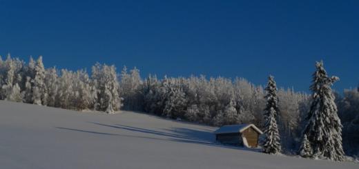
The Sea of Azov is one of those seas that fully freezes in winter. The Black Sea never freezes completely, but the Azov Sea freezes completely in frosty winters. The ice turns out to be berthing, it freezes to the shore and the entire water surface becomes covered with ice, if you wish, you can walk on such ice.
For a very, very long time there was an extensive ocean basin- Paratethys. An extremely large latitudinal elongated body of water consisted of the Alpine, Carpathian-Balkan, Crimean-Caucasian-Aral parts. Complex and hardly recognizable geological processes led to sharp fluctuations in sea level, advances on land and retreats - transgressions and regressions.
In the process of the development of Paratethys, its eastern Crimean-Caucasian-Aralian honor separated from the reservoirs lying much to the west. Sediments of this basin - the eastern branch of Paratethys - have been recorded over significant areas in the south of the CIS and, in particular, on the territory of the southern part of Ukraine. By the beginning of the last (Quaternary) period of the Earth's development (it began a million years ago and continues to this day), the sea retreated from the vast territories of modern land, the Black Sea bowl was formed, the relics of Paratethys broke up into a number of isolated reservoirs, a reservoir was formed in the place of the modern Azov Sea. predecessor.
The geological history of the Azov-Black Sea basin and the entire Ponto-Caspian Sea in the Quaternary has long been of interest to specialists. Many famous scientists - N.I. Andrusov, A.D. Arkhangelsky, P.V. Fedorov, G.I.Popov, G.I. Goretsky, G.I.Molyavko, L.A. Nevesskaya, V.N. Silkoplyas and others worked to recreate it. In the second half of the twentieth century, PV Fedorov paid particular attention to this issue. Basically, according to his data, we are describing the history of the Sea of Azov. The studies of the Kerch Strait, carried out by the Institute of Geological Sciences of the Academy of Sciences of the Ukrainian SSR, made it possible to supplement a number of existing ideas, for the strait was that kind of link connecting both the Azov and Black Sea, which allows you to visually record the development of both the first and the second.
By the beginning of the Quaternary period in the south of the CIS, in the Ponto-Caspian region, two large water basins survived - the Paleo-Caspian and the Paleo-Azov-Black Sea, at times connected by a strait located in the modern valley of the Manych River.
The opinions of scientists about the paleogeographic situation at the beginning of the Quaternary period are contradictory. Many experts believe that during this period - in the Chaudin age - the sea retreated from the territory of Azov. Others believe that the regression preceded the Chaudin age, and it was then that a small Chaudin transgressions took place, and on the site of the Sea of Azov there was a reservoir smaller than the modern Sea of Azov. At the beginning of the century, it was freshwater, then the salinity increased.
There are facts indicating the existence of the Manych Strait, which connected the Chaudin (Azov-Black Sea) and Baku (as it is customary to call the Caspian Sea of this time period) reservoirs. The level of the Baku reservoir was much higher than the level of the Chaudin Sea, as can be judged by the preserved coastal terraces. Therefore, a powerful stream flowed from the Caspian, and through the Manych Strait, getting into the Sea of Azov, it penetrated through the Kerch Strait into the Black Sea, and from here into the Mediterranean. Together with the Caspian water, the Baku (Caspian) fauna appeared in the Chaudin basin.
The Chaudin age lasted about 250 thousand years. In the post-Chaudin time (and this is almost 400 thousand years), the sea retreated into the limits of the modern Azov Sea, then a new large transgression of the Ponto-Caspian took place. This next offensive of the sea falls on the next - the ancient Euxinian age of the Quaternary period, which lasted about 100 thousand years.
The level of the Ancient Euxinian Sea did not remain invariably constant, changing several times due to frequent regressions and transgressions. At the end of the century, the water area of the ancient Euxin Sea in the Azov part exceeded the modern contours. The huge influx of both the Caspian (along the Manych Strait) and river waters led to the erosion of the coastal zone and the destruction of the previously deposited Chaudin deposits. The powerful flow of the Azov waters into the Black Sea caused the erosion of the Chaudin deposits along the shores of the Kerch Strait. Only a small remnant of them remained on the banks.
- Postage stamps catalog of stamps of the USSR postage stamps Collector's shop. -
The fauna of mollusks in the Azov part of the ancient Euxinian sea is interesting. There are brackish-water forms here, there are newcomers from the Caspian Sea, there are rare Mediterranean forms. However, the general desalination of the Azov and Black Seas apparently prevented the widespread penetration of Mediterranean mollusks characteristic of the seas of normal salinity.
What happened after the ancient Euxinian transgression is still not entirely clear to geologists. Many admit the Uzunlar Age and the Uzunlar Transgression as a subsequent stage. Others suggest that after a partial regression, the ancient Euxinian reservoir was replaced by the Karangatian one. In the Karangat Age, the Sea of Azov again moved to the shores and occupied an area slightly exceeding the modern one.
The hot climate, the Mediterranean fauna - everything indicated the low water flow of the rivers flowing here, the high salinity of the waters - up to 30 ppm (the salinity of sea water is determined in ppm - the number of grams of salt in 1000 grams of sea water, ed.) In the southern part, - and also about the lack of communication between the Caspian and Azov. The level of the Karangat Sea was higher than the present one. The Karangat Age lasted approximately 50 thousand years.
At its end, when the sea began to retreat, the discharge of Caspian waters resumed along the Manych Strait. Then it left the Azov territory, and a swampy plain arose in the place of the water area. Among the swamps flowed deep rivers, generously fed by melted glacial waters - Paleo-Don, Paleo-Kalmius, Paleo-Berda, Paleo-Korsak, Paleo-Molochnaya and others. The rivers carried out huge masses of solid runoff, most often sands. In place of the ancient channels, powerful sandy bodies remained, fixed in silty sediments and loess strata.
These so-called alluvial (river) deposits make it possible to trace the ancient river network at the bottom of the Sea of Azov. In the post-Karangat period, the Azov water area only dried up, but the level of the Black Sea also dropped - by about 70, and possibly more meters. The latter has lost contact with the Mediterranean Sea, and has ceased to be flowing. The Bosphorus and Dardanelles dried up, the Kerch Strait turned into a generalized mouth zone of the Paleo-Don and other Azov rivers. More and more ancient sediments - Chaudin, Ancient Euxin, Karangat - were once again subjected to powerful erosion, surviving only in the form of small outliers. In the Kerch Strait, impressive masses of quartz alluvial sands formed, a huge paleo-delta protruding into the Black Sea arose.
Approximately 25 thousand years have passed since the last stage in the development of the Azov-Black Sea basin began. As a result of the melting of glaciers, impressive masses of fresh water began to flow into the basins of the Azov and other seas. The sea level rose, and the New Euxinian transgression began. First, along the river valleys, and then everywhere, the sea launched an offensive on land. The Azov region has again turned into the seabed. The entire sea basin occupied a slightly smaller area than the modern sea. The connection of the Black Sea with the Mediterranean was restored, in the last the Black Sea waters were again discharged. From time to time, communication between the Caspian and Azov was established along the Manych Strait, especially in those periods when the level of the Azov Sea exceeded the current one. The Manych Strait disappeared several thousand years ago. At the same time, the Sea of Azov entered its modern shores, a modern climatic situation was established.
The question often arises about the origin of the western Gulf of the Sea of Azov - Sivash. For the first time, the Roman historian Strabo (1st century BC) mentions it: "There is an isthmus 40 stades wide (1st stage - 117 meters, ed.), Separating the so-called Rotten Lake from the sea and forming a peninsula called Some, however, argue that the width of the isthmus is 360 stadia.The rotten lake is said to be even four thousand stades wide and makes up the western part of Meotida, to which it is connected by a wide mouth. It is very swampy and hardly navigable for sewn boats because the winds easily open the shallows and then re-fill them with water, so that these marshes are impassable for larger ships. There are three islands in this bay, and along the coast there are shoals and a few pitfalls. "
According to the scientists-lithologists M.F. Stashchuk and V.A. Previously, these were the underwater bars and islands mentioned by Strabo. The thickness of the deposits of the Arabat Spit is small and confirms the conclusion about its recent genesis. I must say that the geological history of the Sea of Azov is still largely unknown, and studies of the water area will replenish knowledge in this area.
The Sea of Azov has developed for itself a rather complex bed, filled with a rather thick, especially in the southern part, a cover of Quaternary sediments. It, as it were, unites the geological structures of the basement of more ancient deposits of different character and age. In the north, the Quaternary sediments of the Sea of Azov overlap: crystalline rocks of the Azov crystalline massif; the northern zone of the Black Sea depression; the system of Black Sea troughs (North-Crimean, North-Azov, Yeisk); Middle Azov uplift (shaft); Indolo-Kuban trough. Modern sedimentation processes are largely inherited from previous geological eras.
The well-known researchers of the Sea of Azov Yu.P. Khrustalev and F.A. , 1%) and biogenic products - 19.85 million tons (37.9%). Terrigenous material is carried out by rivers, mainly the Don and Kuban, arises from the coastal zone and seabed, to a lesser extent - due to the eolian input. As a result, there is a very complex distribution of bottom sediments.
The local geological processes are much more accessible for study than in other seas. That is why the studies of the Sea of Azov are the development of a kind of model applicable to the study of deeper and less favorable seas.
Our ancestors who inhabited ancient Russia knew the Sea of Azov back in the first century. But they called it differently - affectionately the Blue Sea. It may well be that our great poet Alexander Sergeevich Pushkin, who was staying in Tmutarakan (former name) and wrote the Tale of the Fisherman and the Fish, which is still popular among children and adults, and meant the hut of an old man with an old woman with a broken trough on its shore.
He also called him "blue" !? And "Lukomorye has a green oak" from the poem "Ruslan and Lyudmila"? - this is also about the Blue Sea. The truth about the one that merged with the Black Sea through the Kerch Strait. And the place where our warm southern seas throw themselves into each other's arms was called Lukomorye! This is not far from the resort on the shores of the Temryuk Bay of the Azov Sea, which Muscovites especially love: there is a lot more sun here than in Sochi and Gelendzhik (it shines 280 days a year), plus magnificent sandy beaches plus a lot of attractions and entertainment. But it is also surprising that, after returning home, tourists often get confused in which seas they swam: from the Azov seas to a stone's throw, and there are strong temptations to swim in both! What vacationers do with great passion!
But after all, only Russians lived on the shores of the Sea of \ u200b \ u200bAzov. As then, and to this day, their shores were inhabited and inhabited by representatives of other large and small nations. Therefore, for example, the Greeks who now live in compact settlements with a pronounced Hellenic culture and Athenian architecture called this shallowest body of water in the world - Lake Meotian. Romans - Meotian swamp. Turks - Bahr - el Assak or Bahr-s Assak, which literally translates - dark, blue sea.

I must say that throughout its history, the Sea of Azov was renamed several times. It was called Samakush, Salakar, Mayutis. And as the chronicles, in particular, of Pimen, dating back to the seventeenth century, testify, the Sea of Azov became consonant with the city of Azov, founded on its coast. At least in the eighteenth century, such a name was firmly entrenched behind him. Hence the villages derived from it - Azovskaya, Priazovskaya, the city of Novoazovskiy or the village of Priazovskiy.
Taking into account the fact that the Sea of Azov through the Kerch Strait nevertheless connects with the Black Sea, it can rightfully be called a semi-enclosed sea. It splashes in the east of Europe. This is the most, once again, the shallow sea in the world. Its average depth ranges from 6 to a little more than seven meters, the maximum depth exceeds thirteen and a half meters.
Like the Black Sea, the Azov straits and seas are connected with the great Atlantic Ocean... In this sequence: through the Kerch Strait - with the Black Sea, through the Bosphorus Strait with the Sea of Marmara, then through the Dardanelles Strait with the Aegean and Mediterranean seas and already through the Strait of Gibraltar merges with the Atlantic Ocean. Quite muddy rivers flow into the Sea of Azov, plus not so much depth, silt deposits at the bottom. Therefore, unlike the Black Sea, the Azov Sea is not so transparent - from 0.5 to 8 meters of visibility, depending on weather conditions.
Dimensions and features of the Sea of Azov
Its surface area is 37,800 square kilometers. To these you can add another 107.9 square kilometers, which fall on the islands and spits. The coastline is over 1,470 kilometers. The longest is 380, the greatest width is 200 kilometers. The drainage area is 586,000 kilometers.
Salinity exceeds 14-15 percent. Unlike the Black Sea, the water contains less chlorine and calcium, but it is richer in carbonates and sulfates. The average annual water temperature is about 11 degrees, in the summer it warms up to 24-26, but sometimes, in some places, and up to 30 with a hook. In winter, it can cool down to one with a plus sign or to zero. At lower air temperatures, ice even forms, which through the Kerch Strait enters the Black Sea. Adding extra trouble to the sailors, especially in the Novorossiysk area, when in winter it breaks through the surrounding mountains North wind bora, holding the hulls of ships with an ice shell.
Marine life
The Azov Sea is a real paradise for fishing lovers. There is no more reservoir in the world richer in fish! It is found here six and a half times more than, for example, in the Caspian Sea. Forty times more than in the Black Sea. And 160 times more than the Mediterranean. More than a hundred species and subspecies of fish are found. There are so-called anadromous, entering the rivers for spawning - beluga, stellate sturgeon, herring, vimbets. There are semi-anadromous - which enter rivers for breeding and even winter in them - carp, bream, ram, pike perch, etc. In the desalinated sea area there are sterlet, bleak, pike, goldfish, ide. Well, who among the lovers of fishing is not aware of such inhabitants of the Sea of Azov as red mullet, striped mullet, horse mackerel, mackerel, pelengas from the mullet family or anchovy, which the same Muscovites take away to their native land in large containers, salted or salted in large containers and treat them to their relatives and friends. With boiled potatoes - the most relish!
There are also larger inhabitants in the sea. For example, the porpoise is the Azov dolphin. It is also called chushka, puffin. They live either in pairs or in flocks of up to ten or more individuals. Females are larger than males - 90, 150 centimeters. Weighing thirty or more kilograms. They live for 25-30 years. In the floodplains of estuaries adjacent to the sea, there is a lot of waterfowl; among the reeds you can see wild boar and fox and muskrat brought here from North America.
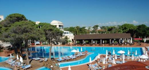
Vacation at sea
We have already said that the length of the coastline of the Sea of \ u200b \ u200bAzov reaches almost one and a half thousand kilometers. Of course, most of them are located on the magnificent sandy beaches. And the entire coast of the sea is an almost continuous recreation area with resort towns and villages, thousands of sanatoriums, boarding houses, recreation centers, children's health camps, tent cities, hotels, hotels, a huge private sector. For example, the same world-famous Taman in 2001 received the status of a federal resort due to the presence here a large number therapeutic mud both extracted from the bottom of salt lakes, estuaries, and extinct or active mud volcanoes.

Silt or mud applications will help you get rid of skin diseases, tidy up your musculoskeletal system, help with rheumatism and radiculitis - the range of their beneficial effects for health is very wide, and the procedures can be alternated with swimming in the sea, in which useful salts are also dissolved and which is just a stone's throw away: the same salt lake
Historically, every sea on Earth has its own unique qualities. The Red Sea is famous for its colorful and rich underwater world. The Dead Sea is the saltiest. The Mediterranean and the Aegean are recognizable for their crystal clear blue waters. The Baltic Sea is rich in amber, and the Black Sea is rich in hydrogen sulfide. Azov sea famous for its depth, or rather - its complete absence.
LAKE OR SWAMP?
It’s even surprising how large ships can walk on the “paddling pool”, which is no more than a million years old, because its maximum depth is about 13-14 m, and the average one is only 7-8 m! It is no coincidence that Azov in ancient times was called anything, but not the sea.
The ancient Greeks called it the Meotian swamp (after the name of the first people who inhabited these places - the Meots). Later, the Scythians and Sarmatians came to the seashore, and its name was accordingly changed to Scythian, and then Sarmatian lakes. The sea area is only 38 000 sq. km, and the maximum width is 230 km.
Only Lake Baikal can accommodate 74 Azov Seas! But Azov also has really unique features, which for some reason gazetteers are silent about.
SCYTHE WILLS WITH DZENDZIK
The Azov Sea is one of the few southern seas which, as a rule, is completely covered with ice in winter. Those wishing to admire the ice rink from horizon to horizon can do it in January - February. In this sense, little has changed since ancient times. “The ice cover there, at the mouth of Lake Meotius, is so strong that in some area in winter the commander of Mithridates won a victory over the barbarians in horse ranks, fighting on the ice,” the ancient geographer Strabo claimed.
But a real miracle of nature is considered to be alluvial sand-shell spits up to several kilometers in length. It turns out that the Sea of \ u200b \ u200bAzov is the world leader not only in the number, but also in the length of such streamers. The most famous are ten of them. On the northern coast: Fedotova, Obitochnaya, Berdyanskaya, Belosaraiskaya, Krivaya, Beglitskaya. On east coast- Yeisk and Dolgaya. On the south - Chushka and, of course, the Arabat Spit, which is one of the five largest spits in the world.

According to the most common version, it is believed that the "bricks" of the Azov spits are quartz sand that falls into the sea from the rivers flowing into it. In this case, the tip of the spit consists exclusively of small shells. The funny thing is that the shell ends of the braids resemble huge hooks.
Locals nicknamed them Zenjiks. It is amazing, but if the braids themselves are relatively constant in their location, then their extremities now and then move under the influence of a changeable wind, turning the zenziki now to the root of the braid, then in the opposite direction.
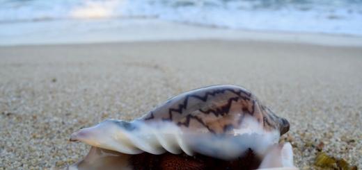
Finally, the third feature of the Sea of \ u200b \ u200bAzov is shell rock, which covers the beaches with a white blanket. Some scientists believe that the spit owes its appearance not only to wind and sand, but also to the enormous productivity of self-reproducing shells. Only in the coastal strip of Temryuk Bay, the annual growth of shells is from 400 to 800 tons per 1 sq. km!
SEA OF DEAD SHIPS
The Sea of Azov is also famous for the inexplicable loss of ships and crews. Moreover, strange phenomena most often occur between the Berdyansk and Dolgaya spits. It sounds like an absurdity - well, how can you disappear or drown in the shallowest sea in the world? It turns out that this is not at all difficult if the bottom of the reservoir resembles quicksand in its structure. At the bottom of the Sea of Azov, scuba divers are unlikely to find the remains of sunken ships.
After all, absolutely everything that gets there immediately disappears without a trace. The bottom of the Azov, as it were, eats up all the objects that touch it. The fact is that a pound of sea is a viscous silt, diluted with a small shell, more than 5 m thick.

Underwater currents are especially dangerous. The press has repeatedly published stories about how vacationers, having moved away from the coast for several tens of meters into the sea, suddenly realized that they could not move. And after all, the water in these places barely reached their waist. The most popular version of this phenomenon is the eddies that occur at the end sand spits at the meeting point of the two currents.
Local fishermen willingly share stories from personal experience when their boats were twisted and carried out into the open sea. It is not surprising that local authorities prohibit vacationers from swimming in zedziks, where most of the tragic events occur. However, the daredevils cannot be restrained by bans, because the end of the sand spit, which juts out into the open sea for kilometers, is so mesmerizing that it is almost impossible to resist visiting it.
The most dangerous are the "tails" of the Belosaraiskaya, Berdyanskaya and Dolgaya sandy spits. Only in the coastal strip of Temryuk Bay, the annual increase in shells is from 400 to 800 tons per 1 sq. km.
During perestroika, the press discussed for a long time the discovery of a vessel near the Dolgaya spit, the crew of which had disappeared. The bodies of the dead were then washed up on the opposite shore of the sea. According to the investigation, they all became victims of whirlpools and underwater currents when they tried to push the ship aground. It was after this incident that scientists noticed that the Dolgaya and Belosaraiskaya spits are practically opposite each other. Water, moving along the sea and reaching this narrow place, naturally intensifies its flow.

Little of! The surge wave in the Taganrog Bay area, where the famous spits are located, under the influence of the west and south-west winds amplifies so much that it rises up to two meters! Only after the winds subside, the water rushes back into the open sea in a powerful stream.
The author of these lines was amazed when, while resting in Yeisk (and this is just the Taganrog Bay), he witnessed a similar phenomenon with his own eyes. For about three days in a row, the sea stubbornly shallowed, and then over the next three days the water returned. And on the outskirts of the Dolgaya Spit, the author of these lines observed two colliding sea currents literally crashing against each other.
Local residents claim that the average speed of the Azov currents is quite high - IQ-20 cm / s, but during stormy winds it increases to 1 m / s. Moreover, the strongest currents are observed in the same resort Taganrog Bay.
STORM IN A TEACUP
The Sea of Azov is famous for its seiches. It is unlikely that this word can say something to a person far from hydrology. Nevertheless, every vacationer who finds himself on the shores of the Sea of Azov should know about this phenomenon. Translated from the language of science to human, seiches are standing waves that form in closed bodies of water. Most often, they are caused by gusts of wind, changes in atmospheric pressure or seismic shocks.
Suddenly arising, such a wave literally stands, reflecting from the walls of the reservoir. The lifetime of a standing wave usually ranges from a couple of minutes to several days, it rises in height from ten millimeters to two or three meters.

It turns out that a global geological fault runs along the bottom of the Sea of Azov at a depth of about one kilometer. It also creates seismic activity that generates standing waves. The creeping of bottom layers on top of each other causes the formation of underwater rivers, which are extremely dangerous for humans.
This is especially true for fans of windsurfing and those who do not mind swimming at the tip. Azov spits because when seiche fluctuations are amplified by storm surges or increased river runoff, a sharp rise or fall of water in the sea can occur, and sometimes even a small tsunami can form!
A similar danger lies in wait for vacationers on the Berdyansk, Fedotov, Dolgaya, Yeisk and Obitochnye spits. For example, on the Dolgaya spit, which is 14 km long in the sea, in 1983 there was a terrible flood. The fishermen's houses were torn off the ground with terrible force and carried into the sea. Later they were found on the other side, in the Ukrainian SSR. A similar story happened in 2006.
Despite the warning from the Ministry of Emergency Situations, tourists vacationing on the spit did not want to leave the places occupied with such difficulty. As a result, an unexpected storm tore about 200 tents. Someone tried to leave in private cars, but in vain. The element tore even the braid itself into several parts. The most offensive thing is that it is almost impossible to predict the appearance of seiches in advance, and they appear even with the slightest wind.
HEALING MUD
The Azov braids have their own positive sides Is a healing mud. On the beach, you can often see a seemingly adult man who furiously digs coastal sand. To play in sand castles is not his age, and the child is not in the neighborhood. What for? The answer becomes obvious after a few minutes, when instead of sand mixed with shells, lumps of black mud appear on the surface.
Old-timers claim that the mud of the Azov Sea, alternating in layers with coastal sand, is very healing. For centuries, the powers that be of the Russian Empire and neighboring states came to lie in the mud of the Sea of Azov.
Local sulphide-silt mud is rich in vitamins, enzymes, hormones, and is also an excellent natural stimulant. Under the influence of mud, many inflammatory processes go away, and the skin rejuvenates.
Dmitry TUMANOV
Similar materials
- Secrets of the Sea of Azov.
- New earth
Subscribe to us
In Russia, the Sea of Azov became known in the 1st century AD, and it was called the Blue Sea. After the formation of the Tmutarakan principality, the modern Azov Sea began to be called Russian. With the fall of the principality, the sea was renamed many times (Samakush, Salakar, Mayutis, etc.). At the beginning of the XIII century. the name of the Saksin Sea was approved. The Tatar-Mongol conquerors replenished the collection of the names of Azov: Balyk-dengiz (sea of fish) and Chabak-dengiz (chabach, bream sea). According to some sources, Chabak-dengiz as a result of transformation: Chabak - Dzybakh - Zabak - Azak - Azov - happened modern name sea (which is doubtful). According to other sources, azak is a Turkic adjective meaning “low, low-lying”, according to other sources, “azak” (Turkic “mouth of the river”), which was transformed into Azau, and then into the Russian Azov. In the interval of the above names, the Sea of Azov also received the following: Barel-Azov ("Dark Blue River"); The Thracian Sea (the Thracians meant the Genoese and Venetians); The Surozh Sea (Surozh was the name of the modern city of Sudak in the Crimea); Kaffa Sea (Kaffa is an Italian colony on the site of the modern city of Feodosia in the Crimea); Cimmerian Sea (from the Cimmerians); Akdengiz (Turkish meaning White Sea).

The most reliable should be considered that the modern name of the sea comes from the name of the city of Azov. There are a number of hypotheses on the etymology of the word "Azov": by the name of the Polovtsian prince Azum (Azuf), who was killed during the capture of the city in 1067; by the name of the tribe of the Wasps (Assy), which, in turn, allegedly descended from the Avestan, meaning "fast"; the name is compared with the Türkic word azan - "lower", and the Circassian uzev - "neck". The Turkic name of the city of Azov is Auzak. But even in the 1st century. AD Pliny, listing the Scythian tribes in his writings, mentions the Asoki tribe, similar to the word Az. It is believed that the modern name of the Sea of Azov came into Russian toponymy at the beginning of the 17th century. thanks to the annals of Pimen. Moreover, in the beginning it was fixed only for its part (Taganrog Bay), and only during the Azov campaigns of Peter I the name of the Sea of Azov was fixed for the entire reservoir. The sea gave the name to the villages of Azov and Priazovskaya and the city of Azov (in the lower reaches of the Don River, Rostov region), the village of Priazovsky and the farm of Azovka.
History of the study of the Sea of Azov
There are three stages in the history of the study of the Sea of Azov:
1. Ancient (geographical) - from the time of Herodotus to the beginning of the XIX century.
2. Geological and geographical - XIX century. - 40s of the XX century.
3. Complex - mid XX century. - today.
The first map of Pontus Euxinus and Meotida was compiled by Claudius Ptolemy, he also identified geographical coordinates for cities, river mouths, capes and bays of the Azov Sea coast.
In 1068 the Russian prince Gleb measured the distance between Kerch and Taman along the ice. As evidenced by the inscription on the Tmutarakan stone, the distance from Tmutarakan to Korchev ( ancient name Tamini and Kerch) was approximately 20 kilometers (for 939 years, this distance increased by 3 kilometers.).
From the XII-XIV centuries. the Genoese and Venetians began to draw up portolans (directions and nautical charts of the Black and Azov Seas).
Back to the main page about.