Geography of Africa
Click to enlarge
In the south of Africa is washed by the Mediterranean Sea, in the northeast Sinai peninsula Washed by the waters of the Suez Canal and the Red Sea, in the East and Southeast, the continent is washed by the Indian Ocean, and in the West - the Atlantic Ocean.
Geographic objects of Africa
Atlas
The system of attras mountains extends from the southwestern part of Morocco along Mediterranean Sea To the eastern border of Tunisia. It includes several smaller mountain chains, namely: high satin, middle atlas, and seaside atlas. The highest point is the Mountain Tubkal, located in the western part of Morocco, with a height of 4 167 meters.
Pool of the River Congo
The Congo River pool, located in the central part of Africa, is located on most of the territory of the Democratic Republic of the Congo, as well as the neighboring Republic of the Congo. In addition, it applies to the territory of Angola, Cameroon, Central African Republic, and Zambia. The area of \u200b\u200bthis fertile basin is approximately 3,600,000 sq. Km, about 20% of all the tropical forests of the world grows on its territory. The Congo River is the second largest river in Africa, and the network of its tributaries and streams performs transport function for the population of Africa.
Great rift valley
A sharp deepening of the earth's surface, about 6,400 km long, extending from the Red Sea, not far from the border with Jordan in the Middle East, south to Mozambique. Essentially, this valley is the result of a series of geological faults caused by large volcanic eruptions a lot of centuries ago. The result of the same faults became numerous sheer cliffs, mountain ridges, rocky valleys, and very deep lakeslocated throughout the significance length of this valley. In the immediate vicinity of the valley there are many of the highest mountains of Africa, including Kilimanjaro, Kenya, and Stanley.
Highlands Ahaggar
Ahaggar - a high-mountainous region in the central part of the Sahara, on the territory of the southern part of Algeria - 1,500 km. South of the capital of the country, and west of Tamanarian. The region is, for the most part, the rocky desert, with medium height Over 900 m. Over the sea level. The highest point is Mount Tahat (3 003 m.).
Desert Kalahari
The desert area is about 259,000 sq. Km, it covers most of the Botswana, the southwest part South Africa, and the whole western part of Namibia. At this desert plateau, the set of mouth of dry rivers, and thick shrubs grow in abundance. In this area there are several small mountain ranges, including Caras and Hans. IN national Park Kalahari Gersbok, located in South Africa, on the border with Namibia, live large flocks of wild animals.
Desert Namib
Namib is a coastal desert in the southern part of the African continent, extending in length over 2,000 km along the coast of the Atlantic Ocean. The desert begins on the territory of Angola, passes through the entire Namibia, and ends at the River Oliphants in the Western Cape Province in South Africa. East of the Atlantic Coast, the desert is gradually gaining height, up to 200 km. At the foot of the mountains a big ledge.
Annual precipitation range from 2 mm. In the most arid areas of the desert up to 200 mm. On the hills, because of what Namib can be considered the only real desert in the southern part of Africa. Namib is also the oldest desert in the world, geologically, it consists of dune (sandy) seas in coastal areas, gravel plains and rocks are dominated in the internal areas.
Sand dunes of deserts, some of which reach 300 meters in height and 32 km. In length, are the second largest in the world, yielding only dunes of Badyn Jaran in China.
Sahara Desert
Covering almost one third of the entire African continent, sugar is the largest desert in the world, with an approximate total area of \u200b\u200b9,065,000 sq. Km. Topographically, the desert includes the stones of the plain areas, movable sand dunes, and numerous dune (sandy) seas.
The height of the desert varies from 30 m. Below sea level up to 3,350 m. Above sea level ( mountain peaks in Ahaggare and Tibsty). At the regional level, the Libyan Desert, Nubian Desert, and the Western Desert in Egypt, to the west of Nile, are distinguished from Sahara.
The precipitation in the Sahara is practically absent, but several underwater rivers take place on its territory, originating in the atlas of the mountains that help irrigate insulated oasis. In the east of the water, the Nile helps fertilize small areas of the desert.
Sachel
Sahel is a wide strip of land extending over the entire width of the northern part of Central Africa, in the southern edge of the constantly expanding sugar desert. This border region is a transition zone between the dry regions of the North and the tropical areas of the south. Very few rain rainfall (15 - 20 cm per year) falls on this territory (15-20 cm. Per year), and vegetation here is presented mainly by scarce herbal cover and shrubs.
Nile River System
People who lived not far from the ancient Carthage, the inhabitants of the city called the word "Afri". With the Phoenician word AFAR means "dust", it is to this language and refer to this name. When the Romans won Carthage, they called this province of Africa. Later, they began to call the regions that were known on this continent. And then the entire continent at all.
Another version says that the word has the roots of the Berber word IFRI, i.e. cave. There were cave inhabitants, the people "Afri". Also the Muslim province called "Iphrikia", which later arose in this place, also had the same root in the title.
I. Efremov, famous writer And the scientist, believed that the word "Africa" \u200b\u200bhas a root in the ancient language, who ("Afros" is a foamy country, Egypt). This is due to the fact that during the approach to the mainland in the Mediterranean, several flows are faced.
Etymology names of physico-geographical objects of Africa
Adenian Bay. Bay Indian Ocean. The name was received by Aden in the south of Arabian P-Ova. According to one version, the toponym is based on the Arab root in the meaning of "settlement", in another interpretation, the name was formed by the term from the ancient seven-khamitic languages \u200b\u200bedinu - plain, the steppe, which clearly reflects the natural features.
Azores. Archipelago in the Atlantic Ocean. Belongs to Portugal. Named by Portuguese Ilhas Dos Azores - "Islands of Hawks" for the abundance of these birds off the coast and on the archipelago.
Amyranta Islands. Archipelago in the Indian Ocean. Opened as an expedition Admiral Vasco to Gama and are named after LLHAS De Almitante - "Admiral Island".


Augrabis.Waterfall on r. Orange. The name comes from Gottentoti Aukrebis - "big noise".

Ahaggar.Mountain array in central sugar. The name comes from the name of the Tairegs of Kel-Ahaggar. At the heart of Etnonym, apparently lies the Arabic term "Ahgar" - cave, i.e. "Ahaggar" - "residents of the caves", "Spirits Caves."
Bab El Mandant Strait. Separates Africa and South-West Arabian P-Ova. The name comes from the Arab words "Bab" - Gate, Mandib - Tears, i.e. Means "Gate tears." Toponym metaphor reflects complex navigation conditions in the strait.
White NileThe name of the middle course of the Nile before the flow of blue. Arabic name River Bahr-El-Abead - "White River". According to experts, the definition of "white" refers to either a mutal color of water, or corresponds to an unknown color orientation.
Bengelege current. Cold flow in the Atlantic Ocean. The name is given in Benghel in Angola: in one of the languages \u200b\u200bof Benguela - "Country Country".
BENUE.Left tributary p. Niger. The name comes from the language of Batta, where BE - "Water", Nue- "Mother", i.e. means"Mother Waters",
Bio.Island in the Gulf of Guinea. Portuguese, opening biko, called it Formosa - "Beautiful" for the abundance of lush vegetation and the presence of fresh water. Later, the island was called Fernando-by in honor of the Portuguese Chief Powder, and in the 70s of the XX century, - Masias Ngema-Byoyan in honor of the President of Equatorial Guinea. Bioo is a modified name, so it is difficult to call a true meaning.
Waal. River, right inflow r. Orange, the name was given by Dutch colonists for the water color: Vaal - "muddy", "gray". Toponym is included in the name of one of the provinces of South Africa - Transvaal (Transvaal) - "Behind Waale".
Wadi, Weddy. The general name of the team of temporary watercourses of North Africa filled with water only during the rain period. Arabic geographical term "Wadi", "UEDD" - dry bed, valley.
Veld.The name of the arid plateau in southern Africa. In Dutch and Afrikaans (Afrikaner language), Veld is a popular geographical term in the "field" value.
Victoria.Lake in East Africa, the largest on the mainland. Unlike Victoria's waterfall, named by D. Livhingston in honor of Queen of Great Britain, the name of Lake Victoria was given by the traveler D.Pikik. Therefore, at present, other names located on the shores of the lake, other names are offered: Moorja - "Unity", Wuora - "Freedom", Shirikisho - "Association", Uhuru Na Umoja - State Motto of Tanzania, drawn on the coat of arms of the state.
Victoria.Waterfall on r. Zambezi. Opened by an outstanding English traveler David Livingston and is named after the Queen of Great Britain. Local residents They call the MOSI-OA-Tuna waterfall - "Rading smoke", or Seongo - "Rainbow Scene".
Virung.Volcanic mountains in East Africa. The name in the language of the people of Nyoro means "volcano".
Volta.River in West Africa. The name Rio-Da-Volta - the "Return River" was given by Portuguese, because In the XV century At the mouth of the river, their ships stopped before returning to their homeland. In Ghana on r. Volta created the reservoir of the same name - one of the largest in the world (8480 km 2 ).
Guardfuju.Cape in the east of P-oval. Scientists believe that the name is educated from the GUARDAFU portuguese distorted by Arabs - "Beware", which is associated with hazardous navigation conditions. There is a long time that there is a magnetic mountain of the very eastern tip of Somalia Peninsula, which attracts the iron parts of the ships approaching it. As a result, the ships, approaching it, was broken about the rocks. The most narrow shelf zone is here. With a strong wind, a high wave, a bad visibility, the ships often endured the peninsula, and they were broken about coastal reefs. The word "Guardafui" was a warning of sailors who floated past this cape.
Guinean bay.Atlantic Ocean Bay at the Western Coast of Africa. Named in the historical and geographical area of \u200b\u200bGuinea washed by him. There are several versions of the origin of the toponym Guinea. According to one of them, the name is the name of the Berber tribe Kinava (Arabic scientist Ibn-Yakut in the XIII century. Mentioned the edge of Kinava). Another point of view is based on the fact that Toponym is formed by the Berber words "Agvinau" - "black" or "iguven" - "dumb" (that is, not knowing the language of Berberov) and referred to the territory populated by black tribes. Later, the Europeans distorted the original word in Gunua, Ginua and, finally, in Guinea.
Strait of Gibraltar.Separates Africa from the Pyrenean Peninsula in Europe. Named on the rock of Gibraltar on the European Side of the Strait. The modern form of the name of the cliff arose as a result of centuries-old use and transformation of the primary Arabic Jebel-El Tarik - "Mount Tarika".
Blue Neal.The largest influx of the Nile. In Ethiopia, the river is called Abbai - "Father Waters, and in Arab countries Bahr-El Azrac -" blue river". ColorsOe name, according to some scientists, reflects the color of water in the river carrying bluish il.
Good Hope. Cape in southern Africa. Opened in 1488 by the Portuguese navigator B.Diash and named it Cabo Tormentoso - "Cape of Storms". The name did not like the king of Portugal Zhuan II and at his order, Cape was renamed Cabo Da to Esperanza - "Cape of Good Hope", having in mind the hope of achieving a fabulously rich and attractive for Europeans in India. Some historians believe that at B.Diash immediately called the Cape with the name of good hope, and the above version is only a historical legend. However, it is impossible to prove or refute this hypothesis due to the lack of sources, modern swimming DRash.
Dragons Mountains. Located in South Africa. It is assumed that the mountains are named by the name of one of the European colonizers of Harrow Drainstein. Etymologically, the surname consists of two words: Draken - "Dragon", Stein - "Stone".
Zambezi.River in South Africa. Previously, the name of the river on the maps was transmitted in a variety of options; Ambezi, Luambezi, Liambey, etc. According to modern toponyms, the primary form of names is Ambezi (or Ambey), which in local languages \u200b\u200ba bow means "Big River". The same value is the name of the river in the middle course in the language of Tonga - Murongo-Mucuri, which is the cataca of the main toponym.
Zanzibar.Island in the Indian Ocean at the eastern shore of Africa. Toponym comes from the Persian, the term "bar" - "shore", "edge" and the ethnonym "Zinj", which is based on the Arab or Persian "Zang", "Zeng" - "black". Zindji is the collective name of the Neosal African Negroid tribes in medieval Muslim literature.
Green Cape. Located on the Peninsula to the same name to the east of the m. Almadi. Named in 1445 by the Portuguese, D. Didash Cabo Verde - "Green Cape", because He was the first seaman seamans covered with tropical flora, which sharply contrasted with the sands of the Sahara.
Green Cape Islands.Archipelago in the Atlantic Ocean. Named by m. Green, against which is located. The transfer of the names of the islands into other languages \u200b\u200bis adopted in the form of translation, in contrast to the name of the state located on them.
Needle.Cape, the most southern tip of Africa. Opened in 1488 by B.Diash and named Cabo Sao Brandao - Cape Sv.Brange, because The opening occurred on the day of this saint. However, soon the name was changed, and Cape was on maps called Agulhas - needle. The word Agulha in Portuguese means "needle", "boom". Modern toponymists are based on the name of the Portuguese metaphorical term Agulha in the value of "peak", the vertex. Based on this, toponym is comprehended as "Cape of Peaks", but the cause-rocky cape.
Idi-amin-dada; Edward.Lake in East Africa. Opened in the XIX century. And Edward is named after the Crown Prince of Great Britain. In 1971, President Idi Amin Dada came to power in Uganda, and the lake called him name. To this day, both names have been preserved behind the reservoir.


Canary Islands.Archipelago in the Atlantic Ocean. Belongs to Spain. Islands are known to the ancient time under the Latin name insulas Fortunatae. Spaniards who visited the archipelago at the beginning of the XV century, called the Islas Canarias - "Dog Islands". According to one version, the sailors saw on the shores of the islands a large number of Dogs, which was the reason for the appearance of toponym. According to another version, the archipelago was called the main island of Gran Canaria. And the island - in the fabulous country, Canary, referred to in medieval European legends.


Kenya.Volcanic array in East Africa. Toponymists see the toponym of the Masai term "Kei-Niya" - "White Mountain", which is associated with the presence of glaciers and snow on the top of the mountain.


Livingston Waterfalls. Located in the lower river. Congo (Zaire). Named in honor of the outstanding researcher of Africa, Scots by origin, D. Livingston.

Limpopo.River in South Africa. The etymology of the name is unknown. Dutch colonists Buras called the Krokodil River River - "Crocodile River" for the abundance of these reptiles in her waters.


Madeira.Archipelago in the Atlantic Ocean. Belongs to Portugal. Named by Portuguese Maderia - Forest, because It was indeed covered with forests, later completely cut down. The earliest names of the archipelago: Carthaginian Al-Agnam - Khod Island (for the abundance of these animals), at the Romans Insulae Purpurinae - "Purpur Islands" (for paint mined there).


Niger. River in West Africa. The name is a distorted portuguese and other Europeans by the Berbery name of the River N "Egypt -" River ". In different parts of the flow, there are various names in local languages: in the upper reaches of Joliba -" Greater Water "; on average and Nizhny Quara -" River ", Issa Bari - "Great River"; Mayo - "River". An explanation of the name from the word Niger in the meaning of the "black" from European languages. Modern toponymists consider incorrect.

Nile.The longest river Africa. The oldest form of the name of the Aur River is "hiding" (i.e., with an unknown source). Egyptians called her Hapi in honor of God fertility and crop. Modern Arabs call the El Bahr River - "River". Toponym Nile in the form of naulos is first found in the ancient Greeks. Romans borrowed it as nilus. On one of the versions, the toponym is based on the ancient term "Nazal" - "River", changed by the Greeks. According to another version, the Greeks borrowed the word LIL in the Libyan tribes - "water", distorting it in Nil. Philologists note the possibility of such a transformation.

Nubian desert. Located in the northeast of Africa. Named by historical area Nubia, located between the Nile Rights. The toponym is based on the ancient Egyptian word "Nuba" - "Gold". In antiquity there were the largest mines here, from where the gold was received to the Palace of Pharaoh.


Orange.River in South Africa. Gottentotes called her Kai Garib - a large river, the Dutch migrants of the Groat River Bura with the same meaning. At all times, people often gave names to objects (rivers, lakes) in the color of water or shore. But the name of the orange river to the color does not have any relationship. Such a name she was given by immigrants from the Netherlands (Holland) Bura in honor of the princes of the Orange - the then rulers of the Netherlands. From someone's easy hand, and perhaps the name of the transformation, the name Orange turned into an orange.


Sao Tome.Island in the Gulf of Guinea. Opened by Portuguese on St. Tome's Day (Thomas) and named Sao Tome in his honor.


Somalia.Peninsula in East Africa. Named by the people of Somalia living on his big part. Etnonym comes from Kushitsky languages \u200b\u200band means "dark", which is associated with the color of the skin of the people. Ptolemya (II century) the peninsula is called southern horn (sometimes African horn is sometimes found). In the peninsula, the cold current in the Indian Ocean is called Somali.


Tristan da Qu'nya. Archipelago in the Atlantic Ocean. Opened by the Portuguese navigator Tristan yes Kunya and called him name.


Mainland Africa is the second largest on the planet after Eurasia. It takes more than twenty percent of all sushi and almost completely located in a hemisphere in the south.
Mainland is washed by several oceans: Atlantic and Indian. The territory is divided between fifth five countries.
African countries and their capital
Africa countries are commonly divided into five groups. The list is as follows:

From the point of view of economic indicators, the most developed and rich is located in the south of the mainland of South Africa. At the same time, the inhabitants of many states, in particular the central part of the mainland, are below the poverty line, in particular the CAR, DRC, Burundi are the poorest countries in Africa.

The largest in the territory of the state is Algeria, and Little Mayotte. The most numerous is Nigeria, and the lowest population in the islands - Seychelles.
His sovereignty African states found in the middle of the twentieth century. Most modern names appeared at the same time.
For example, until 1985, Côte d'Ivoire was called the ivory shore, and Djibouti had official status and name in the form of the French territory of Afarov and Issa. Such changes touched almost half of the territorial units of the mainland.
Characteristic Africa
The area is twenty nine millions of square meters. km. Prevalence from the north down - eight thousand kilometers, and from the West to the left - seven and a half.

Physical map of Africa (press to enlarge)
There are several options for the origin of the name. The most common of them:
- Afri - people who lived next to Carthage later, the Romans became so called the whole area, and then the continent of Africa.
- From Latin Aprica - Sunny.
- From Greek AFRKN - without cold.

Note: Africa is considered to consider the pranodina of a person reasonable, it was there that the remains of the oldest ancestors were found, in particular the hominid and the Sachelanpov.
The continent has long been attracted by Europeans, as the opening history has shown, an active study began with the fifteenth century, when Vasco da Gama across the way to India ran into Africa.
From the end of the nineteenth to the middle of the twentieth centuries, the mainland was divided among the great powers:
- north - part of the Ottoman Empire;
- south - Spain, Portugal and other colonialists.
After World War II, the map has changed, as a wave of independence began. Today there are several territories on African mainland under the control of Europeans, in particular the Canary Islands, Madeira, Chagos Archipelago.
Extreme points of Africa
About what point is the most northern, the most southern, what the easternmost, and where is the most western one - it tells well the following image:

Population
More than one billion people live on the mainland today. Along with this, there is the greatest increase in the number and life expectancy. Demographic estimates predict the increase in population by half over the next thirty years.

In Africa there are two main races:
- nero-shaped - in the center;
- coresoid - mainly in the north and in the South African Republic.

The most common nationality are Arabs. Population density is low compared to Europe and Asia. To date, inter-ethnic conflicts continue.

It is worth noting: The level of urbanization in countries is low, but its pace is the highest in the world.
As for religion, the world's leading, but presented all other religious flows is mainly distributed. Traditional beliefs are still distributed in the central part.
Climatic belts
Africa is considered the warmest mainland, here is the warmer place - Dallol. The whole territory is distributed in warm climatic belts.

The main of them and their characteristics:
- Equatorial - strong rains and actually no change of season, here is a permanent summer.
- Subscance - two main season, rainy summer, winter is characterized by dry trade winds.
- Tropical - there is almost no precipitation, the deserts are common.
Minerals
Africa is rich in minerals that have a high price.

In particular, the main one includes:
- gold;
- oil.
The north coast is also rich in manganese, iron ores and phosphorites.
Flora and fauna
The organic world of Africa is characterized by exceptional diversity.

In tropical areas there are a variety of large animals, in particular, rhinos, elephants, lions, zebras, monkeys and others.

Large birds live on the continent, as Flamingo, Ibis.

In the north, the lizards and snakes are mostly inhabited, which adapted to the climate of the Sahara. The south of the mainland is a "big five": buffalo, lion, leopard, elephant and rhino.

The climatic conditions of North Africa contributed to the adaptation of many plant species. In the south, there are more than two and a half thousand flowering - it is almost ten percent of world wealth.
Geographical objects

Atlas Mountains
The main objects of the geography of Africa include:
- Atlas Mountains;
- Congo pools (lower point) and Nile;
- Rift Valley;
- Ethiopian and Ahaggar Nagorna;
- desert - Calahari, Namib and sugar.

In addition to the oceans, the mainland is washed by one sea - the Red and Suez Canal.
Rivers and seas
One of the most extended rivers in the world is located in Africa.

The length of Nile is almost seven thousand kilometers.
For other major rivers include:
- Niger;
- Congo;
- Zambezi, Limpopo and Orange.

Africa is rich in large lakes: Victoria, Nyasa, Tanganyika and Chad. The latter is the largest salt reservoir, which is inside the mainland.
Plains
Plains in Africa are represented by plateales (East African) and pita (Chad, Congo, Calahari).

The plateaus is high plains, along with them, low.
Mountains Africa
Mostly Africa is a mainland on the plains, it has enough mountains:
- Athamkogo - in the north;
- Ahagar and Tibest - on the territory of the Sahara desert;
- Effiopic Highlands - in the East;
- Caps and dragons - in the south.

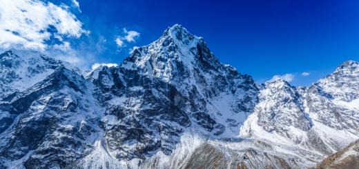
The highest point is Kilimanjaro Volcano, his height is five thousand nine hundred meters.
In conclusion, I would like to focus on the concepts of "Mainland" and "Continent". On the ground there are only six continents, they are all well known. But the continents are only four.
"Continent" translated from Latin means "continuous". Since Eurasia and Africa are connected together by the Suez Canal, they are not separated from each other, because they are not separately continents.
Africa is a unique mainland that combines the variety of plant and animal world. Most of the states are at the stage of economically developing countries, it is partly due to the prolonged colonization of the region.
Africa - the second largest mainland, is located in all four hemispheres. Africa Square - 30 million km2.
Extreme points of Africa:
- north: Cape Ras Engel (38 ° S.Sh., 10 ° V.D.);
- south: Cape needle (35 ° Yu.Sh., 20 ° V.D.);
- western: Cape Almadi 1 (5 ° S.Sh., 17 ° C);
- east: Cape Rasha Hafun (11 ° S.Sh., 51 ° V.D.).
From the West Africa is washed by the waters of the Atlantic Ocean, from the East - Indian, from the north - waters, from the northeast - red. Previously, it was connected with a 120 km wide width, now a Suez canal passes through it. From the mainland is separated by the Gibraltar Strait.
The coast of Africa is relatively weakly cut, there is a large Guinean bay in the West and Adensky - in the East, a large peninsula - ps. B is: Madeira, Green Cape, etc. In the east of the mainland there large Island - except for him in the accumulations of small islands - Comoros, etc.
The specificity of the relief of Africa lies in a large number of plains and a flatbed. Most of the north of the mainland occupies with Highlands Ahaggar and Tibst. Noticeable mountain ranges Two: Atlas Mountains in the north and caps - in the south. In the east of Africa there is a large East African plateau. Such a structure of the relief is explained by the fact that most of the mainland is located on a single ancient African-Arabian platform, separated in antiquity from the general continent - Gondwana. The Northern and Southern Mountain Ridges are formed in the collision area of \u200b\u200bthis platform with other large plates.
Lakes in Africa are quite large, formed in breed faults and therefore very narrow, long and deep: (maximum depth - 1400 m), (700 m). The lake, on the contrary, petty, feeds mainly due to precipitation, in the arid periods of its area is greatly reduced.
Since most of the mainland is in tropical, subequatorial and belts, it is warm here. Summer and winter the average monthly temperatures They differ insignificantly, the seasons differ in the number of drop-down precipitation: for the summer it falls the rainy season, while drought comes in winter. There are tropical forests - swimming pool, east coast of Africa, where up to 3000 mm falls. precipitation. There are arid areas - savanna, desert.
Natural areas of Africa are expressed quite clearly and are arranged accordingly. At the equator and in the Congo, a zone of wet equatorial forests was formed. Here there is a huge variety of trees and shrubs, a tirelessness is well expressed. Form red. In the forests live monkeys, small ungulates, many birds.
Equatorial forests are almost immediately moving to Savannah - a special kind of encountered single trees. This natural zone in Africa occupies an extensive space. There are many herbs, from trees there are acacias, Baobabs. The soil is formed red-brown. Many large empty animals (giraffes, buffaloes, antelopes, zebras, rhinos), there are predators (lions, cheetahs, hyena).
No less large natural zone - tropical deserts, represented by two large deserts: Namib in the south and sugar in the north. Sugar desert is a huge desert located in the northern part of the mainland. Dry Passats, prevailing here, raise sand particles, so for the desert there are no rarity storms, literally paralyzing all living things. Even in the shade rises to + 50 ° C, the sand heats up to + 70 ° C. At night, the temperature drops sharply, it can descend to 0 ° C. In this regard, survival is very difficult, people live exclusively in oases arising due to the proximity of groundwater. Most animals lead a nightlife, afternoon afternoon in Norah.
The zone of subtropical tested evergreen forests stretched out two narrow stripes on the northern and southern coast Mainland. Here are growing beech, oaks, citrus fruits, many coniferous plants and shrubs. Animals are mostly small: foxes, small deer, boys.
In the XIX-XX centuries, Europeans actively destroyed the unique nature of Africa, cutting valuable forests, exterminating animals. Many species died themselves due to the destruction of their natural habitat. This led to the fact that the territories occupied by forests are sharply reduced, but the desert areas, on the contrary, are increasing. To preserve and increasing the populations of wild animals, many of them have acquired world fame - Kruger, Serengeti.
Detailed decision Paragraph § 27 in geography for grade 7 students, authors Corinskaya V.A., Sushina I.V., Schenshev V.A. 2017.
Questions and tasks
1. Name the most significant geographical objects South Africa.
Zambezi, Calahari semi-desert, dragons and caps of mountains.
2. In a comprehensive map, highlight the main types of business activities in South Africa.
Agriculture and mining mining.
3. Name the main features of Nature and the economy of South Africa.
South Africa is a country of various natural complexes and huge natural wealth. Most of the country is a flat plateau, which gradually steps rises to the south and east, by changing the mountains. Savannas prevail in the country. Natural conditions, as in all South Africa, change not only from north to south, but also from east to west.
South Africa with a large variety of landscapes has a very rich fauna. In many areas, hunting and fisheries are still - the main occupation of the local population. But with the arrival of Europeans, the number of wild animals declined markedly and many species almost disappeared. Especially reduced the number of herbivores - antelope, zebras, giraffes, elephants, large black buffaloes, rhinos. Lions, leopards, almost completely disappeared.
In order to preserve wild animals from full extermination, as well as in general natural complexes in South Africa created reserves and national parks. In the largest of them - the Kruger National Park - all kinds of animals found on the mainland are collected.
The territories with fertile lands in the country belong to white farmers - owners of private agricultural enterprises. Farm farms are widely used by equipment and fertilizers and therefore get high yields. They grow corn, wheat, legumes, sugar cane, citrus, cotton and other cultures. On the elevated plateau with good pastures, farms on the breeding of sheep and cattle are placed. Pasture animal husbandry occupies the most important place in agriculture.
South Africa is rich in various minerals. Geological miracle call this country. South Africa takes one of the first places in the world by reserves and mining diamonds, gold, platinum, uranium and iron ore. The economy of the country is depending on the English and American monopolists who lead the development of minerals and receive huge profits.
There are many factories and factories in the country, industry develops rapidly.
4. Compare nature, the population and its economic activities of North and South Africa. What is the similarity and difference? Explain the reasons for differences.
North Africa is part of the Middle East and even sometimes turns into it. Sowing. Africa is the undoubted and inseparable part of the Muslim Arab world, mainly deserted territories and inhabited, it is mostly Arabs, Berbers, and other seven-khamitic tribes along with the traditional African population of Africa. South Africa is classical Africa except that it is more developed, along with the same North Africa, compared to other parts of Africa due to the greater presence of the white population there due to its rich lands.
Consignment of knowledge on the topic
1. Name the main features of the surface of the Africa. What are they explained?
By the type of relief, Africa can be divided into two parts: Low is located in the north and west, high in the east and south. In the relief, the mainland is dominated by plains and plane oils high from 200 to 1000 m, the greatest territory is occupied by East African and South African Plateau. The sublime areas of the mainland alternate with the hollows, the largest of whom Wpadina Congo and the Kalahari Calahari. The highest parts of the mainland are Ethiopian Highlands (up to 4500 m) and the dragons of the mountain (more than 3000 m). You can explain such features of Africa's relief by the fact that most of the mainland has been formed on an ancient Arabian-African platform, within the Relief Platforms are represented by the plains. Atlas, Kapsky and Dragons Mountain are confined to folded belts of different ages. In the east of Africa there is a large rift of the earth's crust - continental rift. In the rift band, the flow of heat flows and the rise of the substance from the mantle, the formed blades are occupied by the lakes, along which the cones of volcanoes rise. It is here that the highest peak of Africa is located - Kilimanjaro volcano (5895 m).
All the well-known statement "Africa is the hottest mainland," it can be explained by the fact that the mainland is located in the most warm climatic belts of the Earth (Equatorial, subequatorial, tropical and subtropical). Africa is located on both sides of the equator, within the latitudes, which receive a significant amount of solar radiation from 160 kcal / cm² to 200 kcal / cm². The temperature on the mainland throughout the year above + 20 ° C. The greatest amount of precipitation falls on the equator, since the belt of low atmospheric pressure is formed here, in which the ascending air currents form clouds saturated with moisture. The smallest amount of precipitation falls on a tropical belt, where the contrary, the formation of clouds does not occur in a high atmospheric pressure belt. The climate of the coasts of the mainland is influenced and cold flows.
2. What are the features of the climate of Africa? What do they depend on?
Features of the African climate was formed as a result of a system of various factors. Most of the mainland is located between the tropics, and therefore the climate of Africa is characterized by high values \u200b\u200bof total solar radiation. Accordingly, a significant part of the mainland has high temperatures, and therefore Africa is considered the hottest mainland. There are areas where the air temperature is sometimes greater than 50 ° C.
In the latitudes of Africa over the ocean, constant winds are dominant - trade winds, which significantly affect the distribution of precipitation. Southeast Passat blows from the Indian Ocean, therefore brings wet air masses. Northeast Passat - from Eurasia, and causes dry weather. South-Western delaying mountains, which affect the redistribution of precipitation: the large number of them get coastal areas, there are few precipitation.
In the formation of the climate of the coast of Africa, sea currents play a significant role. Therefore, the reduced humidity is typical for the North-West coast (due to the cold Canary current), south-west, eastern (Somalia). On the contrary, the western and southeastern shores are well moistened due to warm currents (respectively, Guinean and Mozambique).
In the central part of the mainland, the air is evenly heated throughout the year. Temperature fluctuations are clearly manifested only in tropical and especially in subtropical latitudes. The climate is different, mainly by the amount and mode of precipitation. The greatest number of their number falls on Equatorial areas: the Congo River basin (Zaire) and the Gulf Coast - 2000-3000 mm per year, and on the slopes of the mountains - up to 9000 mm. North of 20 ° PN. sh. and south of 18 ° sh. The climate of Africa tropical, in the northern hemisphere desert, very dry. In Sahara, the amount of precipitation decreases to 100 mm and less per year; Eastern sugar is the most arid area of \u200b\u200bAfrica (10-20 mm precipitation per year).
Africa lies within seven climatic belts. Due to the fact that the equator crosses the mainland in half, climatic conditions are mirrored by the equator to the edges of the mainland. Equatorial, two subequatorial and two tropical belts are allocated on the territory of Africa. The extreme southern and northern parts of the mainland are located in subtropical belts.
The equatorial belt extends a narrow strip along the coast of the Guinean Bay and then deep into the mainland to the eastern coast of Lake Victoria. In this belt round year It reigns constantly wet and evenly hot equatorial air. The air temperature during the year is high here: 26 ° C - + 28 ° C. The total annual precipitation is more than 2000 mm, which are distributed evenly during the year.
3. List the main features of the African Rivers. Which of them depend on the relief, what - from climate?
The longest river of the world - Neil (6671 km). It begins on the East African Plateau and flows through Victoria Lake. In the upper flow of the river, rushing down the gorges, forms thresholds and waterfalls. Going to the plain, she flows slowly and calmly and gets the name of the white Nile. The city of Khartoum River merges with the waters of the largest tributary - the Blue Nile flowing from Ethiopian Highlands. After the fusion of the White and Blue Nile, the river becomes wider and gets the name of the Nile. On average, the Nile cuts up a plateau composed of solid rocks, so there were thresholds that prevented navigation. Now, thanks to the Dam's built in Aswan, shipping conditions are improved. In the bottom of the river flows calmly. When you fall into the Mediterranean Sea, it forms a large delta, in the place of which several tens of thousands of years ago was the Bay of the Mediterranean Sea. The coolest and second on the length of the African River - Congo (Zaire) (4320 km). According to the pool and the area of \u200b\u200bthe pool, it is inferior only to Amazon. The river in two places crosses the equator and multi-year year round. Congo (Zaire) flows on a plane's ledge, so there are many thresholds and waterfalls. Shipping is possible only in some sections. The river, in contrast to the Nile, does not form a delta, her muddy freshwater will go far in a wide stream in Atlantic Ocean. The third largest pool area of \u200b\u200bthe Africa River - Niger. On average, this is a flat river, and in the upper and lower current of its many thresholds and waterfalls. On a significant part of the river crosses arid territories, therefore it is of great importance for irrigation, dams and irrigation canals are built on the river. Zambezi is the largest of the rivers of Africa flowing into the Indian Ocean. Here is one of the world's largest waterfalls - Victoria. The river with a wide stream (1800 m) drops with a ledge of 120 m height in a narrow gorge that crosses its channel.
The source of the river is located in the area of \u200b\u200bblack swamps in the north-west of Zambia, among the hills covered with a forest at an altitude of about 1500 meters above sea level. Eastern source is a belt belt with rather steep northern and southern slopes, lying between 11 and 12 degrees of southern latitude. This belt passes a watershed between the Congo and Zambezi rivers pools. He clearly separates the Lupala River pool (the main influx of the Upper Congo) from Zambezi. In the vicinity of the source, the watershed is expressed implicitly, but these two river systems are not connected. Zambezi is a powerful river. Although the length of Zambezi takes only a fourth place in Africa, but in terms of annual flow, it goes to second place and is inferior only to the Congo River. Food Zambezi mainly gets from abundant summer rains (in these latitudes summer lasts from November to March). At another time of the year, the river is much less complete. The river mode is characterized by a rapid decrease in the water level in March and the subsequent rise in November. In order to prove the dependence existing between the inner waters and the relief, it is necessary to trace the nature of the flow of rivers and the form of the lakes. Mountain rivers differ from the lowest rivers, high shores, the presence of thresholds and waterfalls. Lake Tanganic, located along the line of the Great African Fault, has an extended shape in the meridional direction. The lake length is almost 10 times higher than its width. On the nature of the climate, the fullness of rivers and lakes depends, the mode of their filling water. One of the main sources of nutrition of rivers and lakes are atmospheric precipitation. Therefore, it can be safely argued that rivers and lakes located in the field of equatorial climate are more perpetrated compared to rivers and lakes located within the tropical desert climate. The shallow-water lake Chad, located within the subequatorial climatic belt, periodically changes its shape, increasing and decreasing twice. Such a transformation is associated with the frequency of incoming water from the rivers flowing into the lake. Thus, we see an obvious dependence that exists between the relief, climate and inner waters.
Completeness of the whole year (Congo), or dependence on rains in lower reaches and high spills (NIL).
4. What natural zones prevail in Africa? What are their features and what are they explained? What areas of which zones are most favorable for agriculture?
Africa mainly plain mainland. Mountain systems occupy only the northwestern (atlas of the mountains) and the southern (Cape Mountains) of the outskirts of the mainland. Eastern part of Africa ( High africa) It is engaged strongly raised and fragmented earthly crust shifts by East African plateorem. Here are the highest peaks of the mainland - gigantic extinct and existing volcanoes Kilimanjaro, Kenya, etc. Features of the development of Africa determined the main features of the structure of its surface. For most of the mainland, there is a plain relief with a wide development of alignment surfaces from permo-carboxylic and triad to non-warmeted and even quaternary with separately protruding among them volcanic mountains. Thanks to its own geographical position (mostly in the hot illuminated belt) Africa - is the fierce mainland of the Earth. Thanks to its geographical position (mostly in a hot illuminated belt), Africa is the fierce mainland of the Earth. It gets more solar heat and light than any other mainland. This is the only continent extending from the equator about the same distance to the Northern and South Hemisphere. The sun throughout the year between the tropics is high above the horizon, and twice a year at any point is in Zenith. The main features of the climate are determined primarily by the position of the main part of the mainland in tropical and equatorial latitudes. Against the background of constantly high air temperatures, the main differences in the climate of individual areas are determined by the amount of precipitation and the duration of the rainy season. In tropical latitudes there are huge deserts, closer to the equator - the areas of summer rains, in the equatorial zone of precipitation fall throughout the year. Extensive spaces have acute lack of moisture. The continentality of the climate is particularly sharply pronounced in the northern part of Africa thanks to its large size and near the neighborhood of Eurasia. The Western shores of the continent in tropical latitudes are washed with cold currents - Canary and Bengelsky, cooling air lying over them so much that its lower layers up to a height of about 500 m are becoming noticeably colder than. This eliminates the possibility of developing ascending currents and precipitation. Therefore, along the Western shores in tropical latitudes are the propheanic deserts. The south-east coast, on the contrary, is washed by a warm Mozambic course, which enhances the instability of the air masses and contributes to the fallout of precipitation on the mountain slopes of Eastern and South Africa. Most of the Africa is under the influence of the transmission circulation of both hemispheres. The northern hemispheres coming from sushi carry continental air with low relative humidity. The Passat of the South Hemisphere, coming from the Indian Ocean, is carried to the eastern outskirts of the mainland mass of wet-unstable air. The distribution of the river network and drain on the continent is extremely uniformly, which depends mainly on the difference in climatic conditions, the relief and the nature of the breeds of certain regions. Along with areas having a thick hydrographic network and large lakes, the huge spaces of Africa are almost or completely devoid of a local river network. Many rivers do not reach the ocean and end in intrama-matericular sleeping depressions. Almost all rivers of the continent have rain food. Only in the deserts and semi-desert foods their primer, and on high vertices Atlas Mountains and East Africa, the origins of the rivers are also powered by the same waters of snow and glaciers. In the extreme north and south, the zones of severe evergreen forests and shrubs are located, then the semi-desert zones and deserts, savannah, alternating and constant wet forests are followed. The latitudinal zonality is violated only in the territory of the mountains and Nagrai, but they are a bit on the mainland.
Nature Savannnes, most favorable for agriculture. A distinctive feature of Savannan is the alternation of arid and wet seasons, which occupy, about six months, replacing each other.
5. Name the several of the most prominent natural objects of Africa.
Sugar, Kilimanjaro Volcano, Victoria Waterfall, River Neal.
6. What natural riches is Africa?
Crude oil, natural gas, iron ore, phosphates, uranium, lead, zinc, manganese, limestone, gypsum, talc, asbestos, lead, copper, diamonds, gold. Chrome ore, tungsten, mica, silver, hydropower resources, fish, salt.
7. Give examples of changes in Africa's nature. So that you are offered to stop the offensive deserts to the savannah.
Back in the XIX century. Africa was represented as a continent of virgin nature. However, then the nature of Africa was significantly changed by a person. The forest area was reduced, which were crushed in centuries and burned under arable land and pastures. Especially great damage to the nature of Africa was inflicted by European colonialists. The hunt, carried out by the sake of profit, and often athlete interest, led to massive extermination of animals. Many animals are completely destroyed (for example, some kinds of antelope, zebras), and the number of other (elephants, rhinos, gorillas, etc.) is greatly reduced. Europeans exported expensive wood to their countries. Therefore, in a number of states (in Nigeria, etc.) there was a danger of the complete disappearance of forests. The territory at the site of the deployed forests occupied under cocoa plantations, oilseed palms, peanuts, etc. So on the site of equatorial and variable-wet forests, savannes were formed (Fig. 59). Significantly changed nature and primary savannah. There are huge areas of plowed lands and pastures. In connection with the incorrect management of agriculture (burning, excessive grazers, as well as cutting down trees and shrubs), for many centuries, the savanna is inferior to the deserts. Only over the past half a century, sugar has moved significantly to the south and increased its area by 650 thousand km2. The loss of agricultural land leads to the death of cattle and crops, to the famine of people.
Stop cutting out forests, planting vegetation, desert flood, streamline economic activity.
8. What do you think will happen to the borders of natural zones, if there are no measures to protect the nature of Africa?
The zone of Savannan and Equatorial forests will decrease, and the desert, including sugar, will expand.
9. What cards will you enjoy to describe the nature of Madagascar? What data can be obtained from each card?
Physical (relief), climatic (precipitation, middleweight temperatures of January and July, flow), map of natural zones (vegetation, animals).
10. What nations inhabit Africa and how are they distributed on the mainland?
Africa is populated with a variety of nations. Other peoples were added to the indigenous people for a long history, the roots of the origin of which are not related to this mainland. The colonization of Africa contributed to the resettlement of peoples living in Asian countries, Europe, America. The Arab peoples populate the north of the mainland. The central and southern regions are settled by the peoples of the Negroid race. In the north and south of the mainland, descendants of Europeans live: French, the British, the Dutch.
11. What changes occurred on the political map of Africa for the last 40-50 years? What do these changes indicate?
Many of the countries have gained sovereignty. This indicates that the peoples got the chances to build their states.
12. Name the Africa states known to you and their capital.
Algeria, the capital of Algeria. Ghana, the capital of Accra. Nigeria, the capital of Abuja. Ethiopia, the capital of Addis Ababa. South Africa, the capital of Pretoria. Egypt, Capital Cairo, Tunisia, Capital Tunisia.
13. Highlight among African countries that are located on the plains, and those that lie in the mountains.
On the plains are located: Egypt, Tunisia, Libya, Sudan, Algeria. Located in the mountains: Namibia, Botswana, South Africa.
14. In which parts of Africa would you like to take a journey? Why?
I would like to travel throughout the continent of Africa to see all the features, similarities and differences.